This article contains affiliate links. If you book through them, I earn a small commission at no extra cost to you.
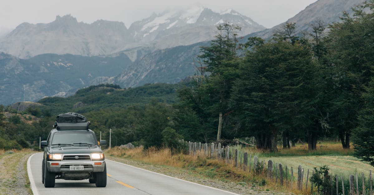
The pavement ended about forty kilometers south of Chaitn. No warning sign, no gradual transition. One moment the tires were humming on smooth asphalt, the next they were crunching over loose gravel and I was white-knuckling the steering wheel through a cloud of dust kicked up by an oncoming truck. My rental car — a modest Suzuki Jimny that the agency in Puerto Montt had handed over with a slightly apologetic shrug — rattled like it might come apart at the bolts.
That was the first hour on the Carretera Austral, and I was already grinning.
Chile is, by some miracle of geography, built for road trips. It runs 4,300 kilometers from the bone-dry Atacama in the north to the wind-blasted tip of Patagonia in the south, and there is a road connecting almost all of it. Some of those roads are smooth toll highways. Some are gravel tracks that require a ferry crossing and a prayer. All of them pass through landscapes that made me pull over so many times I stopped keeping count.
I have driven five routes across Chile over three separate trips. Some took a week. One took an afternoon. Each one felt like a completely different country. Here they are, ranked by how often I catch myself looking at the photos and wanting to go back.
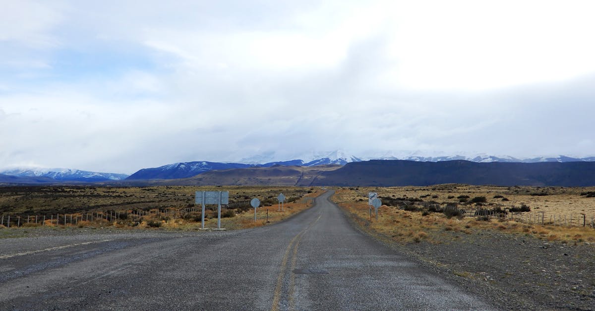
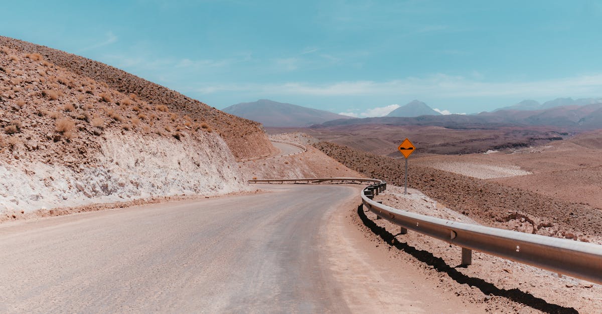
1. The Carretera Austral: 1,240 Kilometers of Gravel and Glory
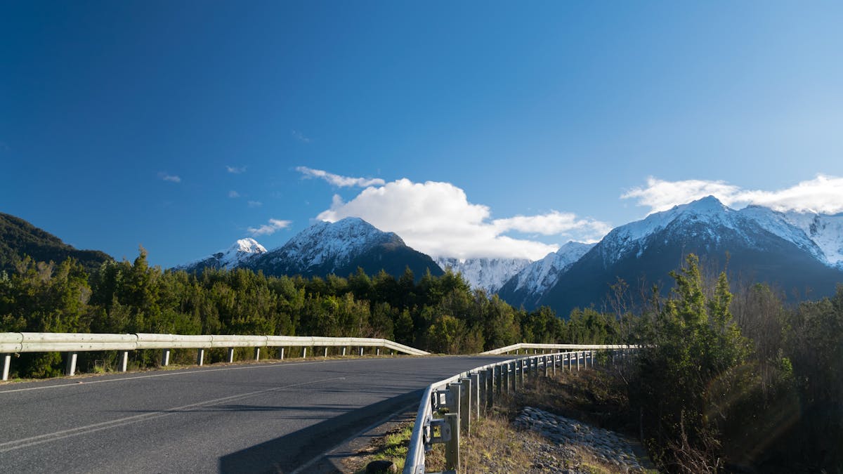
There is no road trip in South America that comes close to this one. I will say that plainly and without qualification. The Carretera Austral runs from Puerto Montt to Villa O'Higgins through some of the most untouched wilderness I have ever driven through — hanging glaciers, turquoise rivers so bright they look artificial, temperate rainforest that presses against both sides of the road like it is trying to reclaim the asphalt.
The route was carved out of the wilderness under Pinochet in the 1970s and 80s as a military project, and large sections still feel like a construction site in progress. About 60 percent of the road is paved now, up from maybe 30 percent when I first drove it. The rest is compacted gravel that ranges from perfectly smooth to axle-threatening washboard depending on when the maintenance crews last came through.
The Route and What to Expect
I started in Puerto Montt and drove south over seven days, though I could have spent ten. The first major stop is Chaitn, which was buried under volcanic ash in 2008 and has been slowly rebuilding ever since. The town itself is functional but not beautiful. The reason you stop here is the access to Pumaln Park, where the alerce trees — some over 3,000 years old — tower overhead in cathedral silence.
South of Chaitn, the road gets properly remote. Futaleufu — famous for some of the best whitewater rafting on the planet — sits on a spur road to the east. I did not raft it, which I regret. Past La Junta and into Queulat National Park, you get the Ventisquero Colgante, a hanging glacier that drops ice into a valley below. The short hike to the viewpoint took about ninety minutes and absolutely justified the detour.
Coyhaique is the biggest town on the route, and it felt almost urban after three days of nothing. Stock up on supplies here. South of Coyhaique, the road follows the Baker River — the bluest water I have ever seen, full stop — down to Cochrane and eventually to Villa O'Higgins, where the road simply ends at a lake.
Quick Tip
Fuel stations on the Carretera Austral are spaced 150-250km apart in the south. Fill up every single time you see a station, even if the tank is half full. I learned this the hard way outside Cochrane with the fuel light blinking.
The Practical Details
| Distance | 1,240 km (Puerto Montt to Villa O'Higgins) |
| Days needed | 7-10 minimum, 14 if you want to hike |
| Road surface | 60% paved, 40% gravel (improving yearly) |
| Vehicle | High-clearance recommended. 4WD ideal for southern sections |
| Fuel cost | Budget CLP 1,400-1,600/liter for gasoline |
| Ferries | 2-3 required crossings. Book Naviera Austral in advance during January |
| Best months | November through March. Roads can close in winter |
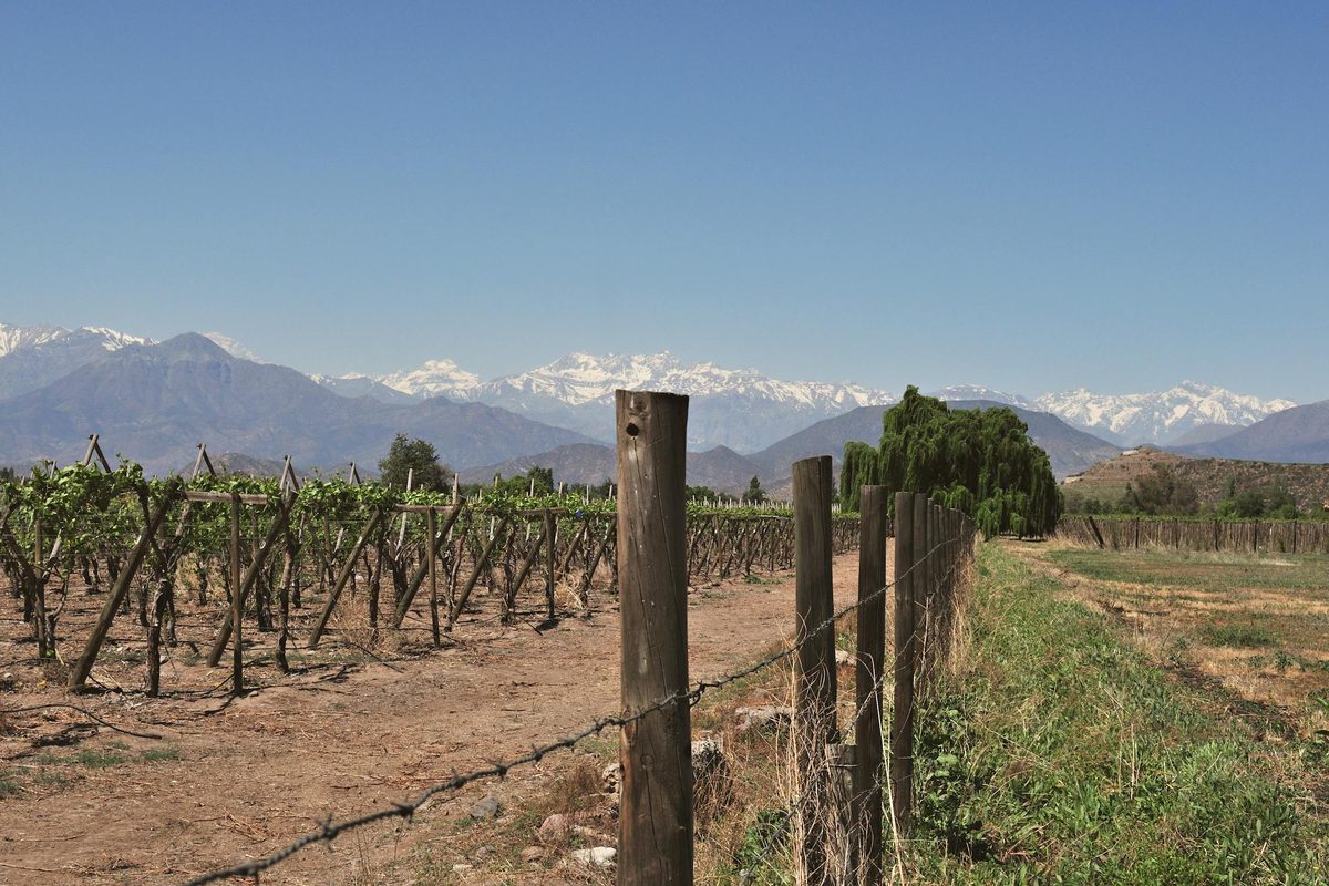
2. The Ruta del Vino: Three Valleys in a Day (or a Very Good Weekend)
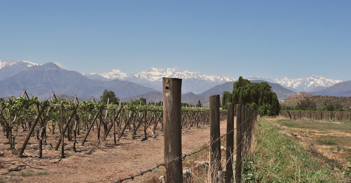
Not every Chilean road trip needs to be an expedition. The wine valleys surrounding Santiago are some of the easiest and most rewarding driving in the country, and you can hit three distinct regions without ever spending a night away from the capital.
I based myself in Santiago for four days and drove out to a different valley each morning. The highways are smooth, well-signed, and fast. The valleys themselves — Maipo, Casablanca, and Colchagua — are close enough to feel like day trips but different enough from each other that you never feel like you are repeating yourself.
Maipo Valley: The Closest and the Classic
Forty-five minutes south of Santiago on the Autopista del Sol, the Maipo Valley is where Chilean cabernet sauvignon built its reputation. I visited Concha y Toro (tourist trap, but the gardens are genuinely beautiful and the Casillero del Diablo cellar has a great story behind it) and then drove further up the valley to a smaller producer called Antiyal, where the biodynamic wines were some of the best I tasted in Chile. The drive up the Cajn del Maipo is spectacular even if you skip the wine — the Andes close in on both sides and the river drops through gorges below the road.
Casablanca: The Coastal Cool
Casablanca sits between Santiago and Valparaso on the Ruta 68 highway, which means you can combine a wine day with a visit to the coast. The valley is cooler than Maipo, which makes it better for white wines — the sauvignon blanc and chardonnay here are genuinely world-class. I stopped at three wineries and was tasting by 11am, which felt indulgent but is apparently standard practice. The whole valley has a more relaxed feel than Maipo. Fewer tour buses. More dogs sleeping in the sun outside tasting rooms.
Colchagua: The Worth-the-Drive One
Colchagua is the furthest from Santiago — about two and a half hours south on the Ruta 5 and then east toward Santa Cruz. This is the one I would recommend if you only have time for a single valley. The town of Santa Cruz has a surprisingly excellent museum, the wineries are less commercialized than those closer to Santiago, and the carmenere from this valley — a grape that everyone thought was extinct until they found it hiding in Chilean vineyards in the 1990s — is unlike anything you will taste elsewhere.
| Distance | Maipo: 45 min from Santiago. Casablanca: 1 hr. Colchagua: 2.5 hrs |
| Days needed | 1-3 (one per valley, or combine Casablanca with Valparaso) |
| Road surface | All paved highways, excellent condition |
| Vehicle | Any rental car works. The roads are flat and fast |
| Fuel cost | Budget CLP 50,000-70,000 total for all three valleys from Santiago |
| Tasting fees | CLP 10,000-25,000 per winery (usually includes 4-6 wines) |
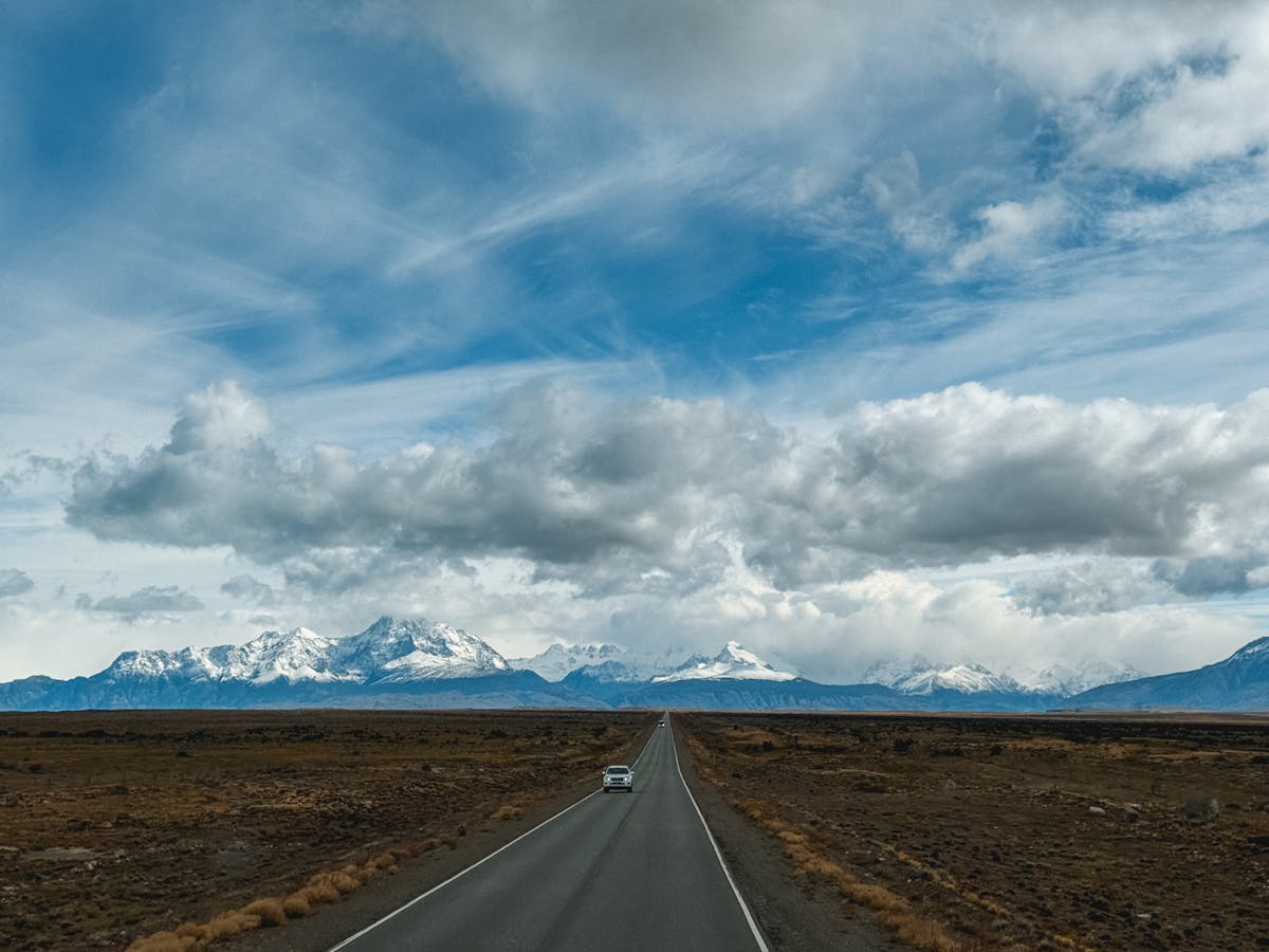
3. The Pan-American North: Santiago to the Atacama Desert
This is the drive that made me understand how big Chile actually is. Santiago to San Pedro de Atacama is roughly 1,600 kilometers on the Ruta 5 — the Chilean section of the Pan-American Highway — and it took me two full days of driving with an overnight stop in Copiap. The landscape shifts gradually from the green central valley around Santiago to scrubland, then to genuine desert, then to some of the most Mars-like terrain on earth.
I will be honest: long stretches of this drive are boring. The Pan-American through northern Chile is a straight, flat highway through featureless desert, and there were hours where the only thing that changed was the number on the kilometer markers. But the Atacama at the end of it is so extraordinary that the drive felt like earning the reward.
Breaking Up the Drive
The trick is not to try to do it in one shot. I stopped in La Serena on the first afternoon — a pleasant coastal city with good seafood and cheap accommodation — and then pushed through to Copiap the next morning. From Copiap, the highway climbs east toward Calama and then drops into the Atacama basin where San Pedro sits at 2,400 meters elevation.
The section from Calama to San Pedro is the most dramatic: the road drops off the altiplano through a narrow canyon, and suddenly the Licancabur volcano appears on the horizon like something from a science fiction film. I arrived just before sunset and the Valle de la Luna was already turning gold. That single moment justified the entire drive.
Alternatively, you can skip the drive entirely and fly Santiago to Calama in two hours. But you miss the slow transition from green to brown to absolutely nothing, which is its own kind of beautiful.
Quick Tip
The Ruta 5 through northern Chile has long sections with no services. Carry at least 2 liters of water per person and a full tank of fuel. Cell service drops out for 100km+ stretches north of Copiap.
| Distance | 1,600 km (Santiago to San Pedro de Atacama) |
| Days needed | 2-3 driving days, plus 3-4 days in the Atacama |
| Road surface | Fully paved toll highway (Ruta 5) plus paved secondary roads |
| Vehicle | Any car works for the highway. High-clearance useful for Atacama excursions |
| Toll costs | CLP 30,000-40,000 in tolls Santiago to Calama (get a TAG device) |
| Fuel cost | Budget CLP 120,000-160,000 total for the full Santiago-Atacama run |
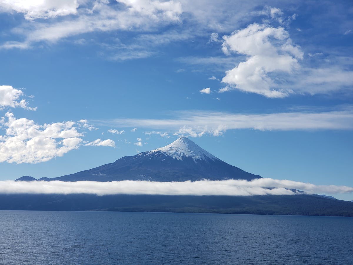
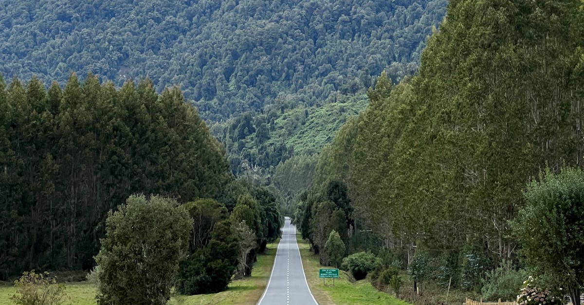
4. The Lake District Loop: Pucn, Puerto Varas, and Chilo
The Lake District is where Chileans go on holiday, and for good reason. The loop from Temuco south through Pucn, west to Valdivia, south to Puerto Varas, and then across to Chilo Island covers roughly 800 kilometers of some of the most beautiful driving in the country. Volcanoes, lakes, German-influenced towns with unexpectedly excellent kuchen, and hot springs that you can soak in after a day behind the wheel.
I drove this loop over five days in late February, which is the tail end of Chilean summer. The roads were perfect — fully paved, well-maintained, and almost empty outside of the main towns. The weather cooperated for four of those five days, which is apparently above average for a region that gets more rain than almost anywhere else in Chile.
Pucn to Puerto Varas via the Inland Route
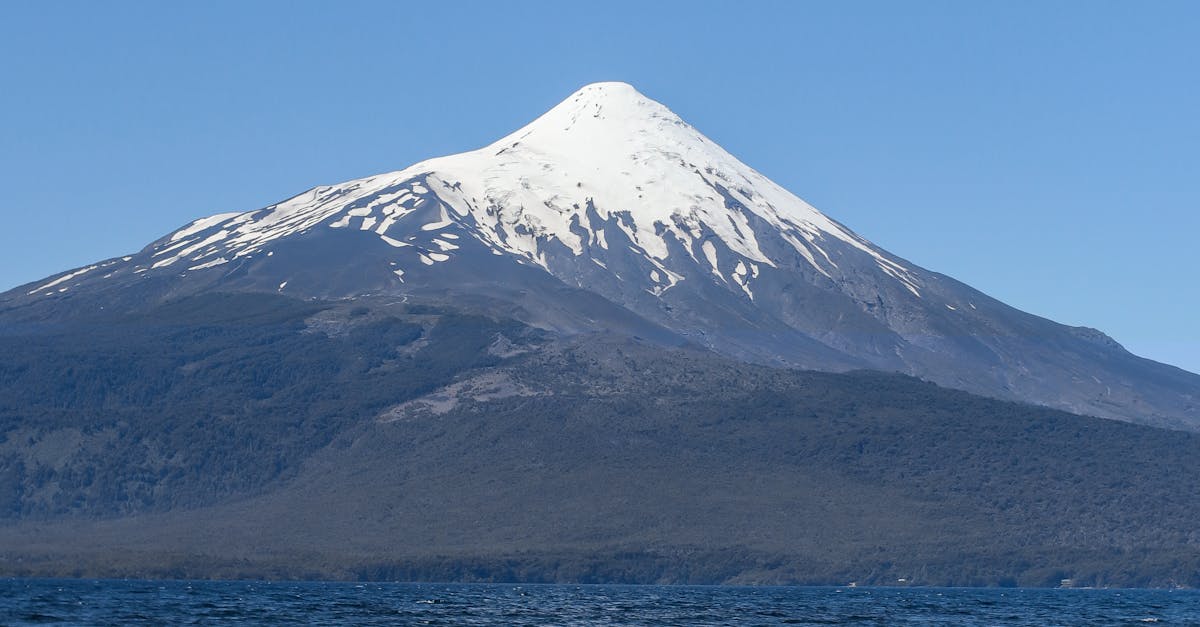
Pucn is the adventure capital of the Lake District, and I spent two days there before starting the drive. Villarrica volcano looms over the town, smoking gently, and the main street is lined with agencies selling rafting trips and volcano climbs. From Pucn, the drive south through Panguipulli and along the chain of lakes is stunning — Lago Ranco, Lago Panguipulli, Lago Riihue, each one bluer than the last.
Valdivia deserves at least a night. The riverside fish market where sea lions beg for scraps is one of those scenes that sounds touristy but is genuinely entertaining. The craft beer scene here is the best in Chile, thanks to the German settlers who brought their brewing traditions in the 1800s.
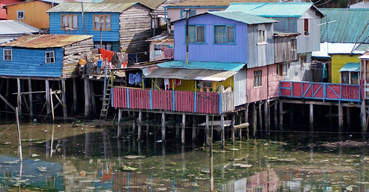
The Chilo Detour
From Puerto Varas, it is a two-hour drive south to the ferry crossing at Pargua, which takes you across to Chilo. The ferry runs every thirty minutes and costs almost nothing. Chilo is a different world — misty, mythological, full of wooden churches (sixteen of them are UNESCO World Heritage Sites) and a food culture built around curanto, a traditional pit-cooked feast of shellfish, meat, and potatoes.
I spent two nights on Chilo and wished I had allowed three. The western coast is wild and largely empty. The small towns of Castro and Dalcahue have markets selling wool sweaters and smoked shellfish that you can eat on the spot. The whole island operates at about half the speed of the mainland, which after several days of driving felt like exactly what I needed.
| Distance | ~800 km loop (Temuco-Pucn-Valdivia-Puerto Varas-Chilo-Puerto Montt) |
| Days needed | 5-7 comfortable, 4 if you rush |
| Road surface | Fully paved throughout. Excellent condition |
| Vehicle | Any car. Even a compact will handle every road on this loop |
| Fuel cost | CLP 80,000-100,000 for the full loop |
| Ferry | Pargua-Chacao crossing: CLP 15,000 for a car, runs every 30 min |
| Best months | December through March. Rain is possible any time |
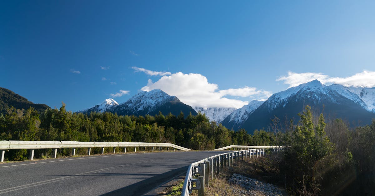
5. The Patagonia Circuit: Punta Arenas, Torres del Paine, and Puerto Natales
The Patagonia circuit is less a road trip and more a pilgrimage. You fly into Punta Arenas — the southernmost city of any real size in Chile — rent a car, and drive north through the steppe to Torres del Paine National Park, the crown jewel of Chilean Patagonia. Then back south through Puerto Natales, where you return the car and collapse into a restaurant that serves king crab the size of a dinner plate.
The total driving distance is modest — maybe 400 kilometers round trip — but the conditions make it feel longer. The wind in Patagonia is not like wind anywhere else. It comes off the Southern Ice Field in horizontal gusts that physically push the car sideways, and there are stretches of the road between Puerto Natales and the park entrance where I had to grip the wheel with both hands and lean into it. This is not an exaggeration. The wind is the defining feature of driving in Patagonia.
Punta Arenas to Puerto Natales
The drive from Punta Arenas north to Puerto Natales takes about three hours on the Ruta 9, a straight two-lane highway through open grassland. The landscape is bleak and flat and beautiful in a way that takes a few hours to appreciate. Guanacos — wild relatives of llamas — graze in groups along the roadside, and condors circle overhead if you are lucky. I saw three on my drive and pulled over each time to watch them.
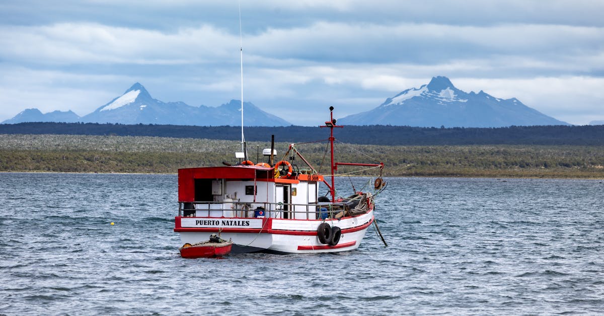
Puerto Natales is the gateway to Torres del Paine, and most people spend at least one night here before heading into the park. The town is geared entirely toward hikers and trekkers — gear shops, hostels, restaurants serving carbo-loading pasta portions. The centolla (king crab) at the waterfront restaurants is expensive but worth it once.
Into Torres del Paine
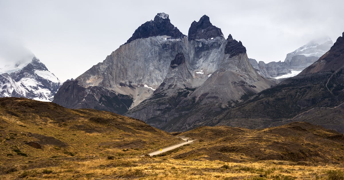
The park entrance is about 1.5 hours north of Puerto Natales on a paved road that turns to gravel for the last 30 kilometers. The gravel section is well-maintained but slow — budget an hour for what looks like a short distance on the map. Once inside the park, the roads connect the major trailheads and viewpoints, and you can drive between them to do day hikes without committing to the full W Trek or O Circuit.
The drive through the park is, even without leaving the car, one of the most photogenic I have done anywhere. The Cuernos del Paine appear and disappear behind clouds. Lago Nordenskjld stretches out in impossible blues. Guanacos stand on the hillsides looking unbothered by everything. I drove through the park twice — once on the way in, once on the way out — and noticed completely different things each time because the light had changed.
Quick Tip
Rental cars in Punta Arenas are expensive during peak season (December-February) and sell out fast. Book at least two months ahead. Budget CLP 50,000-80,000 per day for a basic SUV. Check that your rental allows gravel roads — some do not.
| Distance | ~400 km round trip (Punta Arenas-Puerto Natales-Torres del Paine-return) |
| Days needed | 3-5 for driving + day hikes. More if trekking the W or O |
| Road surface | Paved to Puerto Natales. Mixed paved/gravel to and inside the park |
| Vehicle | SUV or high-clearance vehicle recommended for park roads |
| Park entrance | CLP 38,000 for foreigners (high season). Cash or card |
| Fuel cost | CLP 50,000-70,000 for the full circuit. Fuel up in Puerto Natales — no stations in the park |
| Best months | November through March. Wind is worst in December-January |
Road Trip Essentials: What You Need to Know Before You Drive Chile
Driving in Chile is not difficult if you have experience with highway driving, but there are a few things that tripped me up and will probably trip you up too. Here is what I wish someone had told me before my first trip.
The TAG Toll System
Chile's main highways — especially the Ruta 5 and the autopistas around Santiago — use an electronic toll system called TAG. You can drive through without a TAG device, but you will receive a bill at your home address (or your rental agency will charge your credit card at a markup). Most rental agencies offer a TAG device for CLP 2,000-5,000 per day. Take it. The tolls add up fast — Santiago to Temuco can run CLP 20,000-30,000 in tolls alone. Check the details at our getting around guide.
Your License and Documentation
Chile accepts foreign driver's licenses for tourists staying less than 90 days. That said, I have always carried an International Driving Permit as well, which costs about $20 from your home country's automobile association. The one time I was pulled over — a routine check outside Temuco — the officer glanced at both documents and waved me through. Having the IDP translated into Spanish probably saved me a conversation I was not equipped to have at 7am.
Speed Cameras and Fines
Speed cameras are everywhere on the Ruta 5 and the autopistas around Santiago. The limits are typically 120 km/h on highways and 50 km/h in towns, and the cameras are not always signed. I got flashed once entering a 60 km/h zone that I swear appeared out of nowhere. The rental agency charged my credit card CLP 67,000 about three weeks after I returned the car. Lesson learned. In rural areas and on the Carretera Austral, speed cameras are rare, but Carabineros (police) set up checkpoints that include speed checks.
Rental Costs and What to Book
Rental prices vary dramatically by location and season. In Santiago during the off-season, a compact car runs CLP 25,000-35,000 per day. In Punta Arenas during January, expect CLP 50,000-80,000 per day for the same vehicle. For the Carretera Austral, you want at minimum a high-clearance vehicle — a Suzuki Jimny or similar — which runs CLP 40,000-60,000 per day from Puerto Montt agencies.
Book through international agencies (Hertz, Europcar, Budget) for the highway routes. For the Carretera Austral, I had better luck with local agencies in Puerto Montt that actually understood the road conditions and did not panic when I said where I was going. Some international agencies explicitly prohibit driving on unpaved roads, which would rule out half the country.
For a full breakdown of transport options and costs, see our money and costs guide.
Fuel and Distances
Fuel in Chile runs CLP 1,300-1,600 per liter depending on the region and octane. Patagonia and the Carretera Austral are the most expensive. COPEC and Shell are the most common chains, and both accept credit cards everywhere. Keep in mind that in remote areas — southern Carretera Austral, the Atacama outside San Pedro — fuel stations can be 200+ kilometers apart. I carried a 10-liter jerry can on the Carretera Austral and used it once. Worth the peace of mind.
The Driving Culture
Chileans drive faster than the posted limits on highways and slower than you expect in towns. Truck drivers on the Ruta 5 are generally courteous — they pull to the shoulder to let you pass and expect you to flash your hazards as a thank-you. On the Carretera Austral, every oncoming vehicle gets a wave. On Santiago's urban highways, all courtesy disappears and it becomes every driver for themselves. Stay in the right lane unless passing. Use your turn signals. Do not honk unless someone is about to hit you. You will be fine.
Which Route Should You Drive?
If you have two weeks and want the single best driving experience Chile offers, do the Carretera Austral. Nothing else comes close. If you have a week, the Lake District loop gives you the most variety — volcanoes, lakes, hot springs, an island, and great food — for the least amount of difficult driving. If you have a long weekend in Santiago and want to escape the city, the wine valleys are right there waiting.
The Atacama drive is for people who find beauty in emptiness and want to feel the scale of Chile in their bones. The Patagonia circuit is for people who want to stand in front of mountains that make them feel small and are not bothered by wind strong enough to open their car doors for them.
I have done all five. I am already planning my next trip back for the Carretera Austral, because seven days was not enough and I know it now. The road ends at Villa O'Higgins, but the feeling that there is more to see around the next bend does not end at all.