This article contains affiliate links. If you book through them, I earn a small commission at no extra cost to you.
The wind stopped. That is the part I keep coming back to. Eight days of horizontal rain and gusts that bent my trekking poles sideways, and then, at the top of John Gardner Pass, the wind just... stopped. I stood at 1,241 meters with my jaw somewhere near my boots, staring at the Southern Patagonian Ice Field — a white emptiness stretching to the horizon like the surface of another planet. No trees. No trails. No people. Just ice, in every direction, for as far as I could see.
I had been walking for six days at that point. My shoulders were raw from pack straps. I had eaten cold oatmeal for breakfast three mornings in a row because my stove lighter died on day four. And I was standing in front of a view that made all of it feel like a bargain.
That is what the O Circuit gives you that the W Trek does not. The W is the greatest hits — Grey Glacier, the French Valley, the Towers. The O takes you behind the mountains, through the back section where there are no refugios, no day-trippers, and no escape route if you change your mind. It is longer, harder, lonelier, and the single best thing I have done in Patagonia.
Why the O and Not the W
I did the W Trek two years before attempting the O. The W is magnificent — I have written a full guide to it and I stand by every word. But the W has a crowding problem. Peak season, you are sharing the trail with hundreds of people. The refugios feel like hostels. The campsites are packed. You are never truly alone.
The O Circuit adds roughly 50 kilometers to the W by looping around the back of the Paine massif. That extra distance filters out about 80% of the hikers. On the back section — the stretch from Dickson to Paso John Gardner to Grey — I saw maybe fifteen people in three days. One morning I walked for four hours without seeing another soul. Just me, the lenga forest, and a silence so thick it felt like pressure in my ears.
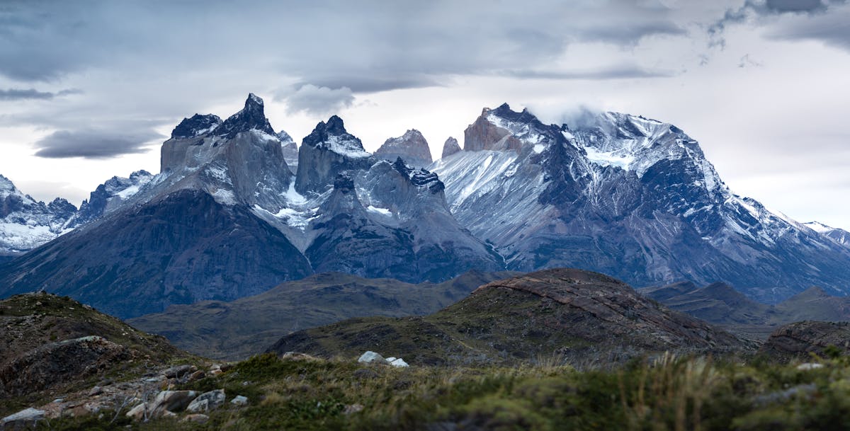
The O also includes John Gardner Pass, which is the single most dramatic viewpoint in the park. The W Trek hikers never see the ice field. They get Grey Glacier from below, which is impressive, but it is like seeing the edge of an ocean from the beach. From John Gardner, you see the whole thing. The scale breaks your brain.
But I need to be straight with you: the O Circuit is not for casual hikers. This is a serious multi-day trek that requires full camping gear, real fitness, and the mental toughness to push through days when the weather is actively trying to make you quit. If you have not done a multi-day backpacking trip before, do the W first. Get a sense of what Torres del Paine throws at you, then come back for the O.
The Route at a Glance
The O Circuit is roughly 110-130 kilometers depending on which side trips you include, typically done in 7-9 days. It follows the entire W route plus the back section behind the mountains. Think of it as the W with an extension that loops around the north side of the Paine massif.
Most people hike counterclockwise — starting at the Torres base, heading west along the W, then continuing around the back through Dickson, up and over John Gardner Pass, and finishing at the Grey sector. I went counterclockwise and think it is the right call for most people. The big reason: you hit John Gardner Pass on a day when your pack is getting lighter (less food) and you descend to Grey sector with civilization in sight. Going clockwise means climbing the pass on your first or second day with a full pack, which sounds miserable.
That said, clockwise has its partisans. The argument is that you knock out the hardest section while you are fresh, and you finish with the iconic W highlights as a reward. There is logic there. But I have talked to people who did it clockwise, and more than one said the pass nearly broke them on day two with a week's worth of food on their backs.
Day-by-Day: How I Did It in 8 Days
I will walk you through the counterclockwise route I took. Your specific itinerary will depend on campsite availability — you cannot always get consecutive nights where you want them. But this gives you the shape of the thing.
Day 1: Las Torres to Serón (15.5 km)
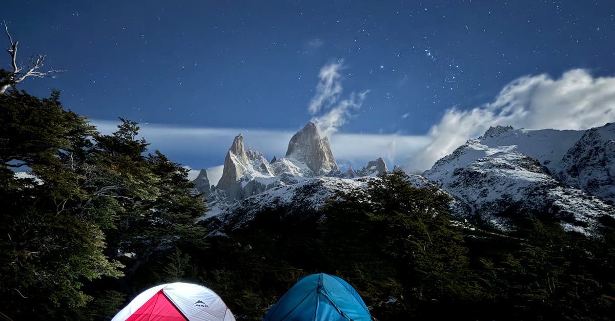
The bus from Puerto Natales drops you at the Hotel Las Torres park entrance. From there, you head north along the eastern edge of the park. This first stretch is open grassland — big sky, rolling terrain, guanacos watching you from the ridges. The trail is clear and the walking is easy. I made it to Serón in about five hours, feeling strong and optimistic, which is exactly how Patagonia wants you to feel before it humbles you.
Serón campsite sits in a flat meadow with views back toward the Towers. It has basic toilet facilities and a cooking shelter. Set up camp early and enjoy the views. This is the last campsite with any kind of amenity for a while.
Day 2: Serón to Dickson (18.5 km)
This is the longest day on the circuit and the one that sets the tone. You drop into the Río Paine valley and follow it west through dense lenga forest. The trail gets rougher — muddy sections, root tangles, the occasional creek crossing on sketchy log bridges. I slipped off one of those bridges and got a boot full of glacial melt. The water was so cold it felt like an electric shock.
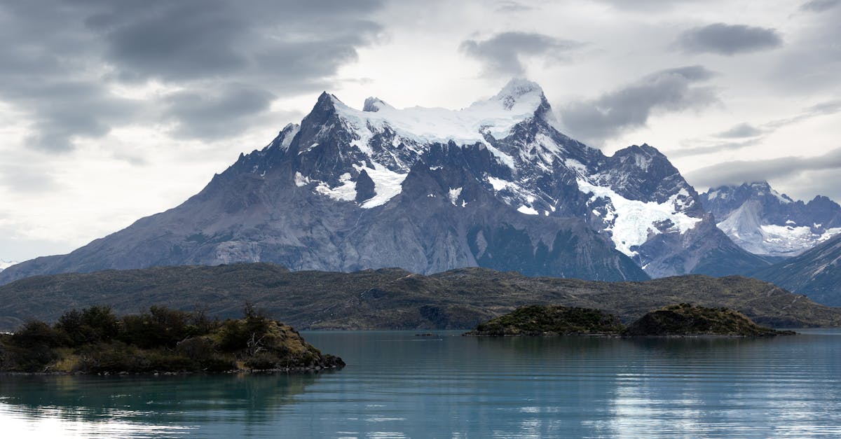
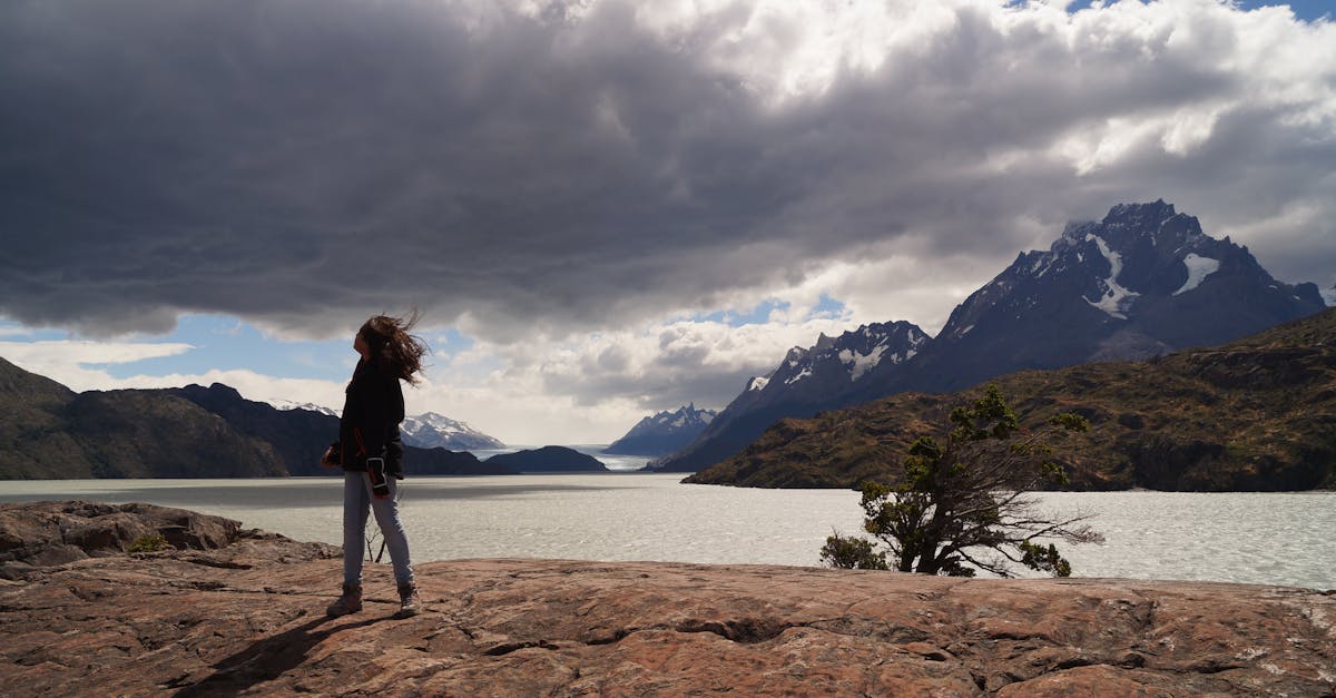
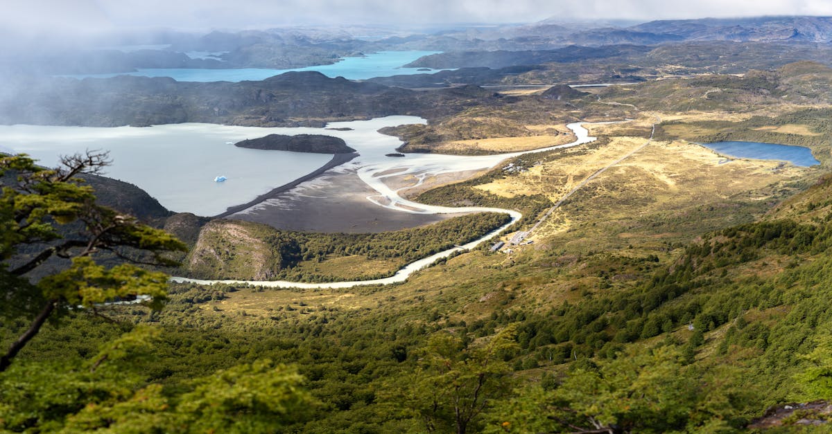
Dickson campsite sits on the shore of Lago Dickson with a glacier at the far end. The setting is absurd. I arrived exhausted, set up my tent, and sat watching icebergs calve into the lake while eating cold trail mix because I was too tired to cook. This is peak back-section energy — you are too wrecked to do anything but stare at something beautiful.
Day 3: Dickson to Los Perros (9 km)
A short day on paper, but the terrain earns every kilometer. You climb through thick forest along the Río de los Perros, gaining elevation steadily. The trail is narrow, overgrown in places, and muddy enough that I sank to mid-shin at one point. There is a river crossing that can be knee-deep after heavy rain.
Los Perros camp is at the base of John Gardner Pass. It sits in a clearing in the forest at about 750 meters, and it is bleak in the best possible way — a handful of tent platforms, a basic cooking shelter, and the sound of wind funneling down from the pass above. I went to sleep nervous. The ranger at Dickson had told me the pass was open but that conditions were "interesting," which I have learned is Patagonian for "pray."
Day 4: Los Perros to Paso John Gardner to Grey (16 km)
This is the day. The reason you came.
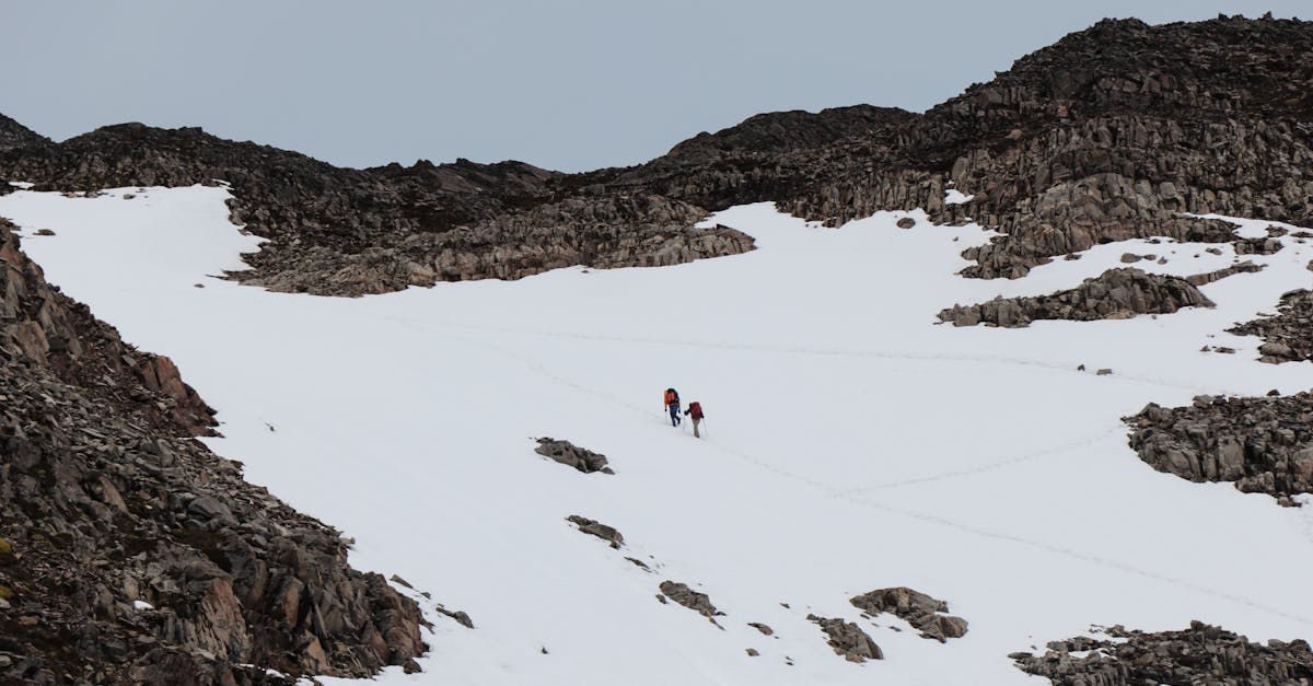
You start early — 6am at the latest, because the pass can close if weather moves in, and you do not want to get caught up there. The climb from Los Perros is steep and unrelenting. Fixed ropes on the steepest sections. Mud, scree, and wind that builds as you gain elevation. I was sweating hard inside my rain shell and freezing everywhere the wind found an opening.
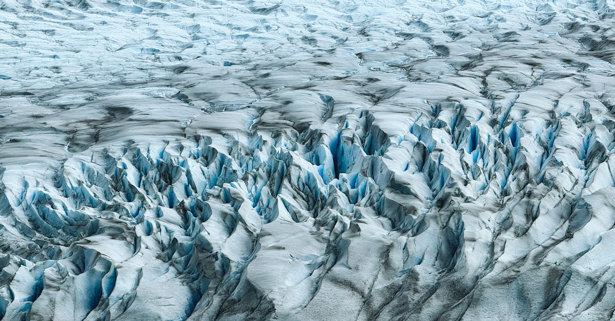
And then you crest the pass and the world opens up.
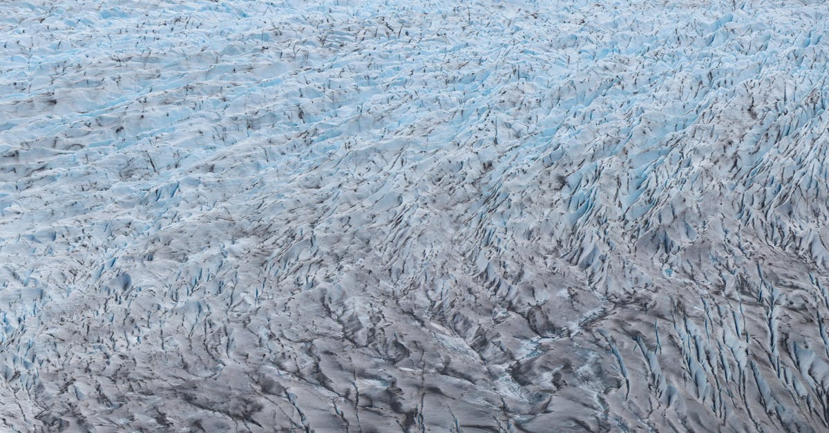
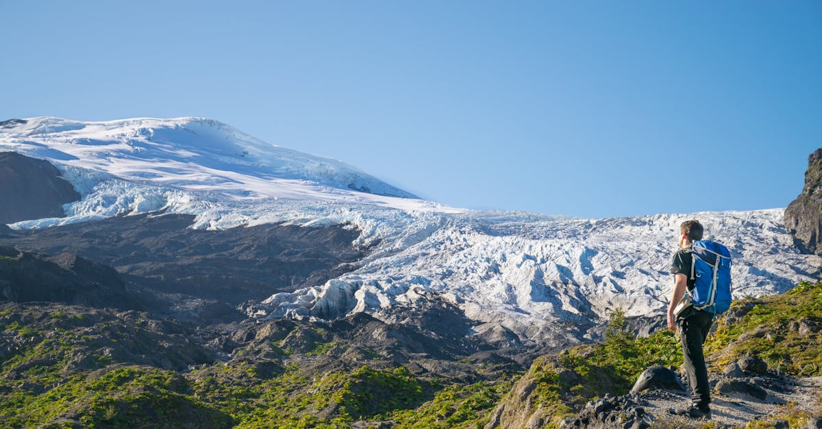
The Southern Patagonian Ice Field. Third-largest ice mass on earth, after Antarctica and Greenland. A white plain stretching to the horizon in every direction, broken by nunataks — dark peaks poking through the ice like islands in a frozen sea. Grey Glacier spills down from it toward you, and you can trace the ice from its source all the way to the lake below.
I stood there for thirty minutes. The wind was calm — a rare gift. Other hikers arrived and we all just stood there, not saying much. Someone whispered "holy shit" and that was about the right level of commentary.
The descent from the pass to Grey is steep, relentless, and hard on the knees. You drop over a thousand meters in about eight kilometers, through forest, over boardwalks, past viewpoints where the glacier keeps reappearing through gaps in the trees. By the time I reached Campamento Grey, my knees were staging a formal protest. But the campsite sits right next to the glacier, and you fall asleep listening to ice crack.
Quick Tip
Check pass conditions with the ranger at Los Perros the evening before. If they say the pass is closed, it is closed — do not attempt it. People have died up there in bad weather. Wait a day if you need to. Bring enough food for one extra day on the back section, just in case.
Day 5: Grey to Paine Grande (11 km)
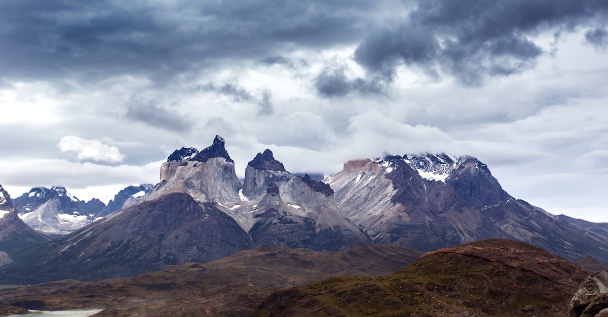
You rejoin the W Trek route here, and the difference is immediate. More people, better trails, actual signage. After three days in the back section, seeing a maintained boardwalk felt like arriving in a city. The walk along Lago Grey is flat and scenic — icebergs floating in turquoise water, the glacier visible behind you. This is a recovery day. Your body needs it.
Paine Grande is the busiest campsite on the circuit, right next to the catamaran dock on Lago Pehoé. It has a shop that sells overpriced beer and snacks. I bought a beer that cost what a six-pack would in Puerto Natales and did not regret a single peso.
Day 6: Paine Grande to Francés (French Valley Day) (11 km + side trip)
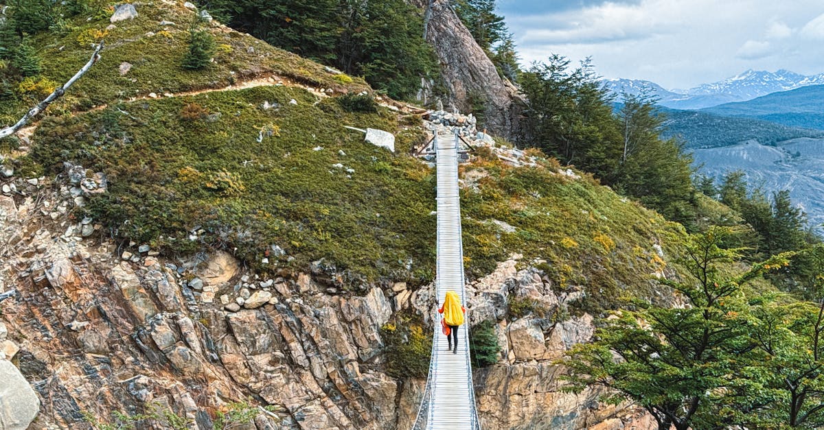
You hike to Campamento Italiano, drop your big pack, and head up into the French Valley with just a daypack. This is one of the W Trek highlights and it hits different when you are six days in. The valley is a natural amphitheater — granite walls on three sides, hanging glaciers, the occasional rumble of an avalanche echoing off the rock. I sat on the British Lookout for an hour watching ice fall off a hanging glacier in slow motion.
After the valley, you continue to Campamento Francés (or Los Cuernos, depending on your booking). The day hikes in this section are some of the best in the park.
Day 7: Francés to Chileno (Los Cuernos Route) (13 km)
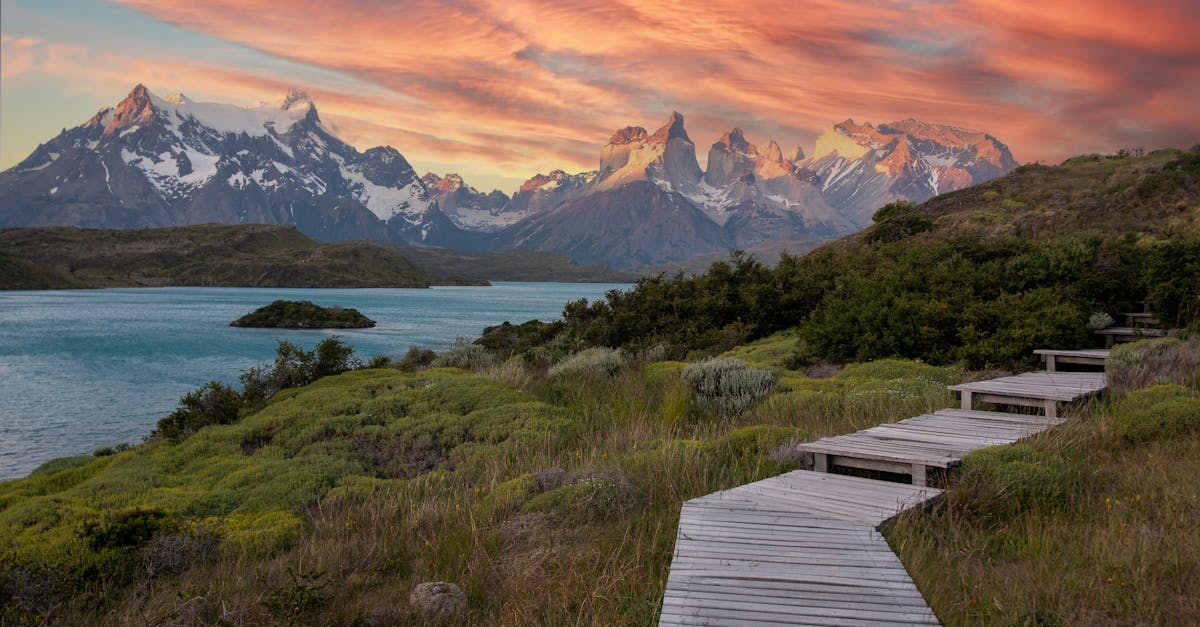
The trail hugs the shore of Lago Nordenskjöld with the Cuernos del Paine (the "Horns") looming above you the whole way. This is postcard country. The walking is moderate, with a few up-and-down sections, and the views are relentless. I kept stopping to take the same photo from slightly different angles, which is a very specific kind of insanity that Patagonia inflicts on people.
Campamento Chileno is the staging point for the Torres base hike. Get to sleep early. You have a 4am wake-up coming.
Day 8: Chileno to Base Torres to Las Torres (Exit) (16 km round trip + 7 km out)
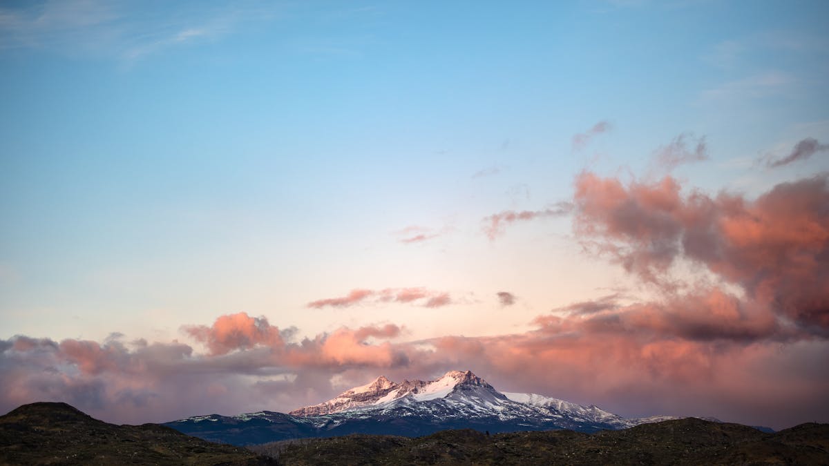
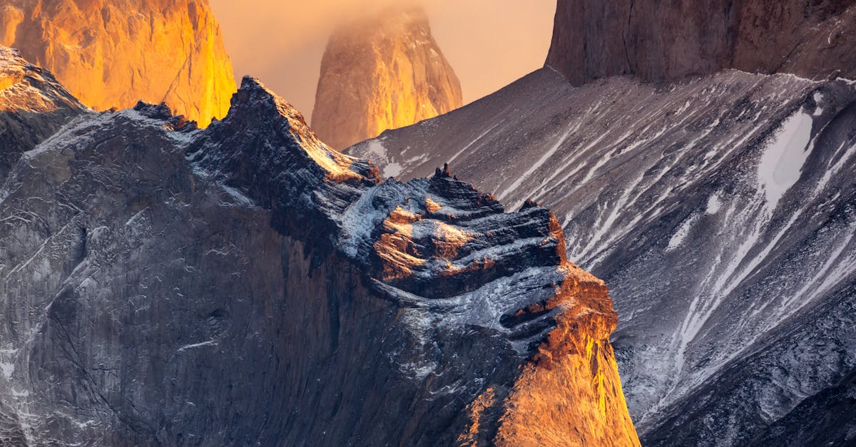
The final day. The climax. You start in the dark with a headlamp, climbing the moraine to the Torres lookout. The last kilometer is a boulder scramble that feels endless in the pre-dawn cold. And then you come over the final rise and the three towers are right there, reflected in the glacial lake at their base, lit orange and pink by the sunrise.
If you get the sunrise. I did not. I got clouds and a thirty-second window where the light broke through and turned one tower gold while the other two stayed in shadow. It was still magnificent. But bring your expectations and your flexibility — the weather controls this show.
From there, you descend back to Las Torres, catch the bus to Puerto Natales, and sit in a restaurant eating the largest steak you can find while staring at a wall with an expression that says you have been somewhere.
The Back Section: What Nobody Tells You
The back section of the O — from Serón through Dickson, Los Perros, and over the pass — is a different animal from the W. Here is what I wish someone had told me before I went.
There are no refugios. Camping only. You carry everything — tent, sleeping bag, stove, food, fuel. No warm dorm to retreat to when the rain hammers your tent at 2am. No hot meals served at a dining hall. Just you and your gear. If your stove breaks, you eat cold food. If your tent leaks, you get wet.
The trails are rougher. The W Trek trails are well-maintained boardwalks and graded paths. The back section is muddy, rooted, overgrown, and sometimes hard to follow. I lost the trail twice in thick forest near Dickson. Orange markers on trees are your lifeline — if you haven't seen one in ten minutes, backtrack.
River crossings are real. After heavy rain, the creek crossings between Dickson and Los Perros can be thigh-deep. I watched a guy ahead of me get swept off his feet in one. He was fine — grabbed a branch and pulled himself out — but it could have gone differently. If a crossing looks dangerous, wait. The water drops fast when the rain stops.
The solitude is real. On the W, you are rarely out of sight of other hikers. On the back section, you can walk for hours alone. If you get hurt, help is not quick. Carry a basic first aid kit and tell someone your plan.
Booking the O Circuit: Permits and Campsites
This is where the O Circuit planning gets complicated. You need reservations at every campsite on the route, and they must be booked in advance through CONAF (the national park authority) or through the private companies that manage specific camps. You cannot just show up.
Reservations typically open in October for the following season (October through April). Peak dates in December and January go fast. I booked in November and already lost my preferred dates at Los Perros — I had to shift my entire itinerary by two days.
The back-section campsites (Serón, Dickson, Los Perros, Grey) are managed by Vertice Patagonia. The front-section sites (Francés, Los Cuernos, Chileno) are split between Vertice and Las Torres. You will likely need accounts on two different booking platforms. It is annoying, but it is the system.
Quick Tip
CONAF also requires a park entrance fee (around $40,000 CLP for foreign adults, roughly $40 USD). You pay this at the park entrance on your first day. Keep the receipt — rangers check it at multiple points along the circuit. Check current costs and currency info before you go.
One critical detail: the back section of the O is only open during the core season, roughly mid-October through mid-April. Outside that window, John Gardner Pass is closed and you cannot complete the circuit. Check dates carefully before booking flights. The best time to visit Chile page has more on season timing.
What to Pack (It Is More Than the W)
If you have done the W with refugio bookings, forget that packing list. The O Circuit means full self-sufficiency on the back section. Here is what I carried:
Tent: A proper 3-season tent rated for high winds. My tent held up to 80+ km/h gusts at Los Perros. A cheap festival tent would have been shredded. Bring extra stakes and guylines — the ground at some campsites is soft and the wind will test every anchor point you have.
Sleeping bag: Rated to -5°C minimum. I had a 0°C bag and was cold at Los Perros when temperatures dropped to around -3°C overnight. Bring a liner for extra warmth and hygiene.
Stove and fuel: I used an isobutane canister stove. Bring enough fuel for every meal plus a buffer — I went through 230g in eight days cooking twice daily. You cannot buy fuel on the trail. And bring a backup lighter. Learn from my cold oatmeal mistake.
Food: Enough for your full itinerary plus one extra day. I carried freeze-dried meals, oats, trail mix, energy bars, salami, and cheese. At roughly 600-700g of food per day, that is 5-6 kg of food for eight days. Your pack will be heavy at the start. Accept this.
Rain gear: Full waterproofs — jacket and pants. Not negotiable. Also a pack cover or pack liner (I used a heavy-duty trash bag inside my pack, which worked better than the cover in sideways rain). Hiking in Chile means preparing for every kind of weather, but Patagonia takes it to another level.
Layers: Merino base, fleece mid, puffy jacket for camp, rain shell as outer. I wore almost every layer I had on the morning of the Gardner Pass ascent. Temperatures ranged from -3°C to 20°C during my trek.
Total pack weight: Mine was 18 kg at the start, dropping to about 12 kg by the final days as I ate through my food. The W hikers with refugio bookings were walking past me with 6 kg daypacks. I tried not to think about it.
The Weather Reality
Patagonia weather is its own character in this story. It does not cooperate, it does not care about your plans, and it changes faster than anywhere I have ever been.
In eight days, I experienced: hail, horizontal rain, 80 km/h wind, sunburn, near-freezing overnight temperatures, and one afternoon so warm and still I hiked in a t-shirt. That was all in the same week. In January. The "good" season.
The wind is the constant. It blows almost every day, from the west, and it is genuinely powerful. I am not talking about a breeze. I am talking about wind that makes you stagger, that picks up small rocks and throws them at your shins, that turns rain into needles. The trees on the ridges grow sideways. That tells you everything.
My advice: plan for rain every day, celebrate sun when you get it, and never, ever underestimate the wind. Bring everything you need to be comfortable in cold, wet conditions, and treat warm weather as a bonus.
Fitness: How Hard Is It Really?
Honest answer: harder than most people expect.
The O Circuit involves 7-9 days of consecutive hiking with 15-20 km per day, carrying a full backpacking pack over uneven, sometimes poorly marked terrain, in weather that actively works against you. The total elevation gain over the circuit is roughly 4,000-5,000 meters. John Gardner Pass alone is a 700-meter climb on a single day that also includes over 1,000 meters of descent.
You do not need to be an athlete. But you need to be able to walk 6-8 hours with a heavy pack, day after day, on sore legs, in rain, without breaking down mentally. The physical fitness is one thing — the mental endurance is something else. Day six on the trail, with wet socks and aching shoulders, when it starts raining again before you have finished your morning oatmeal — that is where people struggle.
My preparation: I spent three months before the trip hiking with a loaded pack on weekends, gradually increasing distance and weight. I also did stair workouts for the descents, which are harder on the body than the climbs. Was I still sore? Every single day. But I was never in trouble.
If you are questioning whether you are fit enough, start with the day hikes in Torres del Paine or the W Trek. Build up to the O.
Clockwise vs. Counterclockwise: The Debate
I hiked counterclockwise and would do it the same way again. But the debate is real and both sides have merit.
Counterclockwise (my recommendation): You start with the Torres base viewpoint, do the W section first, then enter the back section heading west. You hit John Gardner Pass on approximately day 6-7 when your food supply (and pack weight) has decreased. You finish at Grey sector with easy access out. The pass descent is toward civilization.
Clockwise: You tackle the back section first while your legs are fresh (but your pack is heaviest). You climb John Gardner Pass on day 2-3. You finish with the iconic W Trek highlights as a crescendo. Some people prefer this narrative arc — the remote wilderness first, the spectacle to close.
CONAF has sometimes mandated counterclockwise direction only. Check current regulations when you book. The requirement has been on and off over the years. When it is enforced, the debate is moot.
What It Costs
The O Circuit is not a budget trek. Between flights, gear, permits, and food, the costs add up fast. Here is roughly what I spent:
| Expense | Cost (USD approx.) |
|---|---|
| Park entrance fee (CONAF) | $40 |
| Campsite fees (8 nights) | $80-100 |
| Bus: Puerto Natales to/from park | $30-40 round trip |
| Food (8 days of freeze-dried + snacks) | $100-150 |
| Gas canister (230g) | $10-15 |
| Flight: Santiago to Punta Arenas | $80-200 |
| Bus: Punta Arenas to Puerto Natales | $15-20 |
| Puerto Natales accommodation (2-3 nights) | $40-80 |
| Total (excluding gear) | $400-650 |
If you need to rent or buy camping gear, add $200-400. Good gear is expensive but it is the wrong place to cut corners. A leaking tent or an under-rated sleeping bag will ruin your trip. Check the money and costs guide for current exchange rates and budgeting tips.
For context, the W Trek with refugio bookings runs $800-1,200+ for the trek portion alone. The O is actually cheaper if you are camping and carrying your own food. You pay in physical effort instead of money.
Getting There
Fly to Punta Arenas from Santiago (about 3.5 hours). From Punta Arenas, catch a bus to Puerto Natales (3 hours, multiple daily departures). Spend at least one full day in Puerto Natales buying last-minute supplies and eating solid meals.
From Puerto Natales, morning buses run to the park. If starting counterclockwise, you want the bus to the Laguna Amarga entrance (about 2 hours), then a shuttle to Hotel Las Torres. If starting clockwise, you go to the Pudeto/Administration entrance instead.
Puerto Natales has outdoor gear shops where you can buy gas canisters (you cannot fly with them), rent gear, and stock up on freeze-dried meals. The selection is decent but pricier than Santiago. Bring what you can from home or from the capital. Getting around Chile at this latitude requires some logistics, but the bus network is reliable.
The O Circuit vs. Everything Else
If you are planning a Patagonia itinerary, the O Circuit should be the centerpiece. Build the rest of the trip around it. The hiking in Chile page has more options if you want to extend your trip, but nothing in the country delivers the same combination of wildness and access that the O Circuit does.
It is not easy. It is not comfortable. There will be moments when you wonder why you are doing this to yourself. And then you will crest John Gardner Pass, or you will wake up to a sunrise over Lago Dickson with not another person in sight, or you will sit in your tent listening to a glacier groan in the dark, and you will know exactly why.
Go. Bring too many layers and not enough expectations. The ice field will take care of the rest.