This article contains affiliate links. If you book through them, I earn a small commission at no extra cost to you.
I was sitting on a rock at 4,600 meters, legs shaking, lungs burning, staring into the smoking crater of an active volcano. Below me, the entire Lake District stretched out in greens and blues I didn't know existed outside of desktop wallpapers. Six days later, I was at sea level in Patagonia, rain hammering my hood sideways, squinting at a glacier that had just dropped a chunk of ice the size of a bus into a milky lake. Same country. Same trip. Chile doesn't make sense, and that is exactly why you hike here.
I have spent the better part of three trips putting together what I think is the most honest list of the best hikes in Chile. Not every trail here is a masterpiece. A few are overhyped, a few are undersold, and a couple nearly broke me. But all of them taught me something about this ridiculous 4,300-kilometer-long country that you can't learn from a bus window.
What follows is 15 hikes organized by region, with honest difficulty ratings, distances, and my personal take on whether each one is actually worth your time and knee cartilage. I ranked my top five at the end. Let's get into it.
Patagonia: Where the Wind Earns Your Respect
This is why most people come to Chile to hike, and for good reason. Patagonia has the kind of landscapes that make you question whether you're looking at a photograph or a place. But it also has weather that changes four times before lunch, trails that fill up with booking-savvy Europeans months in advance, and wind that I can only describe as personal.
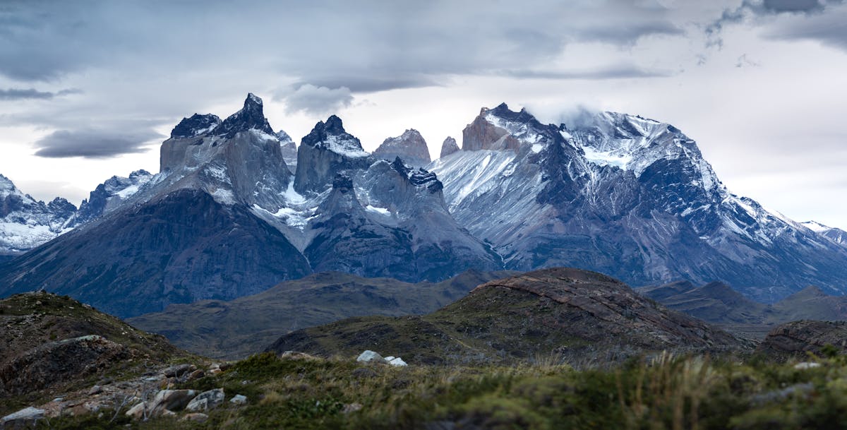
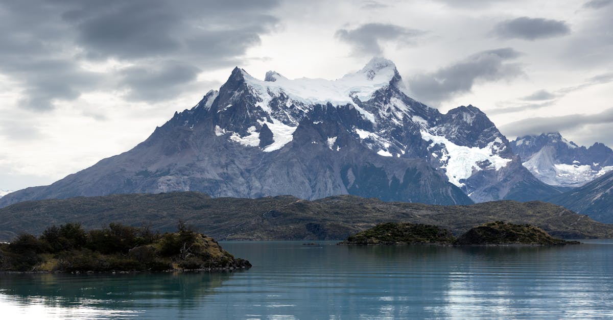
1. The W Trek, Torres del Paine (4-5 Days)
Distance: ~80 km | Difficulty: Moderate-Hard | Best months: November-March
The W is the most popular multi-day trek in Chile, and probably in all of South America. The route traces a W shape through Torres del Paine National Park, hitting three massive highlights: Grey Glacier, the French Valley, and the Torres themselves. I did it in five days, camping, and it remains one of the best things I have ever done with my feet.
Day three was the hardest. The French Valley ascent gains about 600 meters over loose scree, and the wind at the top was so strong I genuinely considered crawling. But the view from the mirador — a 360-degree amphitheater of granite spires and hanging glaciers — was worth every miserable step. I sat up there for forty minutes because my legs wouldn't let me stand back up.
The catch: everything must be booked months in advance. Refugios and campsites sell out fast, especially in January. I covered the full logistics in my W Trek guide, but the short version is — book in October for the following season, have flexible dates, and be prepared to spend more than you expect. Camping is $8-12 per night, but refugios run $120-180.
Quick Tip
Do the W east to west. Most people go west to east, which means you'll hit the Torres sunrise viewpoint on day one when your legs are fresh. The French Valley and Grey Glacier are better as a crescendo anyway.
Is it worth it? Yes. Full stop. Even with the crowds and the logistics headache. This is a top-five life hike.
2. The O Circuit, Torres del Paine (7-9 Days)
Distance: ~130 km | Difficulty: Hard | Best months: November-February
The O is the W plus the backside of the mountain range — a full loop that adds the John Gardner Pass, Dickson Lake, and several remote campsites that see a fraction of the W Trek traffic. I haven't done the full O (yet), but I hiked the backside section with a friend who had, and his verdict was simple: "The W is the highlight reel. The O is the real movie."
The John Gardner Pass is the crux — a steep climb to about 1,200 meters with exposure to full Patagonian wind, followed by a descent to the Grey Glacier viewpoint that apparently makes grown adults cry. You need to be self-sufficient for more of the route, carry more food, and be comfortable with genuine isolation.
The O must be done counterclockwise (park rules), and the season is shorter than the W because the pass is often snow-covered outside of December-February.
Is it worth it? If you've done the W and want more, absolutely. If it's your first time in the park, do the W first — you can always come back for the O.
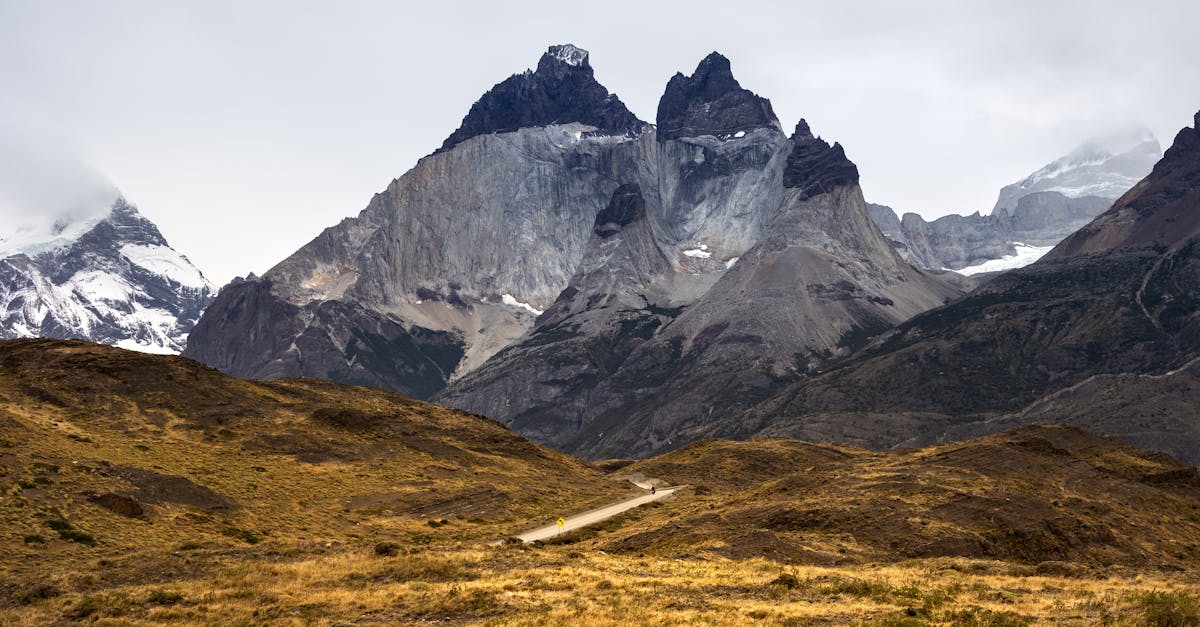
3. Base Torres Day Hike (1 Day)
Distance: ~22 km round trip | Difficulty: Hard | Best months: October-April
This is the single most famous day hike in Torres del Paine — the out-and-back to the base of the granite towers. The postcard shot. The one with the turquoise lake and three stone pillars that looks like it was made in a rendering program.
It's also genuinely hard. Twenty-two kilometers with about 800 meters of elevation gain, the last stretch being a brutal scramble over boulders that takes way longer than it looks. Most people need 8-10 hours. I did it in about nine, and my quads reminded me about it for three days afterward.
Start early. The trail gets crowded by mid-morning, and the final boulder field becomes a traffic jam. I left the Hotel Las Torres trailhead at 6:30am and had the mirador nearly to myself at 10am. By the time I left at 11, there were fifty people up there.
Is it worth it? Yes, but manage expectations. The approach through lenga forest is beautiful. The last hour is just grinding. And the view at the top depends entirely on weather — I got lucky with clear skies, but the towers are socked in with cloud about half the time.
4. Cerro Castillo Trek (3-4 Days)
Distance: ~62 km | Difficulty: Hard | Best months: December-March
If Torres del Paine is Chile's Beyonce, Cerro Castillo is the incredible opening act that not enough people stuck around for. This trek through Reserva Nacional Cerro Castillo, about four hours north of Coyhaique on the Carretera Austral, delivers the same Patagonian drama — hanging glaciers, turquoise lagoons, jagged basalt peaks — with a tenth of the people.
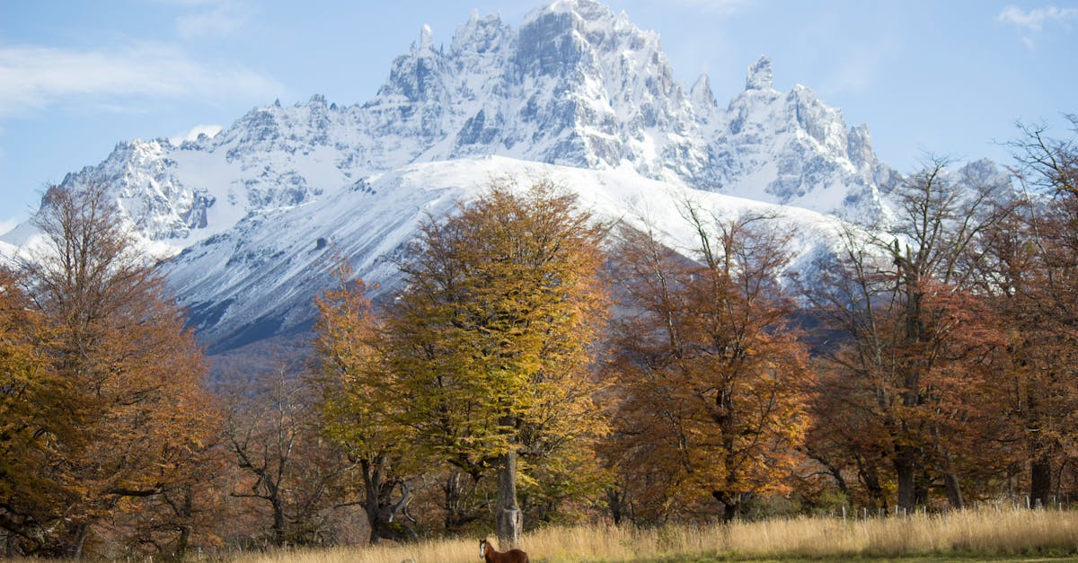
The highlight is the Laguna Cerro Castillo viewpoint on day two — a glacial lake backed by the castle-like spires that give the mountain its name. The trail is less developed than TDP, which means rougher terrain but also more solitude. I crossed paths with maybe fifteen hikers over three days.
You'll need to be more self-sufficient here. No refugios, limited camping infrastructure, and the trail markings can be vague in places. Bring a good map and don't underestimate the river crossings early in the season — snowmelt can make them thigh-deep.
Is it worth it? This is my dark horse pick. If you've already done Torres del Paine or want to avoid the crowds entirely, Cerro Castillo is the move. One of the most underrated treks in all of Patagonia.
5. Dientes de Navarino (4-5 Days)
Distance: ~53 km | Difficulty: Very Hard | Best months: December-February
The southernmost trek in the world. Let that sink in. Dientes de Navarino sits on Isla Navarino, across the Beagle Channel from Ushuaia, and south of it there is nothing but water until Antarctica. This is one of those hikes that attracts a very specific type of person — the kind who gets excited about suffering.
The circuit crosses several mountain passes above 800 meters through terrain that is essentially untouched — no shelters, no infrastructure, no cell service, no rescue teams around the corner. Navigation can be genuinely difficult in fog. The weather window is tiny. When it goes right, you get views across the Beagle Channel to the Darwin Range that make you feel like the last person on earth.
I haven't done this one. I'll be honest about that. But I've talked to four people who have, and every single one said the same thing: hardest trek they've ever done, and they'd do it again tomorrow.
Is it worth it? Only if you're an experienced backcountry trekker with solid navigation skills. This is not a trail for beginners. But if you want bragging rights and genuine wilderness, nothing in South America competes.
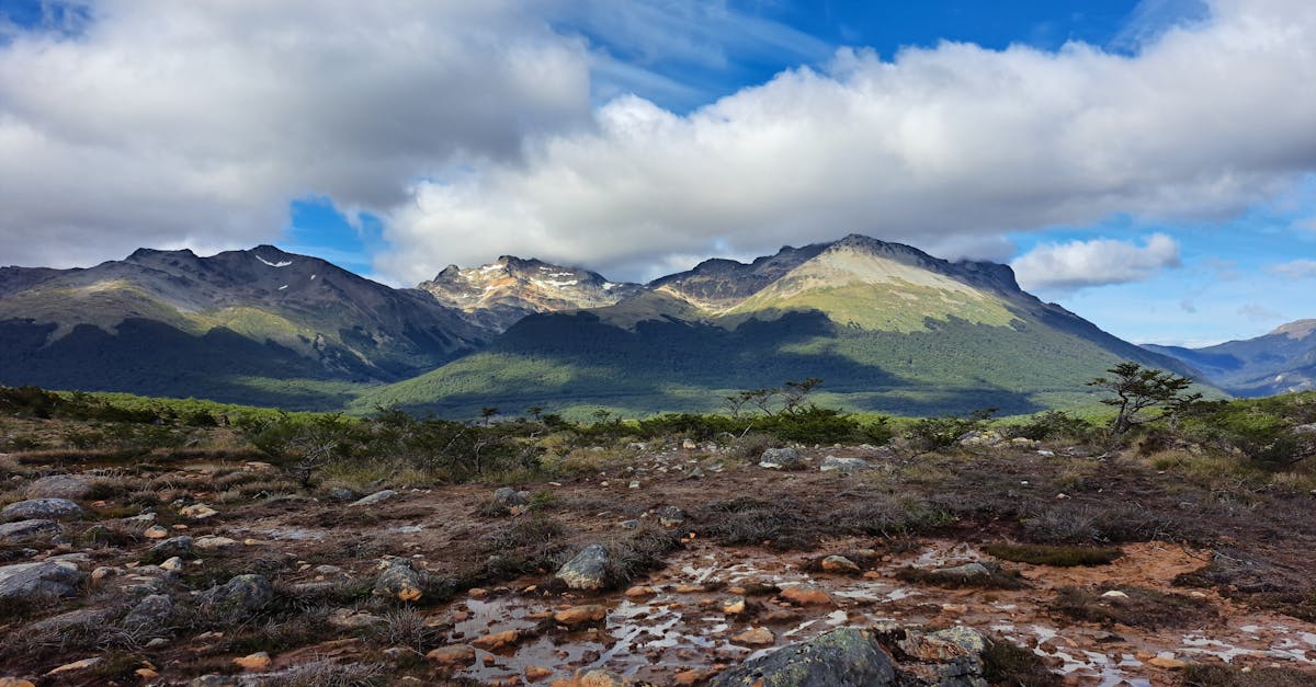
The Lake District: Volcanoes, Forests, and Fewer Blisters
The Lake District doesn't get the same hype as Patagonia, and that's a shame. The hiking here is more accessible, the scenery is just as dramatic in a different way, and you can sleep in a real bed at night. This region sits roughly between Temuco and Puerto Montt, and it's all volcanoes, araucaria forests, and lakes that look like someone poured teal paint into the mountains.
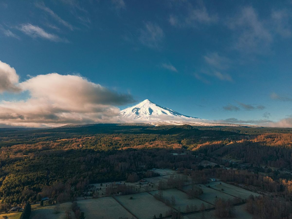
6. Villarrica Volcano Summit (1 Day)
Distance: ~12 km round trip | Difficulty: Hard | Best months: November-March
This is not a hike. It's a climb. You strap on crampons, rope up with a guide, and spend about six hours ascending one of Chile's most active volcanoes to stare into a smoking crater. Climbing Villarrica from Pucon is one of those experiences that sounds insane on paper and feels even more insane while you're doing it.
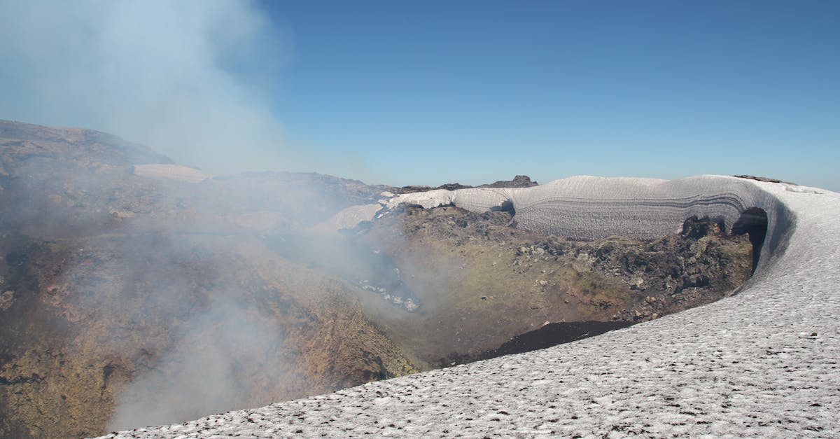
The last eruption was in 2015. This is not historical trivia — there's an active lava lake at the bottom of the crater. Standing on the rim, looking down at glowing orange magma while sulfur burns your nostrils, is genuinely surreal. The descent is the fun part: you slide down the snow slopes on your butt for about twenty minutes, using your ice axe as a brake. It's terrifying and hilarious.
A guided climb costs around $100-150 and includes crampons, ice axe, and gas mask. Yes, gas mask. The summit gets canceled frequently for weather or volcanic activity. Budget at least two or three days in Pucon in case your first attempt gets postponed.
Is it worth it? Absolutely. This is a bucket-list day. The combination of physical effort, genuine danger, and the absurdity of staring into an active volcano makes it unlike any other hike in Chile.
7. Huerquehue National Park — Los Lagos Trail (1 Day)
Distance: ~18 km | Difficulty: Moderate | Best months: October-April
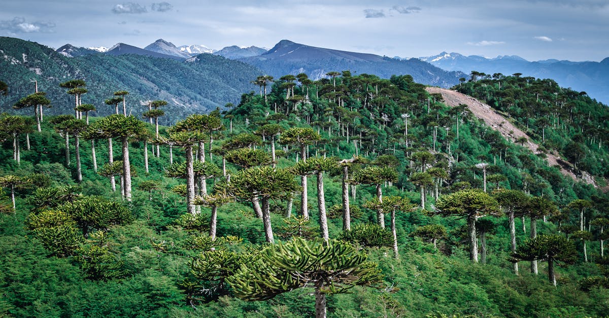
Huerquehue sits about 35 kilometers from Pucon and is wildly underrated. The Los Lagos trail climbs through dense araucaria forest — those bizarre, prehistoric-looking trees that grow nowhere else on earth — to a chain of three mountain lakes, each one bluer and more ridiculous than the last.
The climb is steady but not punishing — about 700 meters of gain spread over a few hours. The araucarias start appearing around the halfway point, and by the time you reach Lago Chico, you feel like you've walked into a Jurassic Park prequel. I spent an hour at the third lake just sitting in the sun, eating crackers, watching nothing happen. Probably the most relaxed I felt on any trail in Chile.
Is it worth it? Best easy-to-moderate day hike in the Lake District. If you're in Pucon for the Villarrica climb, add a day for this. The contrast between climbing a volcano and walking through an ancient forest is perfect.
8. Conguillio National Park — Sierra Nevada Trail (1 Day)
Distance: ~10 km | Difficulty: Moderate | Best months: November-April
Conguillio is the araucaria mothership. If Huerquehue is a nice introduction to these trees, Conguillio is total immersion — forests of them stretching in every direction, standing over black volcanic rock from the 2008 eruption of Llaima volcano. The Sierra Nevada trail is the best way to see it all, climbing to a viewpoint over Laguna Conguillio with Llaima smoking in the background.
Getting to Conguillio requires a car or joining a tour from Temuco — there's no regular public transport. The roads inside the park are gravel and rough in places. But the payoff is a landscape that looks nothing like anywhere else in Chile, or the world. Walking through old-growth araucarias on hardened lava flows is genuinely otherworldly.
Is it worth it? Yes, especially if you're into botany or geology. It's harder to reach than Huerquehue, but the landscape is more dramatic. Combine it with a night at one of the basic campgrounds inside the park for the full experience.
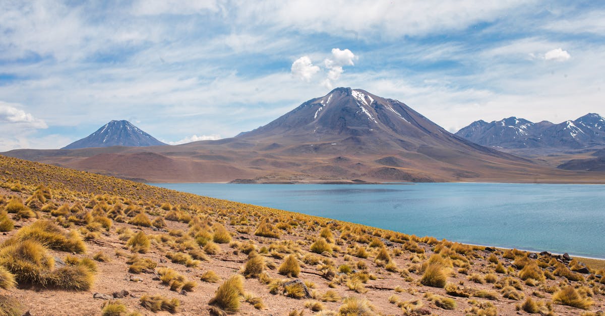
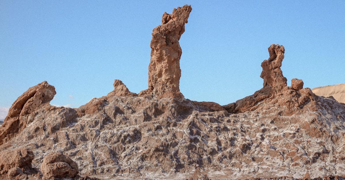
The Atacama: Desert Hikes That'll Fry Your Brain (in a Good Way)
Hiking in the Atacama Desert is a completely different game. The air is thin (most trails sit above 2,400 meters), the sun is relentless, and there's no shade. But the geology is so alien — salt flats, wind-carved rock formations, lunar landscapes — that it barely feels like hiking on earth. Based from San Pedro de Atacama, most of these are half-day walks, but don't let the short distances fool you. Altitude makes everything harder.
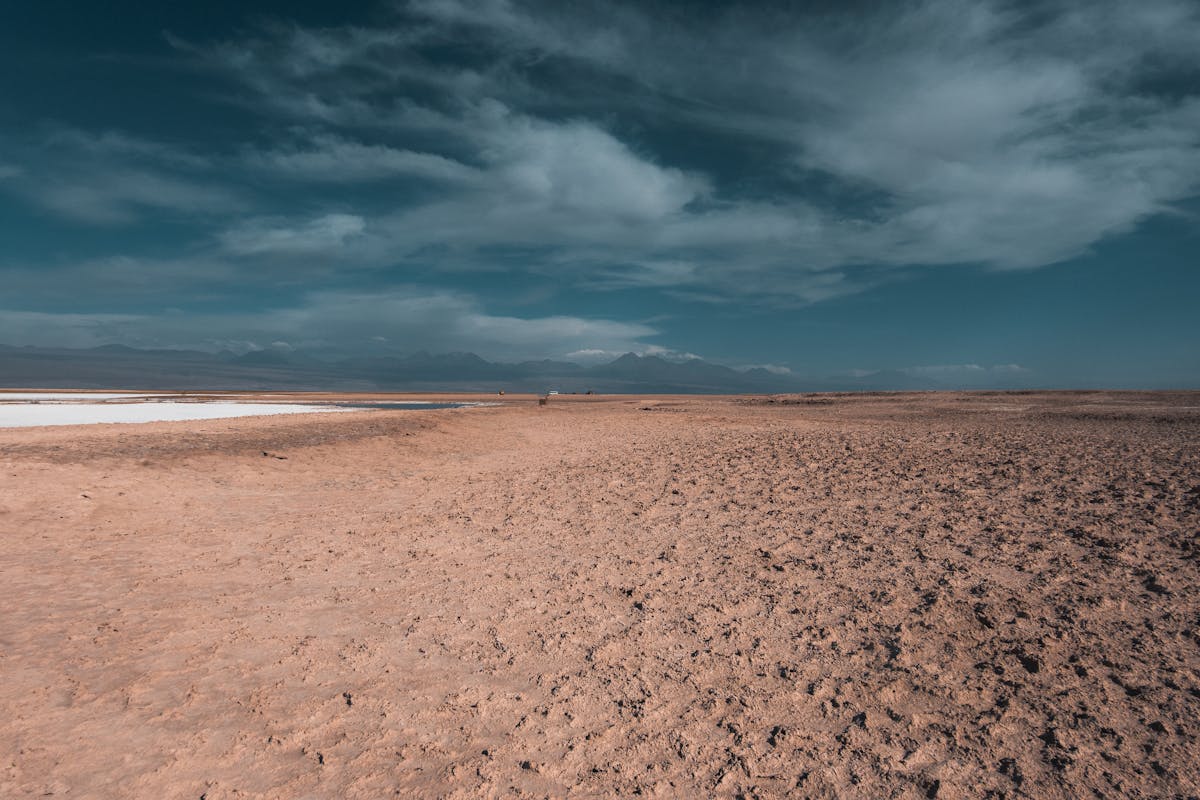
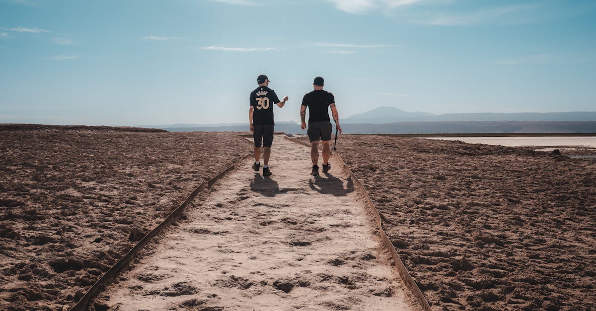
9. Valle de la Luna (Half Day)
Distance: ~5 km (main loop) | Difficulty: Easy | Best months: Year-round
Valle de la Luna is the most visited spot in the Atacama, and I went in expecting it to be overhyped. It's not. Walking through the valley is like being inside a geology textbook that someone brought to life. Wind-eroded salt formations, sand dunes flowing between crumbling rock walls, and a silence so thick you can hear your own blood pumping.
Most people visit on a sunset tour, which is fine but crowded. I went at sunrise on my own (you can walk in from the park entrance, about 13 km from San Pedro) and had the valley nearly empty. The morning light hitting the salt crystals on the canyon walls is something I still think about. Read my Atacama guide for the full logistics.
Is it worth it? Yes. Even with the tour buses. Go early, skip the sunset crowds, and give yourself enough time to wander off the main path.
10. El Tatio Geysers Area Hikes (Half Day)
Distance: ~3-6 km | Difficulty: Easy-Moderate (altitude) | Best months: Year-round
El Tatio sits at 4,320 meters above sea level, and it shows. Walking between the geysers and fumaroles at sunrise — when the steam columns are tallest against the cold dawn air — is magical, but the altitude turns a flat stroll into a panting shuffle. I got a headache within twenty minutes and had to sit down twice. Not from the trail. From the air.
Beyond the main geyser field, there are hiking trails that lead to a natural hot pool and across the surrounding altiplano. The landscape up here is all tawny grasslands, vicunas grazing in the distance, and volcanoes on every horizon. It feels more like Tibet than South America.
Is it worth it? The 4am departure is painful. The altitude is real. But watching the geysers erupt at sunrise, then soaking in a hot pool at 4,000 meters with Andean peaks all around you — yes, it's worth it.
Central Chile: Day Hikes from Santiago That People Forget Exist
Santiago sits in a valley surrounded by the Andes on one side and the coastal range on the other. You can literally see 5,000-meter peaks from the city center on a clear day. And yet most visitors treat it as just a layover. The hiking within day-trip distance is excellent.
11. Cerro Provincia (1 Day)
Distance: ~16 km round trip | Difficulty: Hard | Best months: April-November (too hot in summer)
Cerro Provincia is the Santiago day hike that locals actually do. The trail starts in the wealthy eastern suburb of La Dehesa, climbs relentlessly for about 1,500 meters of elevation gain, and tops out at 2,750 meters with a view of the entire city, the Andes, and — on clear winter days — all the way to Aconcagua.
I did this in late April, which turned out to be perfect timing. The autumn colors in the lower valley were gorgeous, the temperature was cool enough for the brutal ascent, and the visibility was crystal clear. In summer, this trail is an oven — exposed, no shade, and temperatures above 30C at the base. Don't try it from December to February unless you enjoy suffering.
Is it worth it? If you have a free day in Santiago and want a genuine workout with a world-class view, yes. Take the metro to the end of Line 1, then a colectivo to the trailhead. You don't even need to rent a car.
12. Cajon del Maipo Trails (Half Day to Full Day)
Distance: Various (5-20 km) | Difficulty: Easy to Hard | Best months: Year-round
Cajon del Maipo is Santiago's backyard mountain playground — a deep river canyon that runs east into the Andes with hot springs, waterfalls, and trails at every elevation. The most popular walks are around Embalse el Yeso (a stunning turquoise reservoir at 2,500 meters) and the trails near Banos Morales, but there are dozens of lesser-known options.
I spent a day exploring the trails around San Jose de Maipo and found a waterfall trail that nobody seemed to know about — a local at the gas station pointed me down a gravel road, and twenty minutes later I was standing alone in front of a 30-meter cascade. That's the thing about Cajon del Maipo. The obvious stuff is good. The stuff you stumble into is better.
Is it worth it? For the accessibility alone. You're an hour from downtown Santiago and suddenly you're in the Andes. Not as dramatic as Patagonia, but perfect for a day when you don't want to fly anywhere.
The Carretera Austral: Wild Trails Off the Road Less Traveled
The Carretera Austral is a 1,200-kilometer gravel highway through some of Chile's most remote and roadless territory. Most people drive or cycle it, but the hiking off the main road is exceptional. These are trails where you might not see another person all day — which, after the crowds at Torres del Paine, is exactly what some of us need. Check my Carretera Austral guide for the full road trip logistics.
13. Queulat Hanging Glacier Viewpoint (Half Day)
Distance: ~6 km round trip | Difficulty: Moderate | Best months: November-March
Queulat National Park has one of the most photographed natural features on the entire Carretera Austral — the Ventisquero Colgante, a hanging glacier wedged between two rock faces, draining through twin waterfalls into a milky turquoise lagoon. The trail to the viewpoint is a rainforest walk through ferns and dripping moss, which makes the sudden appearance of the glacier feel like a glitch in the matrix.
The hike itself is short and not particularly difficult, but the approach by road is an event — winding through old-growth forest in one of the wettest corners of Chile. I got rained on during the hike, which honestly made the whole scene more dramatic. The glacier emerging from the mist is a view I won't forget.
Is it worth it? Yes. Short, easy, and the payoff-to-effort ratio is ridiculous. Stop here on your way down the Carretera and give it two hours.
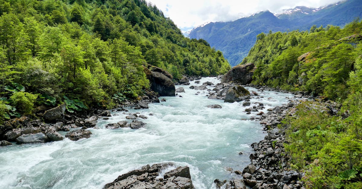
14. Cochamo Valley (2-4 Days)
Distance: ~32 km round trip to La Junta basecamp | Difficulty: Moderate-Hard | Best months: November-March
Cochamo gets called "Chile's Yosemite" because of its massive granite walls, and the comparison is actually fair. The valley sits south of Puerto Montt and is reached by a muddy, root-tangled trail through temperate rainforest that deposits you in a flat river valley surrounded by 1,000-meter granite monoliths. Climbers come from around the world for the big walls. Hikers come for the valley floor and the feeling of being very, very small.
The trail in is the crux for non-climbers — about 16 km of slippery roots, stream crossings, and mud that can swallow a boot. It took me about five hours and I used muscles I forgot I had. But once you're in the valley, the camping is free, the granite walls glow orange at sunset, and the silence at night is so deep it's almost uncomfortable.
Is it worth it? If you like wild places and don't mind a rough approach trail, Cochamo is one of the most special valleys in Chile. It's nothing like Patagonia, nothing like the Atacama, and nothing like anywhere else I've been. Budget at least two nights to make the slog in worthwhile.
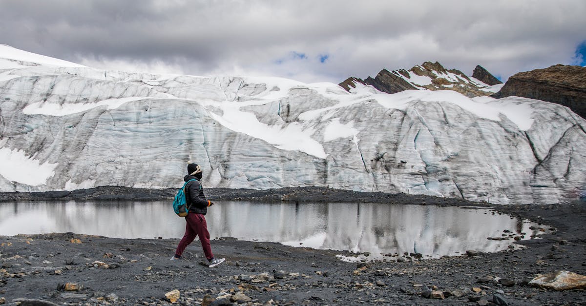
15. Exploradores Glacier (1 Day)
Distance: ~4 km on ice + approach | Difficulty: Moderate (guided, crampons) | Best months: November-March
This one is a bonus because it's technically an ice trek rather than a hike, but it's too good to leave out. Exploradores Glacier sits near the town of Puerto Rio Tranquilo on the Carretera Austral. A guided excursion takes you across the glacier surface, through ice caves and between crevasses, for about four hours. It's the most accessible glacier walking experience in Chile outside of Grey Glacier in Torres del Paine.
The approach drive through dense forest is beautiful, the glacier is massive and blue, and the ice formations are genuinely incredible. I did a similar glacier walk in Patagonia, and Exploradores held up. The guides know the route well, and the crampons they provide are solid.
Is it worth it? If you're driving the Carretera and pass through Puerto Rio Tranquilo, yes. The guided tour costs around $80-100 per person and takes most of a day. Worth it for the ice cave photos alone.
My Top 5 Hikes in Chile, Ranked
After all of that, here's where I actually land. This is personal. Your list will be different depending on whether you prefer crowds or solitude, multi-day slogs or day hikes, forests or deserts.
| Rank | Hike | Why |
|---|---|---|
| 1 | W Trek, Torres del Paine | The total package. Five days of constantly changing landscapes, genuine physical challenge, and views that ruined every other hike for me |
| 2 | Villarrica Volcano Summit | Nothing else in Chile combines adrenaline, absurdity, and beauty like staring into an active crater |
| 3 | Cerro Castillo Trek | Torres del Paine quality without the crowds. The laguna viewpoint on day two is one of the best sights in Patagonia |
| 4 | Cochamo Valley | The most unique landscape on this list. Granite walls, rainforest, total isolation. Feels like you found something nobody else knows about |
| 5 | Huerquehue Los Lagos | Best day hike in Chile. Perfect difficulty, araucaria forests, three ridiculous lakes. If you only have one day, do this |
Honorable mentions: Base Torres for the postcard moment, Valle de la Luna for the sheer weirdness, and Dientes de Navarino for anyone who wants to brag they hiked the southernmost trail on earth.
When to Go: Chile's Hiking Seasons by Region
Chile stretches across so many latitudes that there is no single "hiking season." What works in the Atacama will not work in Patagonia, and vice versa. Here's the breakdown by region — and check my when to visit Chile guide for more detail.
| Region | Best Months | Notes |
|---|---|---|
| Atacama | Year-round | Summer (Dec-Feb) is slightly warmer but busier. Winter nights drop below freezing at altitude |
| Central/Santiago | April-November | Summer is brutally hot. Autumn and spring are ideal. Winter has snow at altitude |
| Lake District | November-March | Rainiest region in Chile. Even in summer, expect afternoon showers |
| Carretera Austral | December-March | Short season. Roads and trails can be impassable outside summer |
| Patagonia | November-March | December-February is peak. October and March have fewer crowds but worse weather odds |
| Tierra del Fuego | December-February | Tiny window. Snow closes trails outside of these months |
Practical Stuff: Gear, Costs, and Getting to the Trailheads
A few things I learned the hard way that apply across all Chilean hikes.
Gear That Actually Matters
Wind protection: The number one thing. In Patagonia especially, a hardshell jacket that blocks wind is more important than warmth. I watched hikers in expensive down puffies get destroyed by wind because they didn't have a shell over top.
Sun protection: At Atacama altitudes (2,400-4,500 meters), the UV is savage. I burned through SPF 50 in two hours. Bring a hat with a neck flap and reapply obsessively.
Trekking poles: I used to think these were for old people. After the Base Torres boulder scramble and the French Valley scree field, I take it all back. They save your knees on the descents and your dignity on river crossings.
Layers: In Patagonia, I wore a t-shirt, fleece, and hardshell on the same day — sometimes within the same hour. The weather shifts are real. Carry all three even if you start in sunshine.
What This All Costs
| Item | Cost |
|---|---|
| Torres del Paine park entry | ~$37 USD (foreigners, peak season) |
| Camping per night (TDP) | $8-12 USD |
| Refugio per night (TDP) | $120-180 USD |
| Villarrica volcano guided climb | $100-150 USD |
| Huerquehue park entry | ~$6 USD |
| Valle de la Luna entry | ~$10 USD |
| El Tatio sunrise tour | $30-50 USD |
| Exploradores Glacier guided trek | $80-100 USD |
| Cochamo Valley | Free (no entry fee) |
Getting Around
Chile's hiking regions are spread across enormous distances. Santiago to Patagonia is a three-hour flight or a 40+ hour bus ride. The Atacama is a two-hour flight north. The Lake District is a 90-minute flight south, or an overnight bus. I covered the transport options in detail in my Chile hiking overview and trip planning guide, but the short version: fly to the region, bus or rent a car within it.
For the Carretera Austral, you need a car. There is no way around it. Public transport exists but is infrequent and unreliable. I rented from Puerto Montt and drove south — the roads are gravel but manageable in a regular car if you're careful.
Quick Tip
Book internal flights on Sky Airline or JetSmart as far in advance as possible. Santiago to Punta Arenas can cost $40 if booked early, or $200+ last minute. Those savings pay for a lot of camp food.
Chile is long, thin, and packed with trails that range from flat desert strolls to multi-day mountain epics. I have hiked in about thirty countries, and Chile keeps pulling me back. The variety is unmatched — you can climb a volcano in the morning and hike through a rainforest in the afternoon and walk across a glacier the next day. No other country does that.
Pick three hikes from this list. Book the flights. Buy the trekking poles. Your knees will hate you. The rest of you won't care.