This article contains affiliate links. If you book through them, I earn a small commission at no extra cost to you.
The cow did not care that I had somewhere to be. She stood in the middle of the gravel road, chewing, staring at the hood of my rented pickup truck with the total indifference of an animal that has never once been in a hurry. Behind her, six more cows. Behind them, a man on a horse who raised one hand in greeting and made zero effort to speed things up. I sat there with the engine idling, fog sitting low in the valley, the Andes somewhere above me behind a wall of cloud, and thought: this is the Carretera Austral. Everything here runs on its own clock.
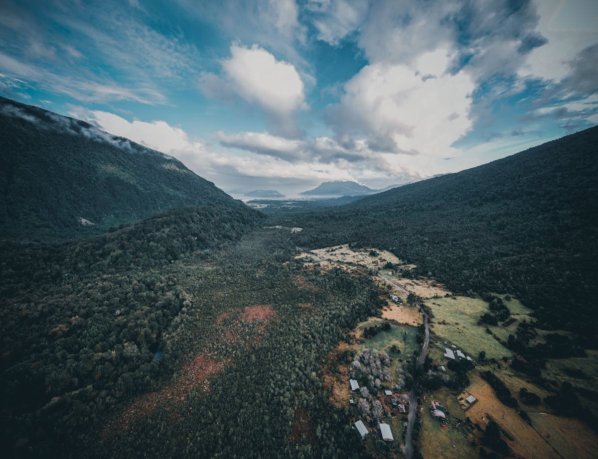
I had been on the road for four hours by that point. Four hours since leaving Puerto Montt, and I had covered maybe 120 kilometers. Not because of traffic. Because I kept stopping. The Carretera Austral does that to you. Every bend opens up something — a waterfall you can hear before you see, a lake so blue it looks photoshopped, a stretch of old-growth forest where the trees are thicker than your car. You plan for six hours of driving and end up doing ten because the road itself is the destination.
This is the story of 1,240 kilometers of gravel, rain, ferries, and some of the most absurd scenery I have encountered anywhere in South America. Here is how the drive went, section by section, and everything I wish I had known before I turned the key.
What the Carretera Austral Actually Is (and Why It Matters)
The Carretera Austral — Ruta 7, officially — is a 1,240-kilometer road that runs south from Puerto Montt to the tiny settlement of Villa O'Higgins. Augusto Pinochet ordered its construction in the 1970s as a military project to connect the remote Aysen region to the rest of Chile. Before the road existed, the only way to reach most of this territory was by boat or plane. Some sections were not finished until the late 1990s. A few stretches still are not paved.
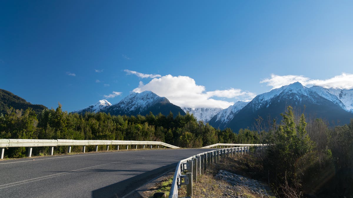
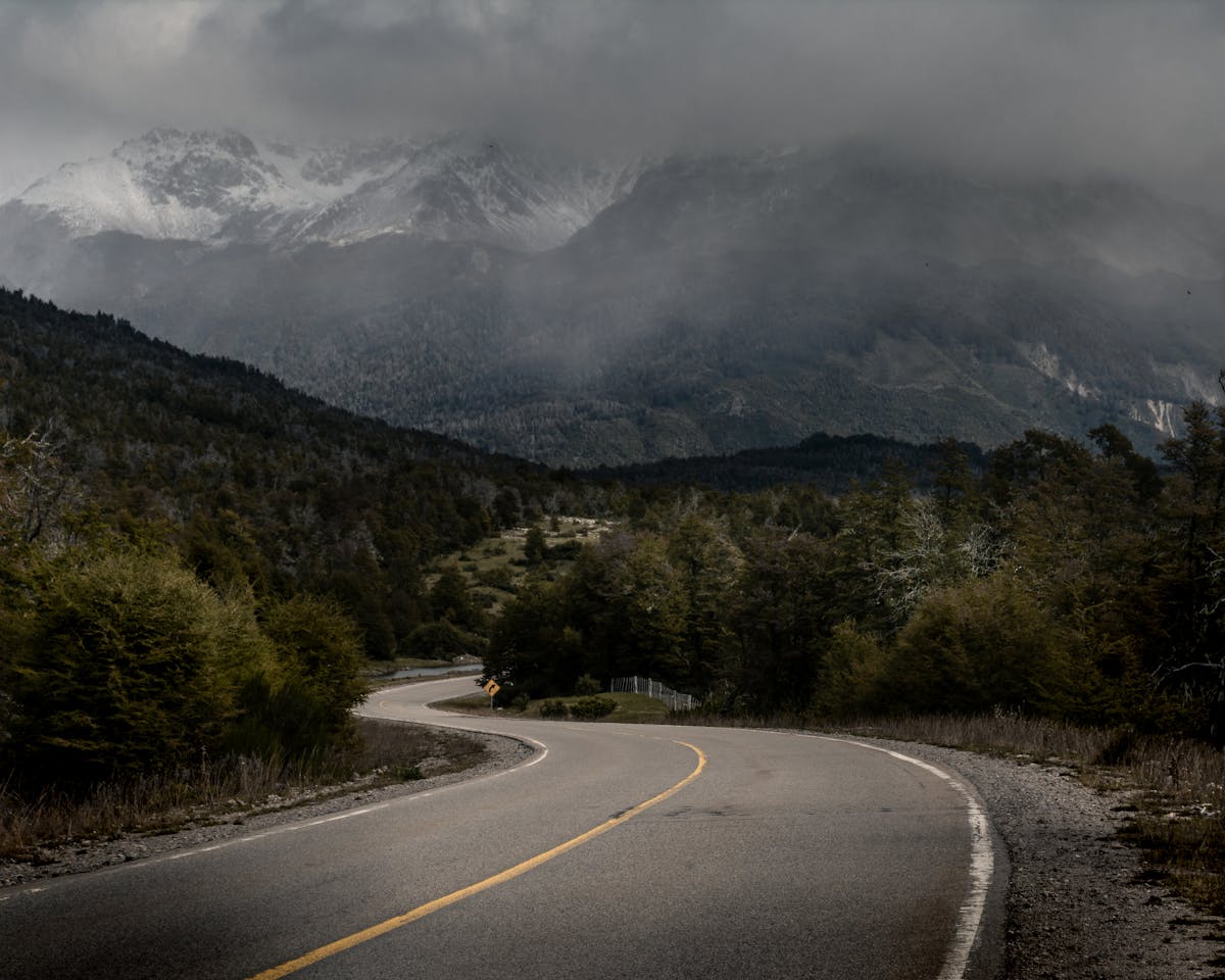
That last part matters. This is not a highway. Large sections remain gravel — washboarded, potholed, single-lane gravel that turns to mud when it rains, which it does constantly. The Carretera Austral passes through temperate rainforest, past active volcanoes, alongside glacier-fed rivers the color of toothpaste, and through towns so small they do not have a gas station. It is the most spectacular drive I have done, and also the most physically tiring.
Most people drive it north to south, starting in Puerto Montt and ending wherever they run out of time or road. I did the same. The whole thing took me twelve days, and I could have used fourteen.
Puerto Montt to Chaiten — The Slow Start That Punches You in the Face
Puerto Montt is not a pretty city. I will just say it. It is a working port, a transit hub, and a place where you buy supplies before heading south. The fish market at Angelmo is worth an hour — raw shellfish, fried fish, loud vendors, and cheap seafood stew that will keep you warm for the drive ahead. But do not linger. The road is calling.
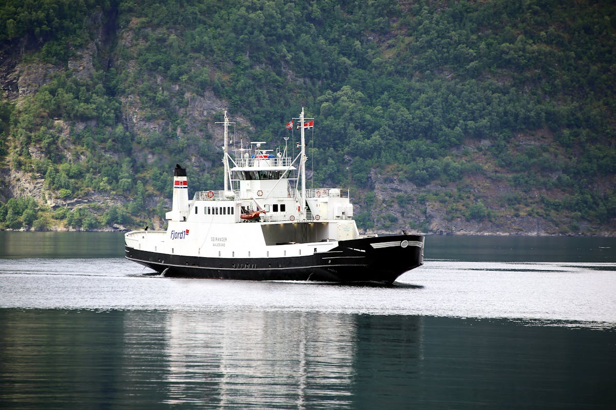
The first decision you make is how to get past the Reloncavi Estuary. There is a ferry from La Arena to Puelche — about 30 minutes on the water — and this is your introduction to a recurring theme of the Carretera Austral: ferries. You will take at least two on the full drive, possibly four depending on your route. They run on schedules that are more like suggestions. I waited 90 minutes for the first one because I arrived five minutes after one departed. Bring snacks. Bring a book. Bring patience.
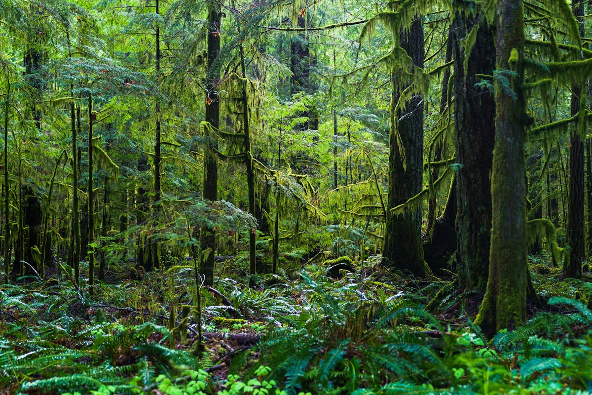
South of the ferry crossing, the road enters Pumalin Douglas Tompkins National Park, and the scenery shifts from pleasant to unreal. This is the legacy of Douglas Tompkins, the North Face founder who bought enormous tracts of land in southern Chile and eventually donated them back as national parks. Pumalin protects some of the largest stands of alerce trees left on the planet — massive, ancient conifers that can live 3,000 years. The Alerce Trail is a short boardwalk loop through a grove of them, and standing at the base of a tree that was alive during the Roman Empire genuinely rewired something in my brain. It took maybe 40 minutes. It was one of the highlights of the entire trip.
The road through Pumalin is rough. Single-lane gravel, steep grades, blind corners with no guardrails and a straight drop into a river valley below. I had a white-knuckle moment when a logging truck came around a bend in the opposite direction and I had to reverse 50 meters to find a pullout wide enough for both of us. My palms were sweating. The truck driver waved as he passed like it was nothing.
Then you come down out of the mountains and into Chaiten.
Chaiten — The Town That Refused to Stay Dead
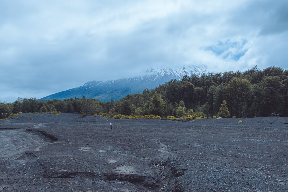
Chaiten was buried. In 2008, the Chaiten volcano — which had been dormant for over 9,000 years — erupted and dumped ash and lahars across the town. The government evacuated everyone and declared the town finished. Move on. Build somewhere else.
The people came back anyway. They rebuilt on top of the ash. Today, Chaiten is a small, slightly rough frontier town of maybe 3,000 people, sitting in the shadow of a volcano that is technically still active. You can see the damage if you know where to look — a few buildings still half-submerged in dried mud on the south side of town, a riverbed that shifted course during the eruption and never went back. But mostly it just looks like a normal small Chilean town. Gas station, a couple of restaurants, a few hostels.
I stayed one night in Chaiten. The accommodation was basic — a room above a family's house with thin walls and a heater that made concerning noises — but the dinner more than made up for it. A woman ran a tiny restaurant out of her front room, six tables, no menu, and served whatever she had caught or grown that day. I got a plate of merluza with potatoes and a salad that tasted like actual vegetables instead of the pale supermarket kind. CLP 6,000. About seven dollars.
Fill your tank in Chaiten. The next reliable fuel stop is Coyhaique, and that is a very long way south.
Quick Tip
Carry at least one spare 20-liter jerrycan of fuel. Gas stations on the Carretera Austral can be 200+ kilometers apart, and a few of the smaller ones close on Sundays or simply run out. I ran my tank to the warning light once and spent a very tense hour doing math on remaining range. Do not do this.
The Detour to Futaleufu — Class V and Cold Water
About 50 kilometers south of Chaiten, a turnoff heads east toward the Argentine border and the small town of Futaleufu. If you have any interest in whitewater rafting, you go here. This is not optional. The Futaleufu River is consistently rated among the top five whitewater rivers on the planet. Class IV and V rapids through a turquoise-green gorge that looks like a screensaver but tries to kill you.
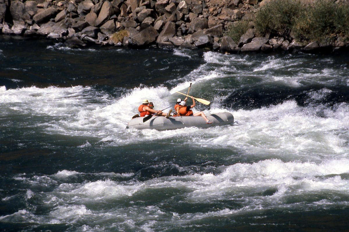
I did a full-day rafting trip and it was the most terrifying fun I have had in a long time. The water is glacier-fed and genuinely cold — cold enough that the wetsuit felt insufficient and my hands went numb within the first hour. But the rapids are extraordinary. The guides are experienced (they have to be, on water like this), and the canyon scenery between the rough sections is so beautiful it almost feels unfair.
Futaleufu town itself is tiny — one main street, a few outfitters, a general store. Rafting season runs from November through March. Book in advance during January and February, which is peak season. A full-day trip runs around $90-120 USD depending on the operator.
The detour to Futaleufu adds about a day to your trip but takes nothing away from it. Do the side trip. You will not regret it.
Queulat National Park — The Glacier That Hangs Off a Cliff
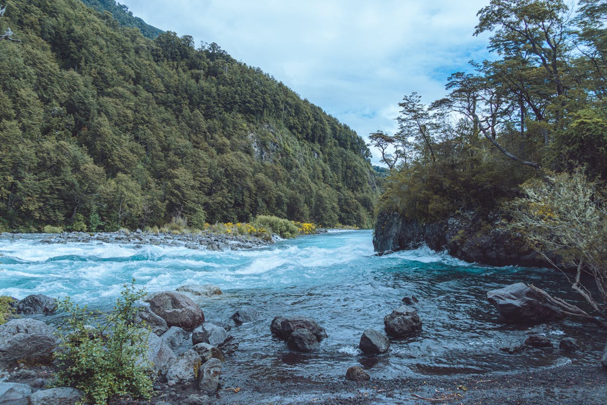
South of Chaiten, the Carretera Austral enters a long, wet, forested corridor. It rains here more than almost anywhere in South America. The trees are draped in moss. The road is frequently muddy. Waterfalls pour off cliff faces directly onto the road surface, and you drive through them like a car wash with no roof.
Then you reach Queulat National Park, and the Ventisquero Colgante — the hanging glacier.
I had seen photos. The photos do not prepare you. The Ventisquero Colgante is a glacier wedged into a notch between two peaks, hanging off the rock face like it is about to fall off. Two waterfalls pour off its edge into a green lagoon below. The whole thing looks impossible, like someone pasted a piece of Arctic landscape onto a South American mountain and forgot to blend the edges.
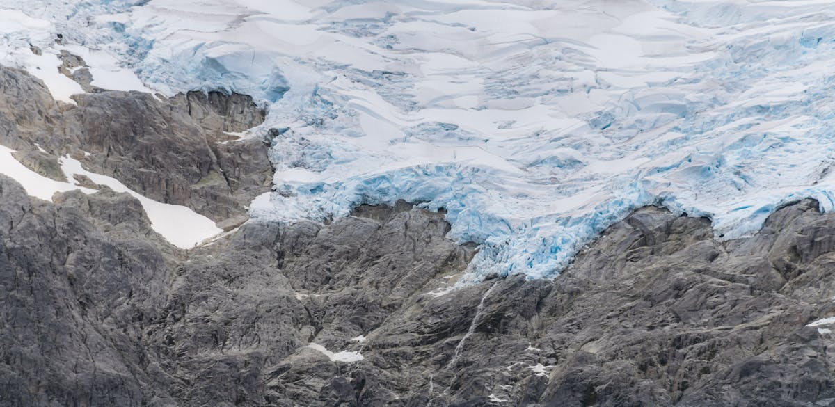
The trail to the main viewpoint takes about 90 minutes one way. It is uphill, muddy, and crosses a suspension bridge that swings in the wind. The last section involves wooden stairs bolted into the cliff face. Worth every step. There is a closer viewpoint at the lagoon base that takes only 30 minutes if you are short on time, but the upper viewpoint is the one you want.
Park entrance is CLP 5,000 for foreigners. There is a basic campground inside the park if you want to stay overnight — I did, and woke up to condors circling above the glacier at sunrise. One of those mornings where you just sit in your sleeping bag and stare.
The drive from Chaiten to Queulat takes about four hours in good conditions. In rain, add an hour. In heavy rain, add two and consider pulling over entirely because the visibility drops to almost nothing and the gravel turns to soup.
Coyhaique — The Only Real City (and the Resupply Stop)
After days of tiny settlements and frontier-grade accommodation, arriving in Coyhaique feels like returning to civilization. It is the capital of the Aysen region, and by Carretera Austral standards it is a metropolis — around 50,000 people, actual restaurants, a supermarket, ATMs that work, and mechanics who can fix whatever the road has done to your vehicle.
I spent two nights in Coyhaique. Not because it is a destination in itself — it is a pleasant mid-sized Chilean city with a nice central plaza and some good restaurants, but it is not why you drove 600 kilometers of gravel. I spent two nights because my truck needed new brake pads (the gravel descents ate through them), I needed to do laundry, and I wanted to eat a meal that was not cooked on a camping stove.
Use Coyhaique for what it is: a base. Resupply here. Fill up on fuel. Get cash — you will not find another reliable ATM until Cochrane, and some places south of here are cash only. If your vehicle needs attention, this is your last chance for a proper workshop.
Quick Tip
The Mamma Gaucha restaurant in Coyhaique does a lamb slow-cooked over open flame — cordero al palo, the Patagonian signature dish. CLP 15,000 for a plate that could feed two people. The best meal I had between Puerto Montt and Villa O'Higgins.
Cerro Castillo — The Trek That Deserves to Be Famous
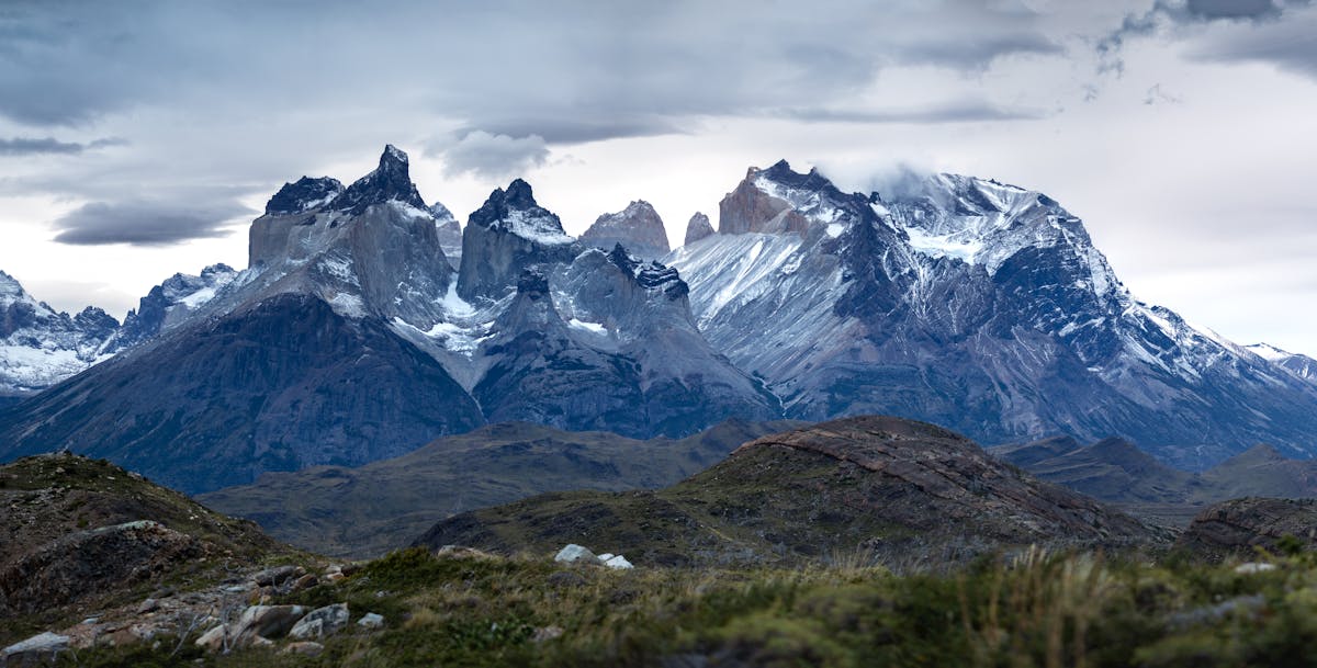
An hour south of Coyhaique, the Cerro Castillo massif rises up from the steppe. It looks like a fortress — dark basalt spires streaked with snow, jagged and angular in a way that Torres del Paine is not. Torres del Paine is the glamorous one, the one on the postcards. Cerro Castillo is the rougher, quieter, less-visited sibling, and in some ways I liked it more.
The Cerro Castillo Circuit is a four-day trek that loops around the massif through lenga forests, past glacial lakes, and over a high pass that had me gasping for air and cursing my backpack. I did not do the full circuit — I did not have four days to spare — but I did the day hike to Laguna Cerro Castillo, which is the money shot. About five hours round trip, moderate difficulty, with the last 45 minutes being a steep scramble up a moraine to reach the lake.
The lake is turquoise. Deeply, intensely turquoise, in a way that looks artificial. Behind it, the spires of Cerro Castillo rise straight up, dark rock and hanging ice. I sat on a boulder and ate my lunch and thought about how strange it is that everyone goes to Torres del Paine and almost nobody comes here. Maybe that is the appeal.
If you are a serious hiker and have the time, the full four-day circuit is apparently spectacular. Multiple people I met on the road raved about it. But even the day hike to the laguna is reason enough to stop. Do not skip this section of the Carretera Austral.
The Baker River and the Road to Cochrane
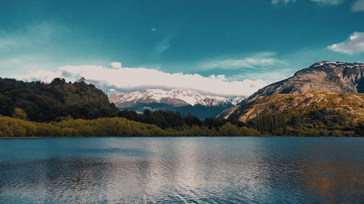
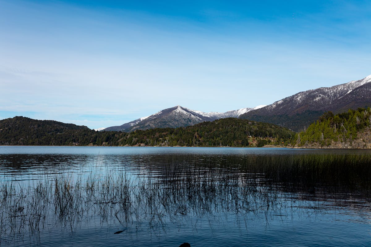
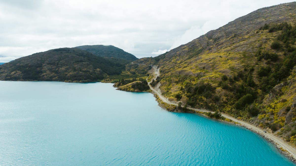
South of Cerro Castillo, the Carretera Austral follows the Baker River, and this is where the road becomes something else entirely. The Baker is Chile's most voluminous river, and its color — a deep, electric turquoise that shifts to jade green depending on the light — is genuinely hard to believe even when you are staring at it. I kept pulling over to look. The color comes from glacial flour, rock ground to fine powder by the Northern Patagonian Ice Field, and it gives the water an almost luminous quality.
The drive along the Baker valley is one of the great stretches of road on the continent. Gravel, single-lane, clinging to the side of cliffs above the river. At one point, the road crosses the Baker on a narrow bridge and there is a viewpoint where you can see the confluence of the Baker and the Nef River — two rivers of different colors merging into a single current. It is a place where you just park and stare.
I stopped for fly fishing along the Baker. I am not a serious angler, but the lodge where I stayed offered a guided half-day session, and casting into water that blue while surrounded by mountains that tall was one of those experiences that felt almost too picturesque to be real. I caught nothing. The guide caught two. He did not gloat, but I could tell he wanted to.
Cochrane is the next town of any size — about 3,000 people, a few hostels, a fuel station, and the gateway to Patagonia National Park. The town is functional rather than charming, but after several days on the road, a hot shower and a bed that does not inflate feels like luxury.
Cochrane to Villa O'Higgins — The Final Push
South of Cochrane, the Carretera Austral enters its wildest, most remote section. The road narrows. The settlements thin out. The landscape opens into steppe and ice and sky. You are approaching the edge of the Northern Patagonian Ice Field, the largest body of ice in the Southern Hemisphere outside Antarctica, and you can feel it — the air gets colder, the wind picks up, the clouds move differently.
The road from Cochrane to Villa O'Higgins is about 230 kilometers and takes at least five hours, possibly seven. There is a mandatory ferry crossing at Rio Bravo — the road literally ends at the water — and the ferry runs just a few times a day. Miss it and you wait. I made the afternoon crossing with maybe ten minutes to spare and sat on the deck watching chunks of ice float past in the river. The guy next to me, a German cyclist who had been pedaling the Carretera Austral for three weeks, told me this was his favorite section. I believed him.
Villa O'Higgins is the end of the road. Literally. The Carretera Austral stops here. The town has maybe 500 people, one or two hostels, a school, and a view south toward the ice field that makes you feel very small. There is a boat you can take across Lago O'Higgins to the Argentine border, and from there you can hike to El Chalten — but that is another story and another article (check our Patagonia itinerary for that route).
I stayed one night in Villa O'Higgins. I ate in the only open restaurant. I walked to the lakeshore at sunset and watched the ice field glow pink. And then I turned around and drove back north, because that is what you do at the end of the road.
Cycling the Carretera Austral (for the Masochists)
I drove. But a surprising number of people cycle the Carretera Austral, and during my twelve days on the road I passed probably 30 or 40 loaded touring cyclists. Most were going south. All of them looked simultaneously destroyed and ecstatic.
I talked to a few at campsites. The consensus: it takes three to four weeks to cycle the full route. The gravel is the hardest part — deep, loose, washboarded gravel that turns every kilometer into a workout. The headwinds from the south can be brutal, which is why most people ride north to south (the prevailing winds push from the north, usually). Rain is constant. The climbs are long. But the cyclists I talked to all said the same thing: this was the best ride of their life.
If you are considering it, bring wide tires (40mm minimum, wider is better), carry enough food for three days between resupply points, and accept that your daily distance will be half of what you think. A fit cyclist on pavement might average 100 kilometers per day. On the Carretera Austral, 50-60 is more realistic, and some days will be less.
The Practical Stuff (Because the Road Does Not Care About Your Plans)
Getting a Vehicle
Rent a 4WD. Full stop. A regular sedan can technically drive some sections of the Carretera Austral — the paved parts near Puerto Montt and Coyhaique — but the unpaved sections will eat a low-clearance car alive. I rented a Toyota Hilux pickup in Puerto Montt and it handled everything the road threw at it. A Suzuki Jimny would also work. Anything with high clearance and four-wheel drive.
Rental companies in Puerto Montt include Econorent and Europcar. Budget about $60-80 USD per day for a basic 4WD pickup. Book well in advance for December through February — inventory runs out fast. Make sure the rental agreement allows gravel road driving (some do not by default) and get the full insurance. The road will scratch, chip, and dent your vehicle. This is not a question of if but when.
Check our getting around guide for more on car rentals in Chile.
Fuel
This is the thing that keeps Carretera Austral drivers awake at night. Gas stations are spaced far apart and some are unreliable. Here is what I found:
| Town | Fuel Available? | Notes |
|---|---|---|
| Puerto Montt | Yes, multiple stations | Fill up here. Last reliable fuel before the road gets wild |
| Chaiten | Yes, one station | Sometimes closes early on weekends |
| Futaleufu | Yes, one station | Detour only |
| La Junta | Yes | Small but reliable |
| Coyhaique | Yes, multiple stations | Fill up and buy a jerrycan |
| Cerro Castillo village | Sometimes | Not always available — do not depend on this |
| Cochrane | Yes, one station | Last proper fuel before Villa O'Higgins |
| Villa O'Higgins | Informal only | You might find someone selling from barrels. Maybe |
Carry a jerrycan. Fill up at every opportunity. Your tank range needs to comfortably cover 300 kilometers of gravel driving, which burns more fuel than pavement.
Ferries
You will need at least the La Arena to Puelche ferry (near Puerto Montt) and the Rio Bravo ferry (south of Cochrane). There is also an optional longer ferry from Hornopiren to Caleta Gonzalo that skips a section of road but takes several hours and costs more. Naviera Austral operates most of the routes.
Schedules change seasonally. In summer (December-February), ferries run more frequently. In shoulder season, some services drop to once or twice daily. Check the Naviera Austral website before you go, then check again when you arrive because the website is not always accurate. I showed up for a ferry that the website said departed at 2pm. It departed at 11am. The website had not been updated.
When to Go
December through March. That is it. Do not attempt the Carretera Austral in winter. Parts of the road close. Ferries stop running. Some towns effectively shut down. The rain is extreme and the days are short.
Within the summer window, January and February have the best weather (or least bad weather — this is Patagonia, it rains year-round) and the longest days. But they are also the busiest months, and accommodation in small towns books out. December and March are quieter, slightly cooler, and you will have more road to yourself. I went in early February and thought the timing was about right.
Read our when to visit Chile guide for seasonal details across the whole country.
Budget
The Carretera Austral is not a cheap trip. The remoteness drives prices up, and there are not many budget options once you leave the cities. Here is roughly what I spent over twelve days:
| Expense | Cost (USD) |
|---|---|
| 4WD rental (12 days) | $840 |
| Fuel | $320 |
| Ferries | $60 |
| Accommodation (mix of hostels and cabanas) | $480 |
| Food (restaurants + groceries) | $360 |
| Activities (rafting, park entry fees) | $180 |
| Total | ~$2,240 |
You could do it cheaper by camping and cooking your own food — plenty of people do. But even at the budget end, factor in at least $100/day once you include the vehicle and fuel. This is not Southeast Asia pricing.
What to Pack
Rain gear. Proper rain gear, not a fashion poncho from a gas station. It will rain on you. Probably every day. A good waterproof jacket and pants are mandatory. Beyond that: layers (temperatures swing wildly even in summer), a headlamp for the campsites without electricity, a spare tire and basic tools (check that the rental vehicle has these), snacks for the long stretches between towns, and cash in Chilean pesos. Cards are accepted in Coyhaique and Cochrane. Everywhere else, assume cash only.
How the Carretera Austral Fits Into a Bigger Chile Trip
Most people combine the Carretera Austral with either the Lake District (north) or Torres del Paine (south, via Argentina). A solid two-week Chile itinerary could include the Lake District plus the northern half of the Carretera Austral down to Coyhaique. If you have three weeks, you can do the full road and then fly from Balmaceda (near Coyhaique) down to Punta Arenas for Torres del Paine.
The Carretera Austral does not connect directly to Torres del Paine by road on the Chilean side. To get from Villa O'Higgins to Torres del Paine, you either fly (Balmaceda to Punta Arenas), cross into Argentina and drive south through Ruta 40, or take the boat and hike combination to El Chalten and work your way down from there. None of these options are quick. Factor in transit days.
If you have been to Cochamo — Chile's "Yosemite" — it sits near the northern end of the Carretera Austral and makes a natural starting add-on before heading south.
The Road Stays With You
I drove back to Puerto Montt on day twelve with a cracked windshield, brake pads at 20 percent, a mysterious rattle in the rear suspension that had not been there on day one, and a memory card full of photos that all looked like postcards. My shoulders ached from the gravel vibration. My lower back was not speaking to me. And somewhere around the first paved road I hit north of Coyhaique, I caught myself feeling disappointed that the rattling had stopped.
The Carretera Austral is not comfortable. It is not efficient. It does not care about your schedule or your vehicle or your need for a reliable internet connection. It is a road that demands you slow down, pay attention, and accept that the cow in the middle of the lane is not going to move just because you honk.
But the glacier hanging off that cliff. The river that color of blue that should not exist. The forest so thick and old it feels like a cathedral. The ferry at sunset with ice floating past. If you have ever wanted to drive to the end of the world and see what is there — this is the road.