This article contains affiliate links. If you book through them, I earn a small commission at no extra cost to you.
I was sitting on the floor of the Santiago airport at 6am, jetlagged beyond reason, eating a gas station empanada that was somehow one of the best things I had ever tasted, and staring at a departures board full of destinations I could not yet pronounce. Calama. Temuco. Punta Arenas. In two weeks, I would visit all of them. I just did not know that yet.
That was the beginning of a trip that took me from the driest desert on earth to the bottom of a glacier, from street art in Valparaiso to the rim of an active volcano, from wine country to the edge of Antarctica. Chile is absurdly long — over 4,300 kilometers from top to bottom — and two weeks is not enough. But it is enough to understand why people keep coming back.
This is the itinerary I wish someone had handed me before I went. Not the one from the guidebook. The one I actually did, including the parts where I got it wrong.
Day 1-2: Santiago — Adjusting to the Altitude and the Empanadas
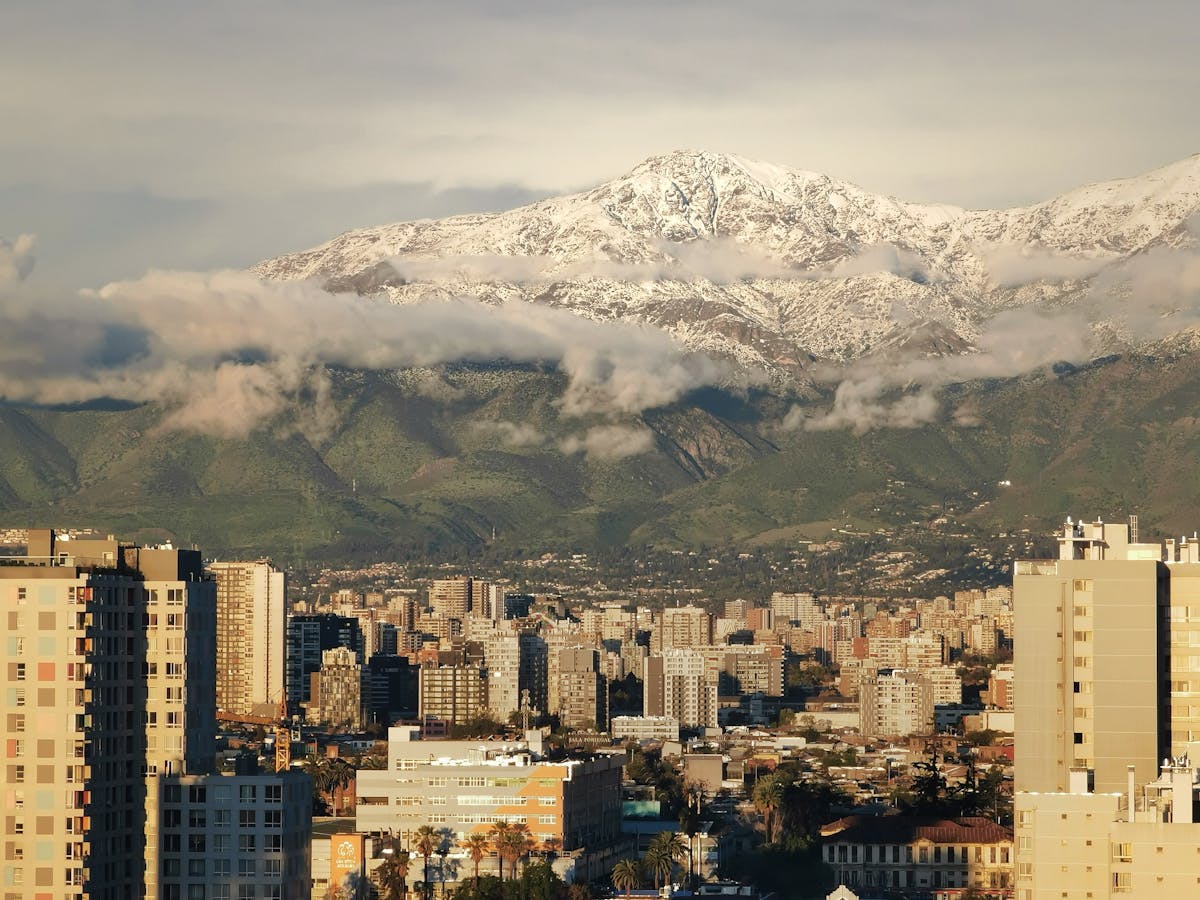
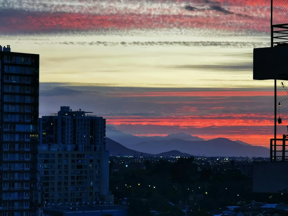
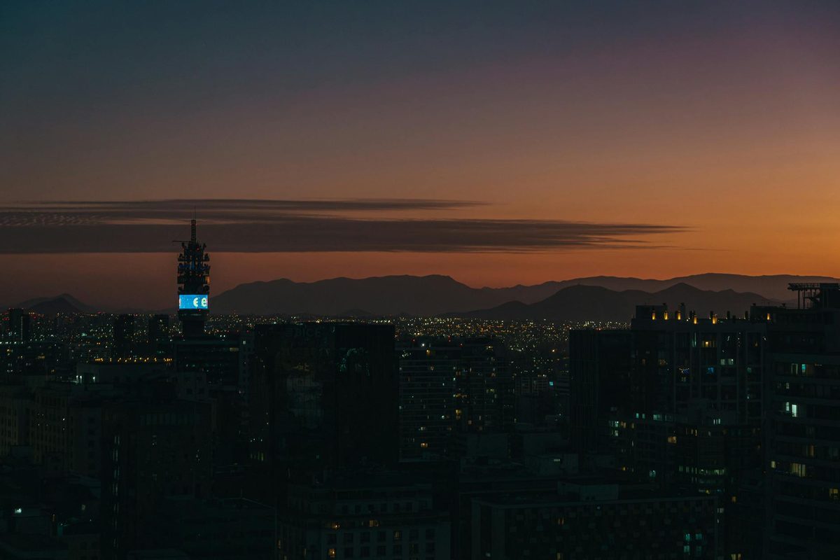
Santiago does not immediately wow you. The airport bus drops you into a sprawling city that looks like a dozen other Latin American capitals — concrete, traffic, billboards. Give it a day. It grows on you. Actually, give it two days, because the jetlag is going to hit you harder than you expect.
I spent most of Day 1 wandering Barrio Lastarria, which has the right balance of interesting without being exhausting. Good coffee. Bookshops. A small cultural center with free exhibitions that I stumbled into while looking for a bathroom. The Mercado Central is a 15-minute walk from there and worth the detour — not for the tourist-facing seafood restaurants on the ground floor (overpriced, aggressive hawkers) but for the smaller stalls tucked in the back where the taxi drivers eat. A bowl of caldillo de congrio there costs about $6 and will change how you feel about fish soup forever.
Day 2 belongs to Cerro San Cristobal. Take the funicular up. Walk down. The views from the top put the entire city in context — Santiago sits in a valley with the Andes rising abruptly on the eastern edge, snow-capped even in October, and it is the kind of view that makes you understand why people settle in impractical places. On a clear day (go early, before the smog builds), you can see how the mountains dwarf everything human. On a hazy day, honestly, you can still see enough.
If you have time in the afternoon, the food scene in Barrio Italia is worth exploring. It is less polished than Lastarria — more secondhand furniture shops, less latte art — but the restaurants are better and half the price. I had a three-course menu del dia for about $8 that included wine. In a real glass. At a table with a cloth on it.
Quick Tip
Santiago's metro is clean, cheap, and easy. Buy a Bip! card at any station (about $2) and load it with credit. It works on buses too. You will not need a taxi inside the city center.
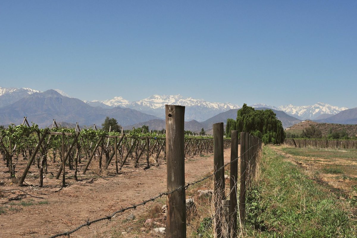
Two days is right for Santiago if you are passing through. You could spend longer — the wine country day trips to Maipo and Casablanca valleys are excellent — but this itinerary has ground to cover, and the desert is calling.
Day 3-5: The Atacama — Stars, Salt, and a 4am Alarm
The flight from Santiago to Calama takes about two hours. Calama itself is a mining town with zero charm, and you should spend exactly as long there as it takes to get on a shuttle to San Pedro de Atacama, which is about 90 minutes into the desert.
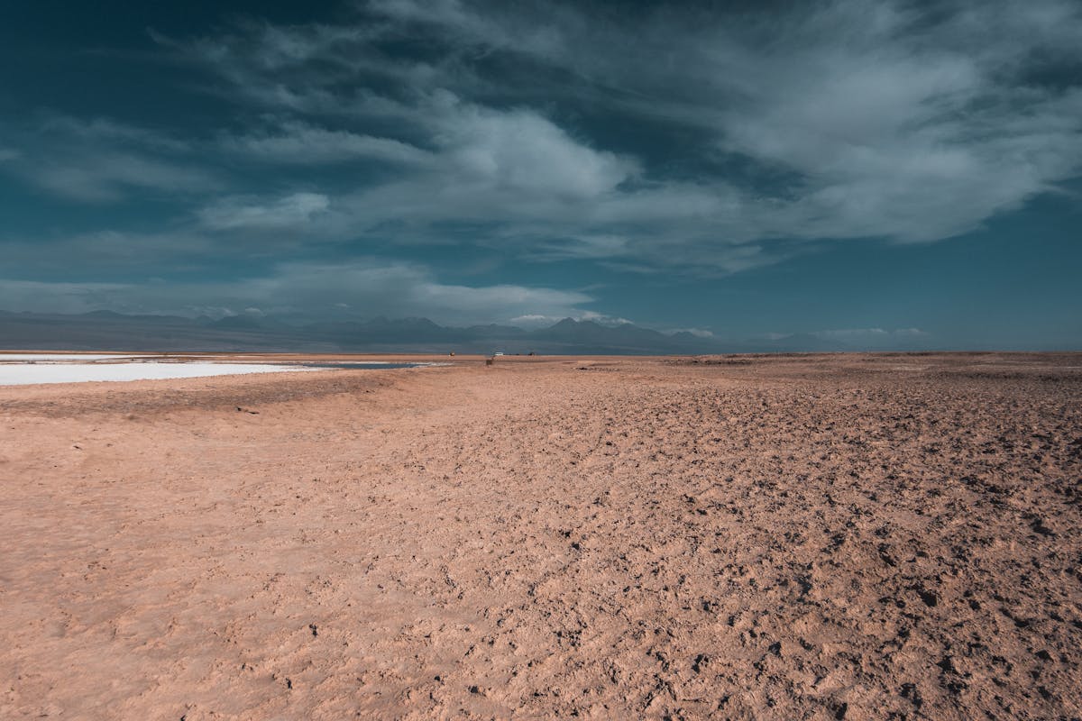
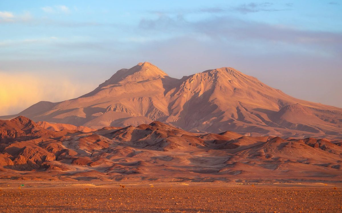
San Pedro is a small town built from adobe that exists almost entirely because of tourism, and somehow it works. The main street has too many tour agencies and too many restaurants serving mediocre pizza to backpackers, but step one block off Caracoles and the town goes quiet. Dusty streets. Dogs sleeping in shade. An old church that has been standing since the 1700s. At 2,400 meters above sea level, the air is dry enough to crack your lips in an hour. Drink water constantly. I cannot emphasize this enough — I got a headache on my first afternoon that I blamed on the flight until I realized I had drunk exactly one coffee since landing.
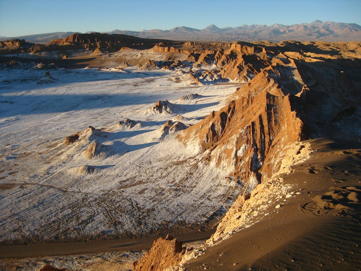
Day 3: Valle de la Luna at Sunset
The Valle de la Luna sunset tour is the thing everyone does on their first day, and for once, the popular choice is also the right one. The valley is a 20-minute drive from San Pedro — a landscape of eroded salt formations, sand dunes, and rock ridges that looks genuinely extraterrestrial. The tour operators stop at three or four viewpoints before finishing at the Duna Mayor for sunset.
Here is what nobody tells you: the sunset itself is fine. What is extraordinary is the 20 minutes after the sun drops below the horizon, when the sky turns colors that should not exist — deep purple bleeding into orange bleeding into green at the edges. The Duna Mayor faces west and you get the full show. Most tour groups start packing up when the sun disappears. Stay. The best part is coming.
Day 4: El Tatio Geysers and the Suffering of 4am
The alarm goes off at 3:30am. You will hate everything about this. The van collects you in darkness and drives for 90 minutes up a dirt road to 4,300 meters, where the El Tatio geysers are doing their thing in the pre-dawn cold. And when I say cold, I mean minus 10 Celsius cold. I was wearing every layer I owned and my fingers still went numb within minutes of stepping out of the van.
But the geysers at sunrise are something else. Columns of steam rising 10 meters into air so cold that everything backlit by the first sunlight turns gold. The ground bubbles and hisses. You can feel warmth through your boots in some spots. The guide warned us not to step off the marked paths — the crust can be thin and the water underneath is boiling. Someone on another tour the previous week had burned their foot. This information made me watch my step very carefully.
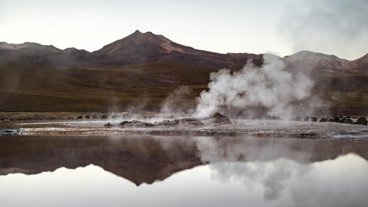
On the way back to San Pedro, the van stops at a thermal pool fed by the geysers. You strip down to your swimsuit in sub-zero air and get in. The water is about 35 degrees. The contrast between the cold air on your face and the hot water on everything else is one of the more memorable physical sensations of my life. I stayed in until the guide physically waved at us to leave.
Day 5: Stargazing and Doing Not Very Much
Day 5 is a rest day, and you need it. The altitude, the early mornings, and the desert sun take a toll. I spent the afternoon in San Pedro doing nothing of consequence — wandering the craft market, eating a late lunch, reading in the hostel courtyard while a dog of uncertain breed slept on my feet.
But the evening: book a stargazing tour. The Atacama has some of the darkest skies on earth — it is why the European Southern Observatory built their telescopes here. Through a decent telescope, you can see the rings of Saturn, the moons of Jupiter, and the Milky Way in a density that makes you feel, for a moment, like you are looking at the universe as it actually is rather than the washed-out version we see from cities.
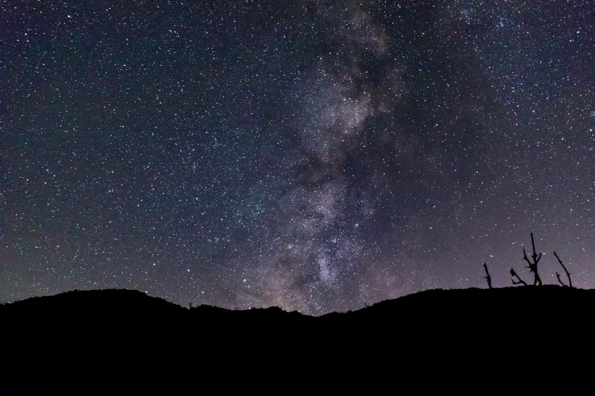
I went with a small-group tour that included telescopes and a guide who clearly loved his job. He pointed out constellations visible only from the southern hemisphere — the Southern Cross, the Magellanic Clouds — and talked about the astronomers who work in the observatories visible as tiny lights on the distant ridgeline. About $40 per person, three hours, and the drive home afterward in the dark with your head still tilted up is part of the experience.
Quick Tip
The ATMs in San Pedro run out of cash during peak season. Bring pesos from Calama or Santiago. Credit cards are accepted at most restaurants but not all tour operators. Check our money guide for current exchange tips.
Day 6: Valparaiso — One Day of Color and Chaos
The flight back to Santiago connects to Valparaiso via a 90-minute bus from the Pajaritos terminal. You could also fly into Santiago and take the bus — it runs every 15 minutes and costs about $6. Either way, by late afternoon you are standing on a hill in Valpo looking at a city that appears to have been assembled by a committee of artists who were not speaking to each other.
Valparaiso is built on 42 hills (cerros) above a bay, and every surface is painted, tagged, or muraled. The ascensores — funicular lifts that are over a century old — rattle up hillsides at angles that seem structurally ambitious. The streets twist and dead-end without warning. You will get lost. This is the point.
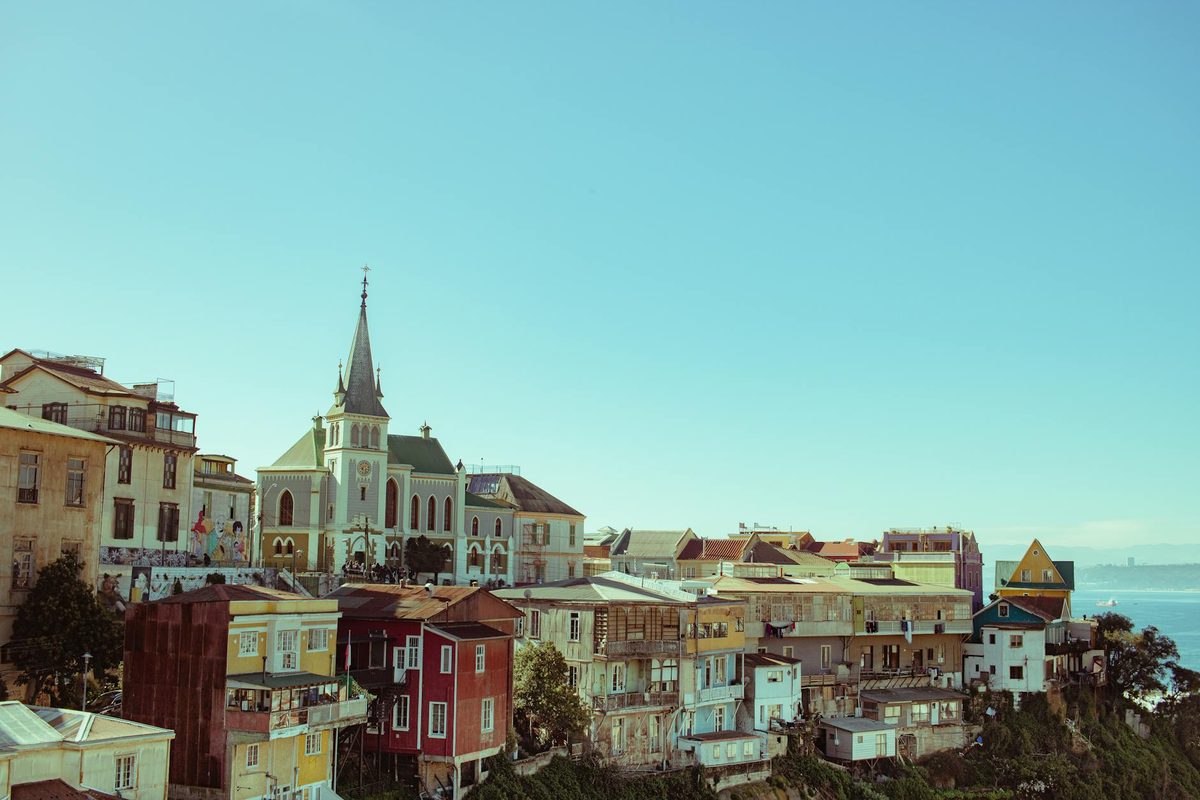
Cerro Alegre and Cerro Concepcion are the obvious starting points and they are obvious for a reason — the density of good street art, interesting restaurants, and views over the port is highest there. But push further. Cerro Bellavista has La Sebastiana, one of Pablo Neruda's houses, and the streets around it are quieter and steeper and the murals are weirder. I spent two hours up there and barely saw another tourist.
For dinner, eat in the port area. The seafood in Valpo is cheaper and fresher than Santiago. Paila marina — a brothy stew packed with mussels, clams, shrimp, and whatever else came in that morning — costs about $10 and comes in a bowl the size of your head.
One day in Valparaiso is tight but doable if you start early. If you have a spare half-day, the beach at Vina del Mar is a 15-minute bus ride away and makes for a good contrast — manicured gardens and a casino next to the graffiti chaos you just left.
Day 7-8: Pucon — The Volcano, the Hot Springs, and the Lake
Getting to Pucon requires either a flight to Temuco plus a 90-minute shuttle, or an overnight bus from Santiago (about 10 hours). I took the night bus. The semi-cama seats recline almost flat, they give you a blanket and a meal, and I slept surprisingly well. It costs about $30 and saves a night of accommodation.
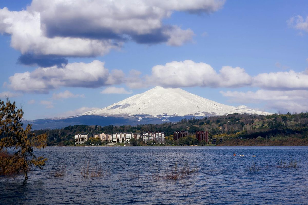
Pucon sits on the shore of Lago Villarrica with the smoking cone of Volcan Villarrica directly above it. The town is small, walkable, and oriented entirely around outdoor activities. In summer, it fills with Chilean families on holiday and the main street becomes a strip of ice cream shops and adventure tour operators. In shoulder season (October, April), it is quieter and better.
Day 7: Climbing Villarrica (Maybe)
I wrote a whole separate piece about climbing the volcano, so I will keep this brief. The climb takes about 10 hours round trip, costs $80-120 per person with all gear included, and is one of the most memorable things I have done in South America. You walk up a snowfield with crampons and an ice axe, stand on the rim of an active volcano, and sled back down on your backside at alarming speed.
The catch: cancellations are frequent. Weather and volcanic activity can shut climbs down for days. Build at least two possible days into your schedule. If your climb gets cancelled, the hiking around Pucon is excellent — the Huerquehue National Park trail through monkey puzzle forests is a strong consolation prize.
Day 8: Hot Springs and the Lake
After the volcano (or instead of, if the weather gods say no), Pucon's other great offering is hot springs. The Lake District sits on a chain of volcanoes and the geothermal activity means natural thermal pools are everywhere.
Termas Geometricas is the most famous — a series of red-painted wooden walkways over a forested ravine, connecting 17 pools at different temperatures. It is gorgeous and not cheap (about $35 entry). The pools range from barely warm to skin-prickling hot, and you work your way along the ravine trying each one while native forest drips overhead. I went in the late afternoon when the light filtered through the canopy and steam rose off every surface. It felt like stepping into a different climate entirely.
If Geometricas feels too produced, Termas Los Pozones is simpler — rock pools on a riverbank, less infrastructure, cheaper ($15), and you can hear the river rushing past while you soak. Both are about 30 minutes from town by car.
Day 9: Puerto Natales — Gateway to the End of the World
The jump from Pucon to Puerto Natales is the biggest leap of the trip, both in distance and in temperature. You fly from Temuco to Punta Arenas (about 3 hours), then take a bus north to Puerto Natales (another 3 hours). Yes, you fly south and then bus north. Getting around Chile involves accepting some geographic absurdity.
Puerto Natales is a small town on the Ultima Esperanza Sound — Last Hope Sound, which is either poetic or ominous depending on your mood. It exists primarily as the staging ground for Torres del Paine, and every other building is either a gear shop, a tour operator, or a hostel. The town itself is not beautiful in any conventional sense — it is windswept, the buildings are functional, and the water is grey. But there is a particular end-of-the-road feeling to it that I liked. You are as far south as most people ever go, and the landscape has started doing strange things — the sky is enormous, the wind is constant, and the light at 10pm is still golden.
Use this day to sort logistics. Book your refugio or campsite for Torres del Paine if you have not already (you should have — they sell out months ahead in peak season). Buy fuel canisters, snacks, and any gear you forgot. Eat a last real meal. The restaurants in Natales are surprisingly good — lamb is the thing here, slow-roasted over open flame. I had the best lamb of my life in a place that looked like someone's living room with extra tables.
Day 10-13: Torres del Paine — The W Trek
Everything before this point was leading here. Torres del Paine National Park is the reason most people come to Patagonia, and it deserves every word that has been written about it, and probably some more.
The W Trek is a 4-day, 3-night hiking route that traces a W shape through the park, hitting the three major valleys: the Torres (the iconic granite towers), the French Valley, and the Grey Glacier valley. You sleep in refugios (basic mountain huts with bunk beds and meals) or campsites. I did a mix — refugio the first and third nights, camping the second and fourth. The refugios cost more but you get a bed and dinner. The campsites are cheaper but you carry a tent and cook your own food. Either way, you carry everything on your back.
Day 10: Catamaran to Paine Grande, Walk to Grey
The standard W Trek starts with a catamaran across Lago Pehoe from Pudeto to Paine Grande refugio. The lake is that particular shade of milky turquoise that glacial lakes have — it does not look like water, it looks like someone mixed paint. From Paine Grande, you walk north along the shore of Lago Grey toward the Grey Glacier.
The walk is about 11 kilometers and takes 3-4 hours depending on wind. And there will be wind. Patagonian wind is not like other wind. It comes in gusts that can physically push you sideways, and it does not let up. I watched someone's hat depart at speed and never return. Bring a chin strap. I am serious.
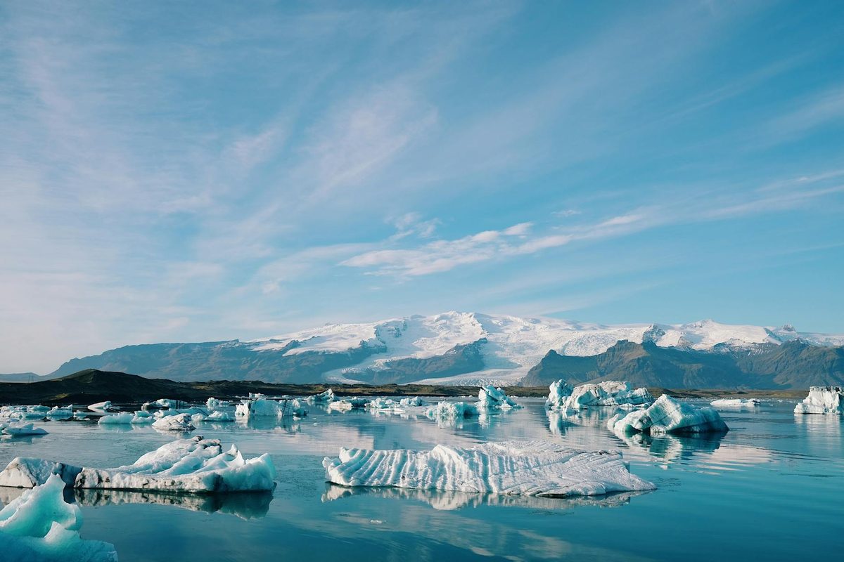
The first glimpse of Grey Glacier stopped me mid-step. A wall of blue-white ice stretching across the entire valley, calving icebergs into a lake full of floating ice chunks. The scale is hard to process — the glacier is 6 kilometers wide and 30 meters tall at the face, and it creaks and groans in a way that makes it sound alive.
Day 11: Grey to Paine Grande (and the French Valley)
Day 2 retraces the route to Paine Grande and then continues east into the French Valley. This is the hardest day — about 20 kilometers total with a significant climb into the valley — and also the most rewarding. The French Valley is a natural amphitheater of granite walls, hanging glaciers, and avalanche chutes. You hear the glaciers before you see them — a crack like a rifle shot, followed by a rumble, and then a plume of ice dust rising from somewhere on the mountainside.
The trail climbs to the Mirador Britanico lookout, which is where I sat down, ate my last energy bar, and genuinely struggled to stand back up. My legs had the consistency of overcooked pasta. But the view — granite towers on three sides, glaciers hanging from every face, the valley dropping away below — was worth every step. I sat there for 40 minutes and no one asked me to move.
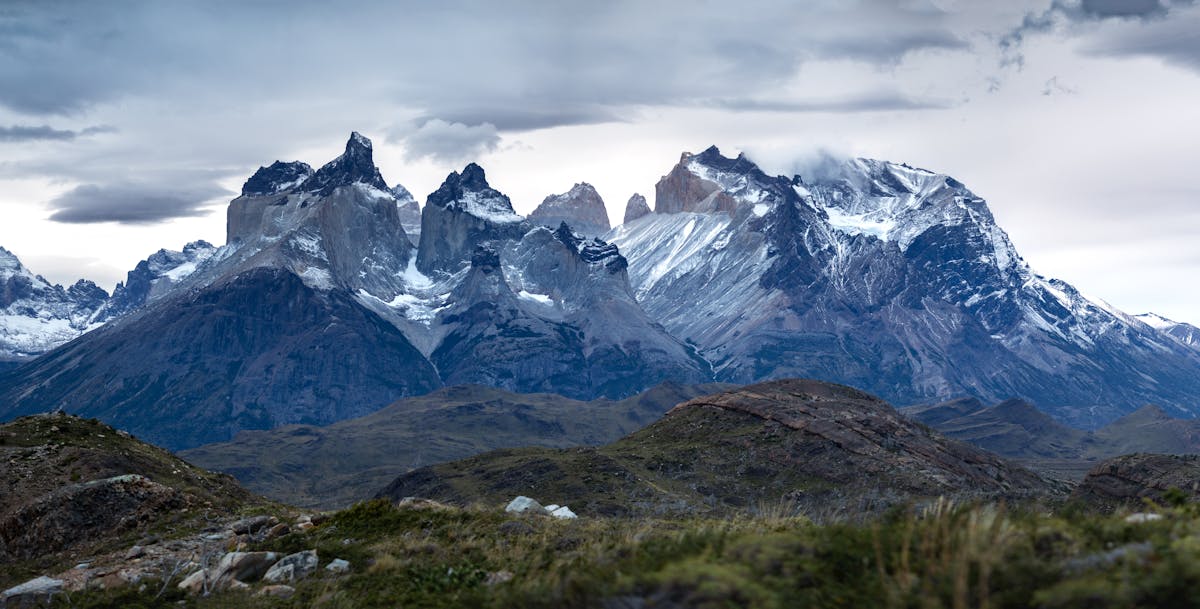
Day 12: Paine Grande to Cuernos to Las Torres
This leg follows the base of the Cuernos del Paine — the horn-shaped peaks that feature on every Patagonia poster. The trail is relatively flat (a relief after the French Valley), winding along the shore of Lago Nordenskjold with views that are almost aggressively beautiful. Every time I looked up, there was another peak, another waterfall, another color of lake that should not exist in nature.
You sleep at the Chileno or Central refugio, setting up for the final day push to the Torres themselves.
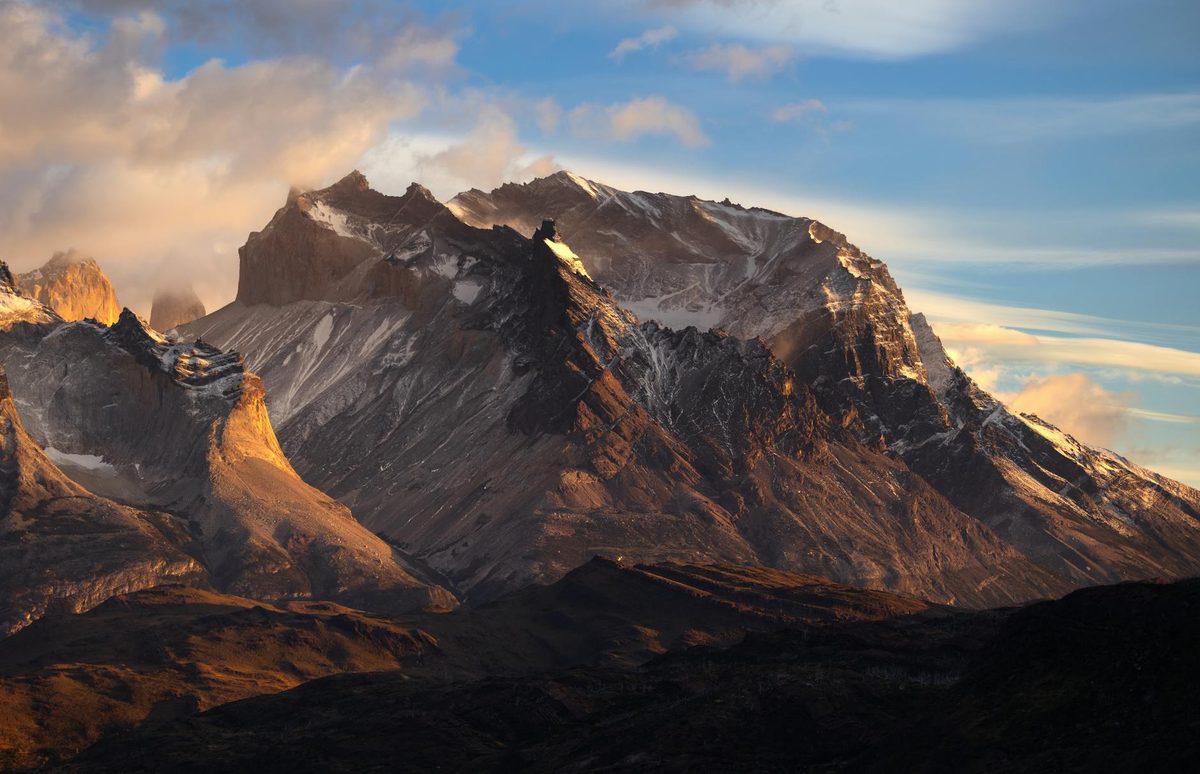
Day 13: The Torres at Sunrise
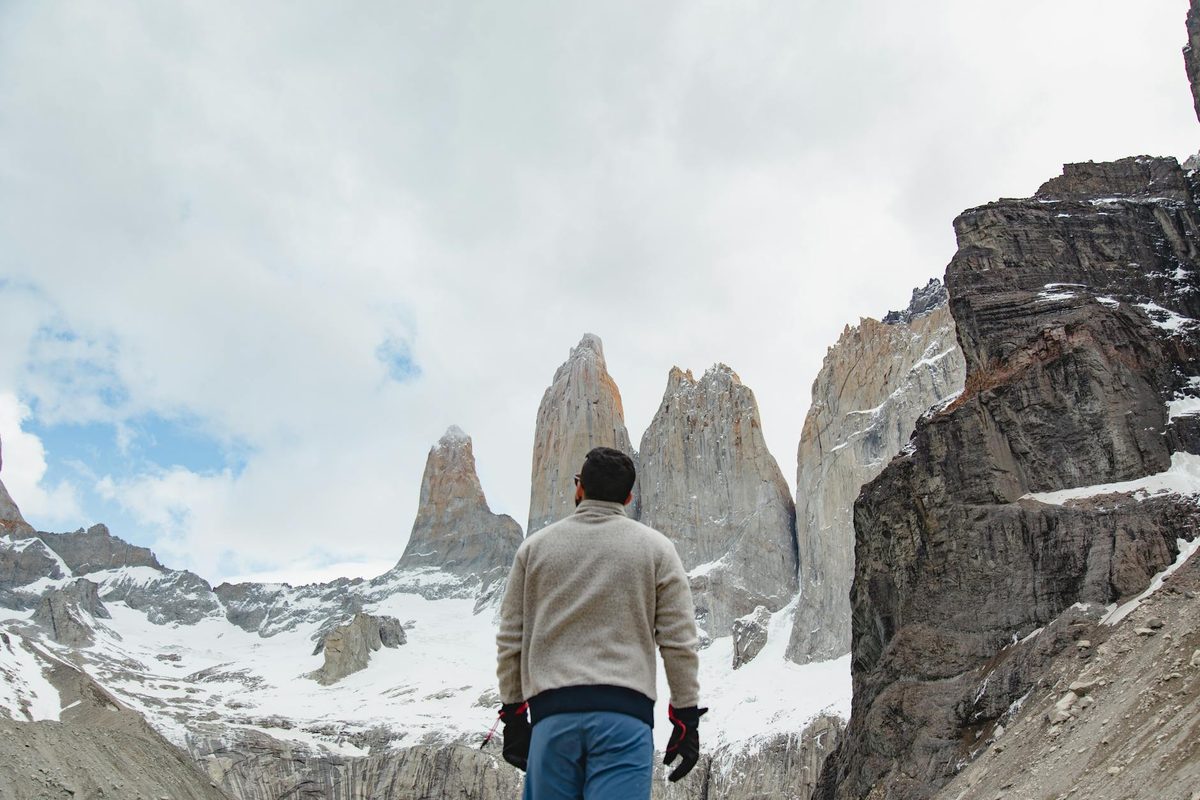
The alarm goes off at 4am. Again. The headlamp goes on. You climb for about 90 minutes through lenga forest in darkness, then scramble up a boulder field — loose rocks, steep, hands-and-feet in places — until you reach the base of the Torres. Three granite towers rising a kilometer straight up from a glacial lake that reflects them perfectly when there is no wind.
I arrived at 6:15am. Sunrise hit the towers at 6:40. The granite turned from grey to pink to orange to white in the space of about 20 minutes, and I stood there with my jaw open and my camera dying from the cold. It is the most photographed scene in all of Patagonia and it earned that status honestly. The photos do not capture the scale — the towers are massive, impossibly vertical, and the lake at their base is small and still and the color of a thunderstorm.
The walk back to the trailhead takes about 4 hours. The bus to Puerto Natales leaves from the park administration. You sit on that bus with trail-filthy clothes and legs that have stopped communicating with your brain, and you look out the window at the mountains getting smaller, and you already want to come back.
Day 14: Punta Arenas — Penguins and the Strait
The last day. Punta Arenas sits on the Strait of Magellan, which remains a staggering name for a body of water you can actually see and stand next to. The city is functional rather than pretty — a grid of low buildings in perpetual wind — but there is a gravity to it. You are at the bottom of the continent. Across the strait is Tierra del Fuego. Beyond that, Antarctica.
If you have a morning free, the Isla Magdalena penguin colony is worth the boat trip (about $50, 2 hours each way). Thousands of Magellanic penguins waddle around a small island in the strait, completely unfazed by the humans walking among them. They stand in their burrows looking mildly put out, like commuters who have been told the train is delayed again. It is charming in a way that animal encounters rarely are — there is no drama, just penguins being penguins.
Your flight home departs from Punta Arenas. The airport is small and efficient. You check in, you look south one more time through the terminal windows, and you leave Chile knowing that two weeks was not enough. It never is.
The Practical Stuff
Budget Breakdown
| Flights (internal) | $250-400 (Santiago-Calama, Temuco-Punta Arenas) |
| Accommodation | $15-25/night hostels, $50-80/night hotels |
| Food | $15-25/day eating at local spots |
| Tours (Atacama) | $100-150 total (Valle de la Luna, El Tatio, stargazing) |
| Villarrica climb | $80-120 |
| W Trek (refugios + meals) | $400-600 for 4 days |
| Park entry (Torres del Paine) | $35 (foreigners) |
| Buses | $60-80 total |
| Total budget estimate | $1,800-2,500 for two weeks (excluding international flight) |
When to Go
Timing matters. The Atacama works year-round (it barely rains, ever), but Patagonia has a tight season. December through March is summer and the only realistic window for the W Trek unless you want snow and closed trails. October-November and April are shoulder season — cheaper, fewer crowds, but more weather risk. I went in late November and had three perfect days in Torres del Paine out of four. The fourth was horizontal rain. You take what you get.
Getting Around
Internal flights are the only sane way to cover the distances involved. Santiago to Calama, Temuco to Punta Arenas — these are not bus-able unless you have an extra week and an iron constitution. Book domestic flights through LATAM or JetSMART. JetSMART is the budget option and genuinely fine for short hops, though the baggage fees add up if you are carrying trekking gear.
For shorter distances (Santiago to Valparaiso, Puerto Natales to Torres del Paine), buses are excellent. Chile's bus network is one of the best in South America. Semi-cama and salon-cama seats on overnight routes are comfortable enough to sleep in, and they cost a fraction of a flight.
What I Would Change
- Add a day in Valparaiso. One day is rushed. Two gives you time to explore beyond the tourist cerros and have a proper evening in the port bars.
- Book Torres del Paine earlier. I scrambled for refugio spots three weeks out and ended up with a suboptimal schedule. Book at least two months ahead for peak season.
- Bring better rain gear. I had a "water-resistant" jacket that proved to be a liar on Day 4 of the W Trek. A proper waterproof shell is non-negotiable for Patagonia.
- Spend less time in San Pedro, more in the Lake District. Three days in the Atacama is enough. The extra day could have gone to the Lake District — Huerquehue National Park, the monkey puzzle forests, the volcanic hot springs I kept hearing about but never reached.
What to Pack
Chile spans climates from hyper-arid desert to sub-Antarctic wind and rain, sometimes in the same week. Layer everything. My packing list that actually worked:
- Merino base layers (top and bottom) — worth every penny in Patagonia
- Down jacket — compressible, warm enough for 4am geyser mornings
- Waterproof shell jacket and pants — the real kind, not "water-resistant"
- Hiking boots (broken in before you go — blisters on the W Trek are a special kind of misery)
- Sunscreen, sunglasses, and a wide-brimmed hat for the Atacama
- A 40-50L backpack if you are doing the W Trek
- Headlamp — for the Torres sunrise hike and the El Tatio geyser run
For full logistics and costs, check the money and costs guide.
The Thing About Chile
Two weeks after landing at that Santiago airport with my gas station empanada, I was sitting in the Punta Arenas terminal waiting for the flight home. I was sunburned from the Atacama and windburned from Patagonia. My hiking boots had a crack in the sole. My phone was full of 2,000 photos, at least 1,800 of which were landscapes taken from slightly different angles.
Chile does something that few countries manage — it makes you feel the scale of the planet. The distance from the desert to the glacier is not just geographic. It is thermal, cultural, visual. You eat fresh seafood in Valparaiso and freeze-dried meals in Torres del Paine. You sweat through a desert stargazing tour and shiver inside a Patagonian refugio. You stand on a volcano and then, five days later, you stand next to a glacier. The country is long and narrow and improbable, and two weeks is enough to know that you have barely started.
I will go back. The Carretera Austral, Easter Island, the wine regions south of Santiago — the list of things I did not get to is longer than the list of things I did. But that first trip, the one that takes you from the top to the bottom, is the one that hooks you. Start here. Adjust as you go. The empanadas will guide you.