This article contains affiliate links. If you book through them, I earn a small commission at no extra cost to you.
The ferry had been rocking for forty minutes when the first penguin appeared. Not on land — in the water, porpoising alongside the hull like a tiny black-and-white dolphin with somewhere urgent to be. I was standing on the upper deck of the Austral Broom ferry, trying to hold my coffee steady in a wind that seemed personally offended by my presence, watching the coast of Punta Arenas shrink behind us and the flat, dark mass of Tierra del Fuego grow ahead. The Strait of Magellan was steel-gray, choppy, indifferent to the fact that I had skipped breakfast because someone at the hostel said the crossing could get rough. It was getting rough. And there was a penguin.
That is Tierra del Fuego in a single moment. Uncomfortable, wild, completely indifferent to whether you showed up or not — and then something happens that pins you to the railing and makes you forget you are cold and slightly nauseous. I spent five days on the Chilean side of the island and I still think about the wind, the emptiness, the king penguins standing in a muddy field like they were waiting for a bus that would never come. This is not Patagonia the way most people picture it. There are no granite towers, no turquoise lakes. It is flatter, harder, lonelier. And it got under my skin in a way Torres del Paine never quite did.
The Strait of Magellan Ferry (Your Introduction to the End of the World)
There are two ferry crossings to Chilean Tierra del Fuego and both of them are experiences in themselves. The shorter one — Primera Angostura, about two and a half hours north of Punta Arenas — takes roughly twenty minutes across the narrowest part of the strait. That is the one most people take if they are driving to Tierra del Fuego or continuing south toward Ushuaia in Argentina. The longer crossing leaves directly from Punta Arenas and takes about two hours to reach Porvenir, the island's main town on the Chilean side. I took the Punta Arenas crossing because I wanted the full experience, and because I did not have a car.
The Austral Broom ferry runs a few times a week in summer and less frequently in winter. Check the schedule before you plan anything — this is not a boat that waits for you, and if you miss it, you are stuck in Punta Arenas for another day or two. Which is not the worst fate, honestly, but it will mess up your timeline. I booked my ticket the day before at the office in Punta Arenas, and the woman at the counter asked me if I got seasick. I said no. She gave me a look that suggested she had heard that before.
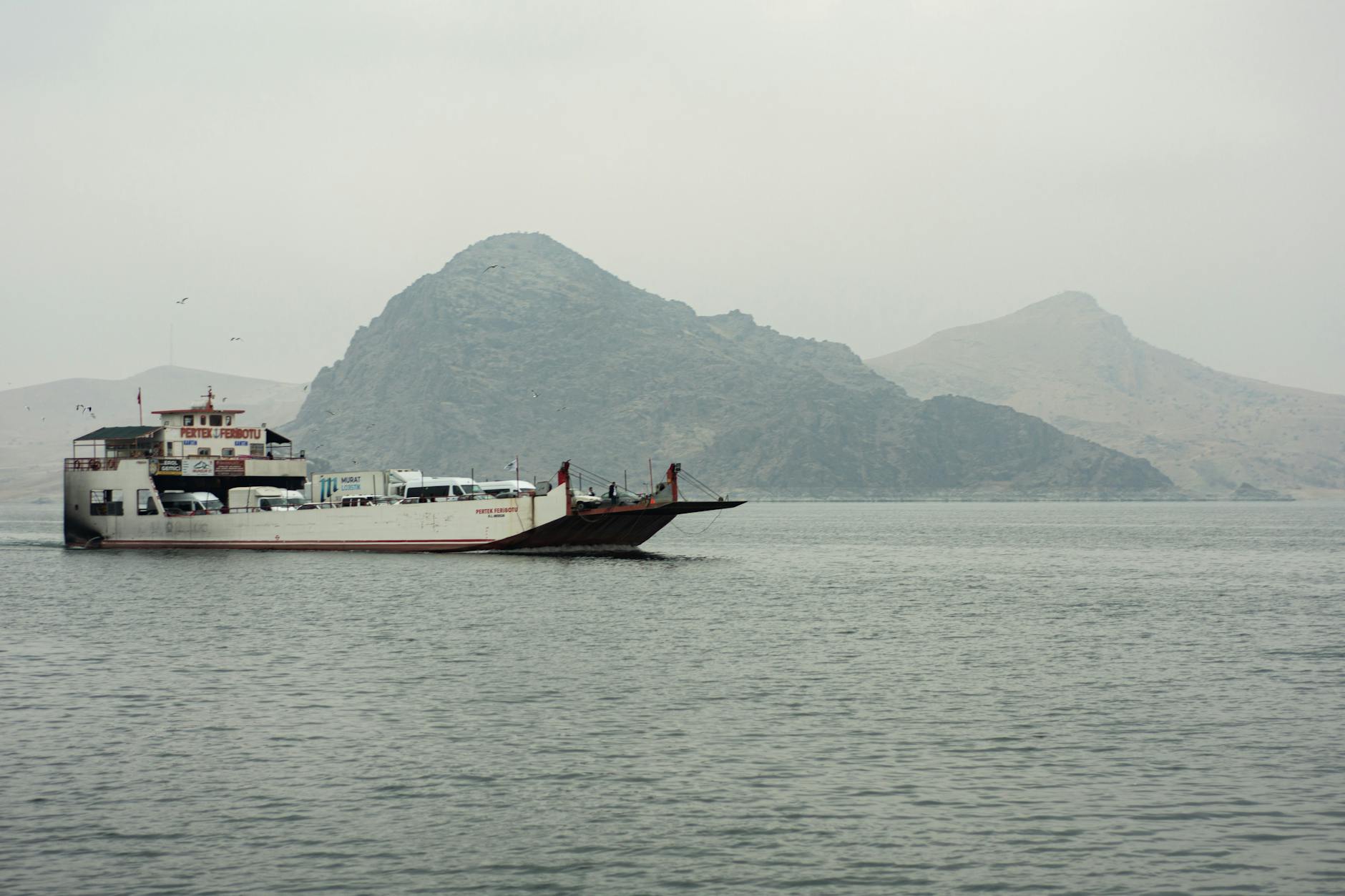
She was right to be skeptical. The strait was a persistent, rolling chop that made standing on the open deck an act of faith. I wore a fleece and spent twenty minutes pretending I was fine before going below to sit in the heated cabin with everyone else who had made the same mistake. Bring a proper windbreaker — the wind is constant and cold even in January, which is midsummer down here.
But the crossing itself is the point. You are sailing the same water that Magellan navigated in 1520, the same passage that terrified sailors for centuries before the Panama Canal made it optional. And the approach to Porvenir — a scatter of low buildings and corrugated roofing on a treeless shore — sets the tone for everything that follows. You are arriving somewhere that does not care about first impressions.
Quick Tip
If you are driving, take the Primera Angostura crossing — it is faster, runs more frequently, and you can just show up. If you are on foot, the Punta Arenas to Porvenir ferry is the better experience. Check schedules at our transport guide. Bring layers, motion sickness medication, and low expectations for the onboard cafe.
Porvenir (the Quietest Capital You Will Ever Visit)
Porvenir is the capital of the Chilean province of Tierra del Fuego. Set your expectations: 6,000 people, one main street, a small museum, a plaza that could fit inside a parking lot. When I stepped off the ferry on a Tuesday afternoon in January — peak summer — maybe a dozen people were visible. A dog was sleeping in the middle of the road. No traffic to move it for.
I liked Porvenir. Did not love it, would not tell anyone to spend three days, but I liked it. The waterfront looks across the strait toward Punta Arenas, and on clear nights you can see the city's lights, which creates a strange intimacy — civilization viewed from outside it. The Museo Provincial covers the Selk'nam people, the gold rush of the 1880s, and the sheep estancias that became the island's backbone. Forty-five minutes to see everything and worth that time.
For food, temper your expectations. A handful of restaurants serve the same things: lamb, fish, basic Chilean staples. I had a lamb stew near the plaza that was genuinely good — the lamb is grass-fed on the steppe and tastes different from anything farther north. Rich, slightly gamey, no apology needed. Do not come expecting a food scene. Come expecting quiet and the unsettling realization that you can hear the wind even when you are inside.
The King Penguins at Parque Pinguino Rey (the Highlight of the Entire Island)
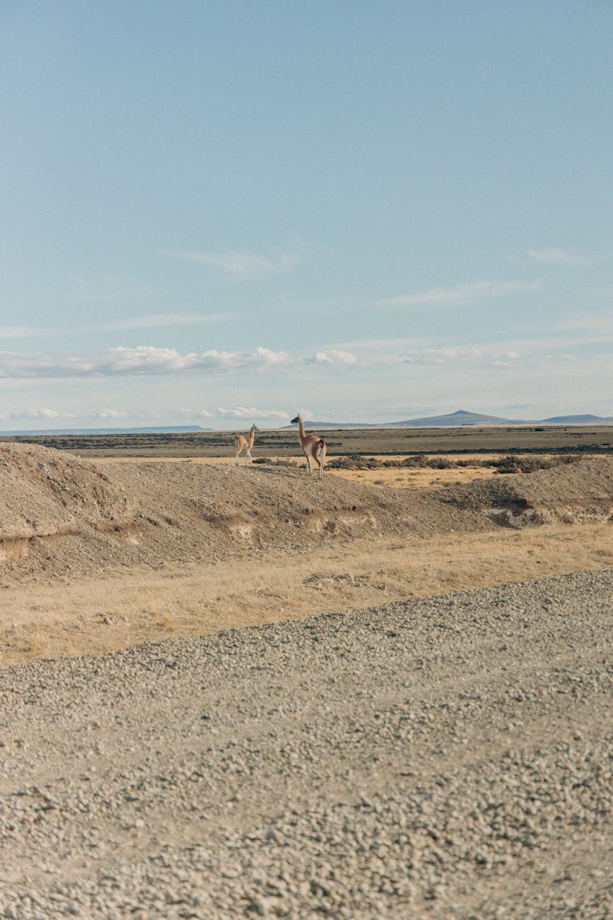
I drove for over an hour on a gravel road through nothing. And I mean nothing — flat steppe, brown grass bent sideways by the wind, the occasional fence post, sky so big it made my rental car feel like a toy. No other cars. No buildings. No phone signal. The GPS had given up twenty minutes earlier and I was navigating by a hand-drawn map from the rental agency in Porvenir, which consisted of two turns and the instruction "keep going until you see the sign." I was not entirely sure I was on the right road. And then I saw the penguins.
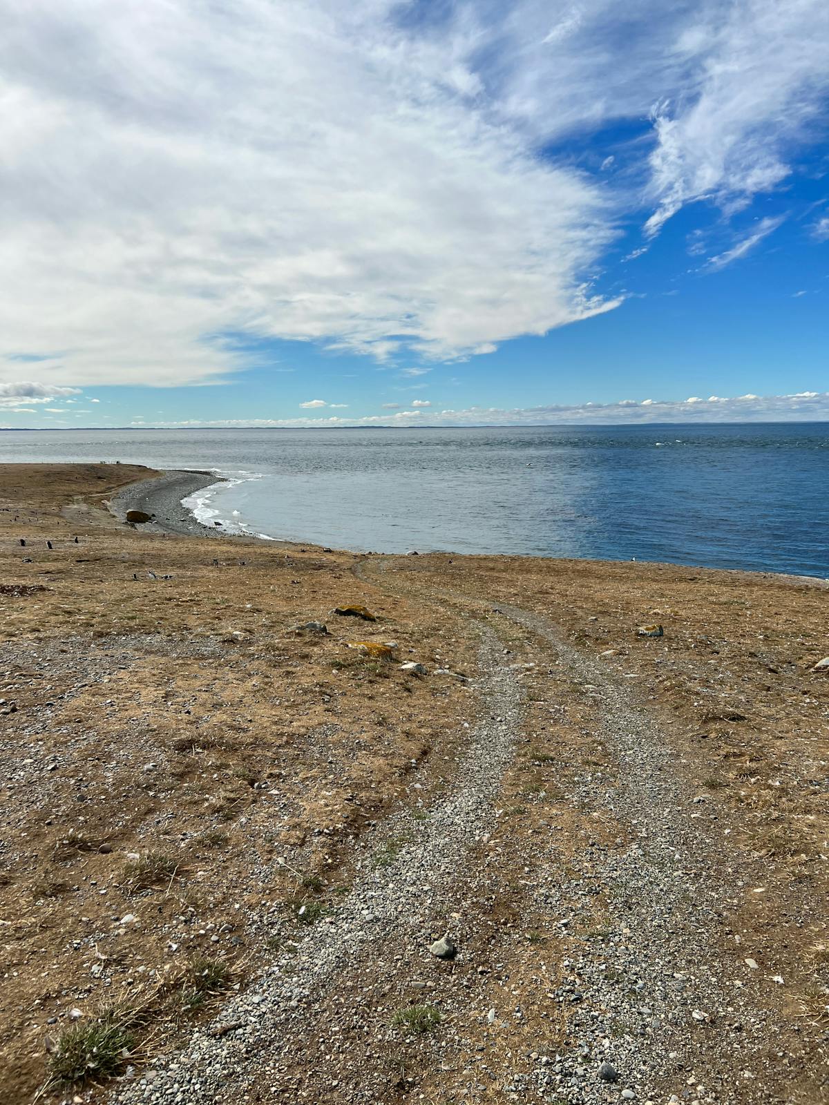
Parque Pinguino Rey is the only king penguin colony in continental South America. Let that sink in. King penguins — the big ones, the ones with the orange-gold patches on their necks that look like they are dressed for an event — normally live on sub-Antarctic islands like South Georgia and the Falklands. But a small colony established itself here on the shore of Bahia Inutil in the early 2010s, and it has been growing since. When I visited, there were maybe seventy or eighty birds standing in a waterlogged field about fifty meters from the viewing platform.
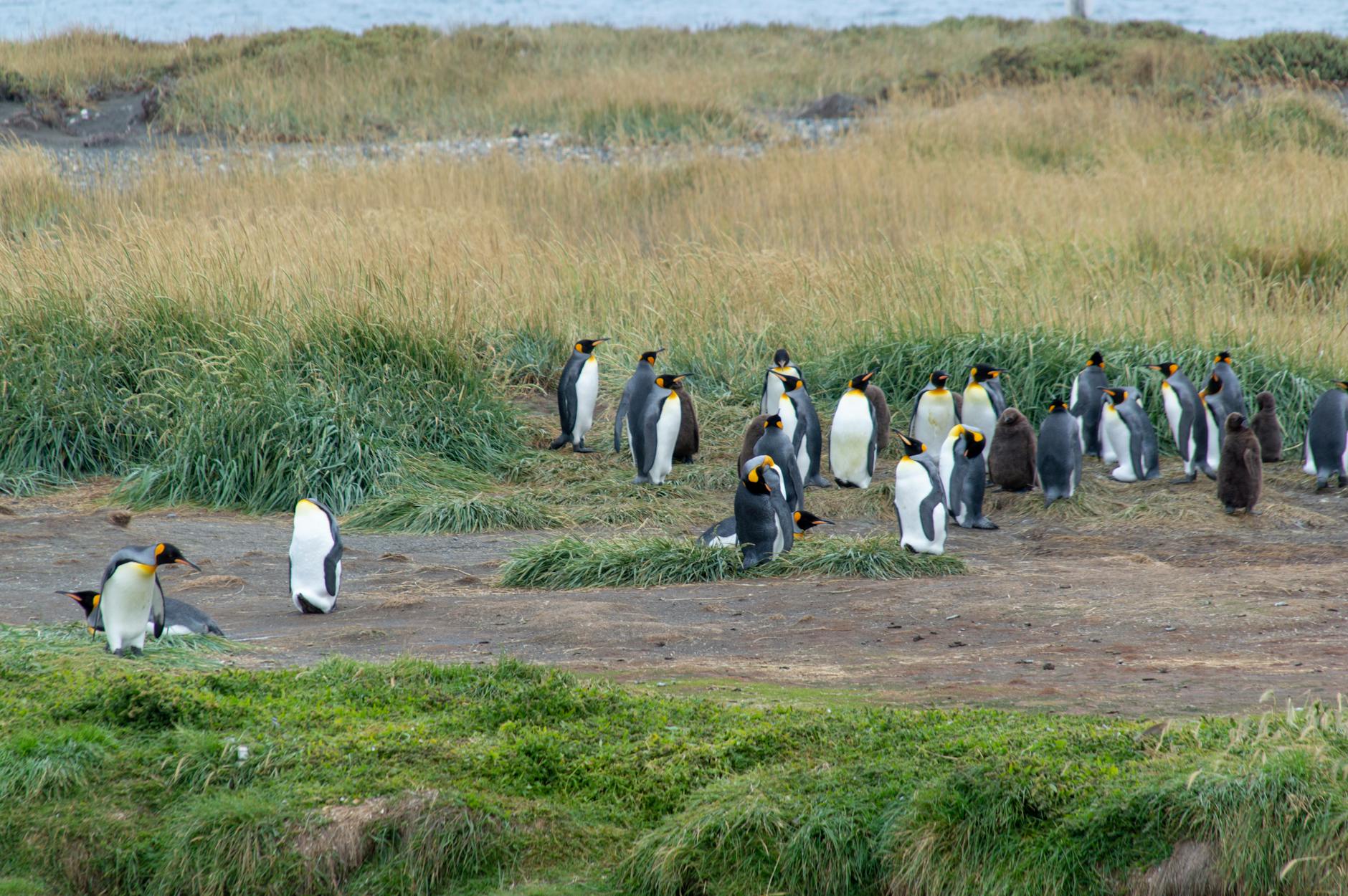
Seventy penguins does not sound like a lot compared to the sixty thousand pairs on Isla Magdalena. But these are king penguins — taller, more vividly colored, carrying themselves with a formality that Magellanic penguins lack. They stand very still, occasionally preening, staring at the water with expressions I can only describe as patient. The chicks — fuzzy brown cylinders on legs — huddle together in the middle. No gift shop, no cafe, no boat tour. Just you and the penguins and the wind across Bahia Inutil, whose name translates to "Useless Bay," which tells you everything about how the early explorers felt about this coast.
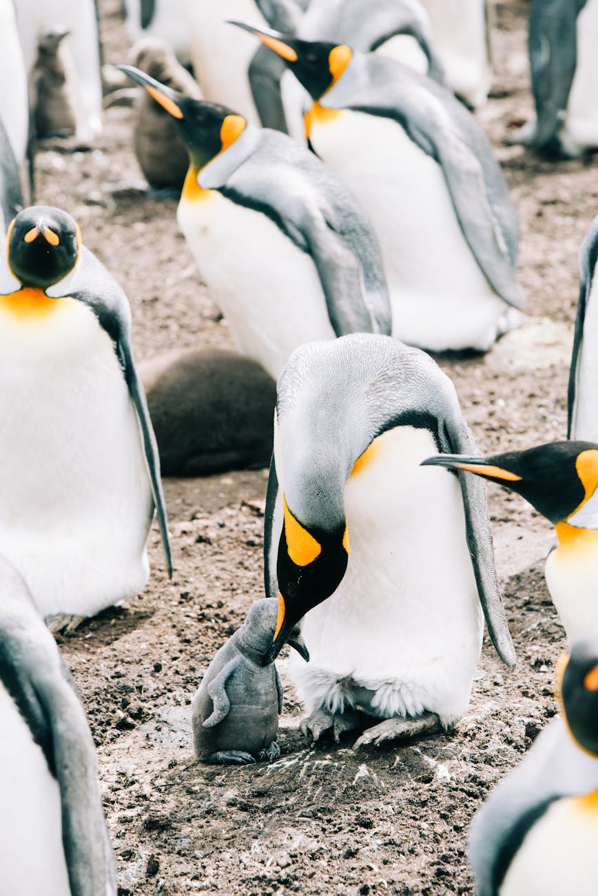
I stayed for over an hour. There was no reason to leave — nobody waiting, no schedule to keep. The light was flat and gray, the kind that photographers hate, but it felt right for the setting. This is not a place that needs golden hour to be impressive. It is impressive because it exists at all: king penguins on a muddy shore in the middle of a sheep ranch at the bottom of Chile. I drove back to Porvenir in a kind of daze, hitting the same potholes in reverse, and realized halfway back that I was grinning.
Quick Tip
The park is about 114 km south of Porvenir on Ruta Y-79. The road is unpaved and slow — budget 90 minutes each way. There is an entry fee of a few thousand pesos. No facilities, so bring water and food. The penguins are present year-round but most active from October to March. A rental car from Porvenir is the only practical way to get there unless you join a tour.
Driving Across the Island (Where the Steppe Eats the Road)
Ruta Y-71 heads south and then east from Porvenir, and for long stretches there is nothing on either side but grassland and sky. The land rolls gently, like a frozen ocean, and the horizon is so far away that depth perception fails. I drove past a flock of sheep so large I could not see the end of it. A condor sat on a fence post and watched my car pass without moving — this island has more wildlife encounters per kilometer than anywhere else I visited in Chile. The road surface changes between pavement and gravel without warning.
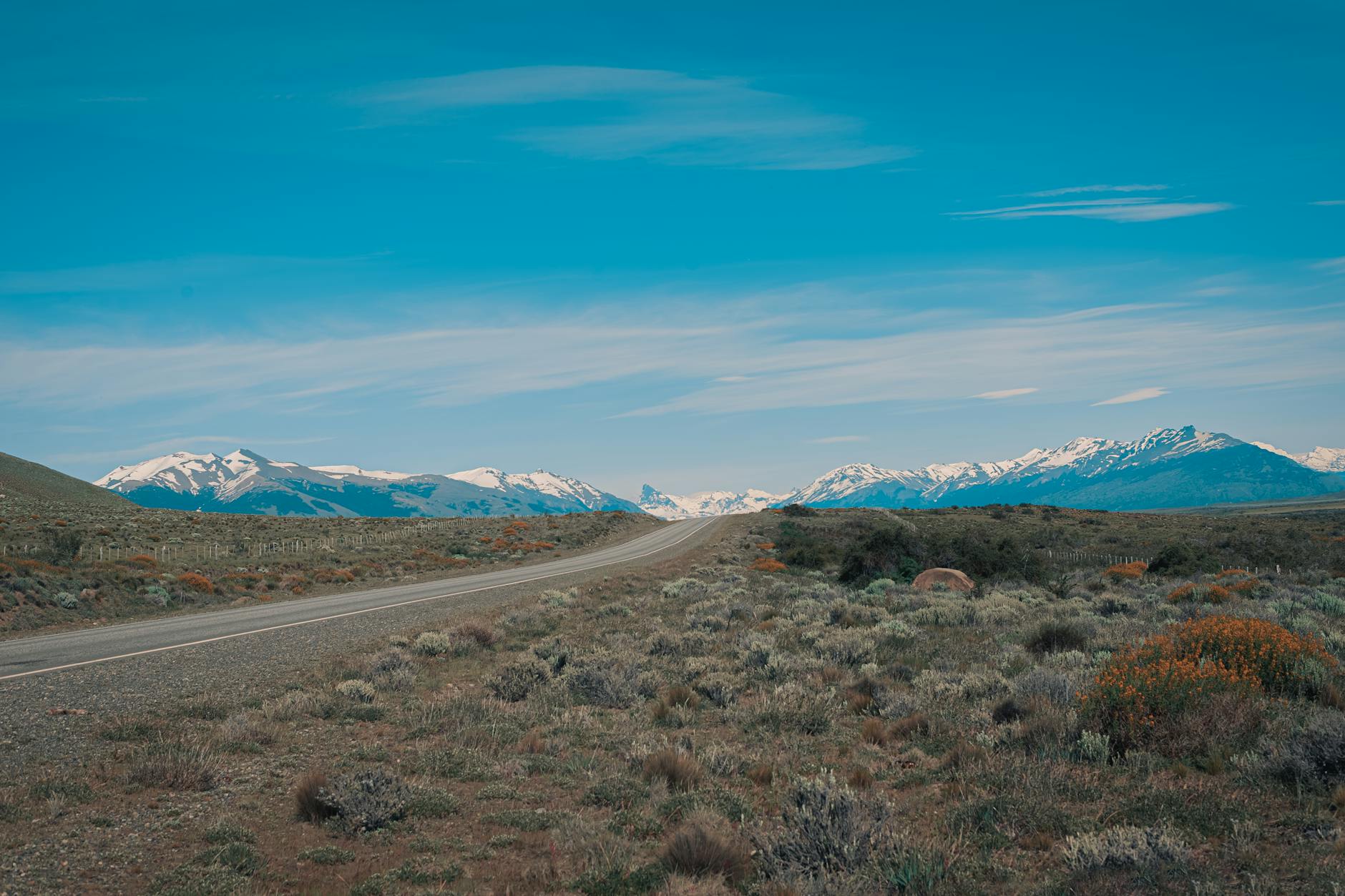
The steppe is not beautiful in the postcard sense. The grass is brown and coarse, bent permanently eastward by the prevailing westerlies. Trees grow at acute angles, shaped by decades of wind into forms that look like they are running away from something. Estancias appear in the distance as clusters of buildings behind windbreaks of cypress. Some people see desolation. Others see freedom. I saw both, depending on the hour.
The estancias — sheep stations that made Patagonia economically viable in the late 1800s — are scattered across this emptiness. Some are enormous, tens of thousands of hectares, and a few have converted into guesthouses where you can stay overnight, eat lamb roasted over an open fire, and ride horses across the steppe. I did not stay at one on this trip, which I regret. Everyone I met who had said it was the most memorable part of their time on the island.
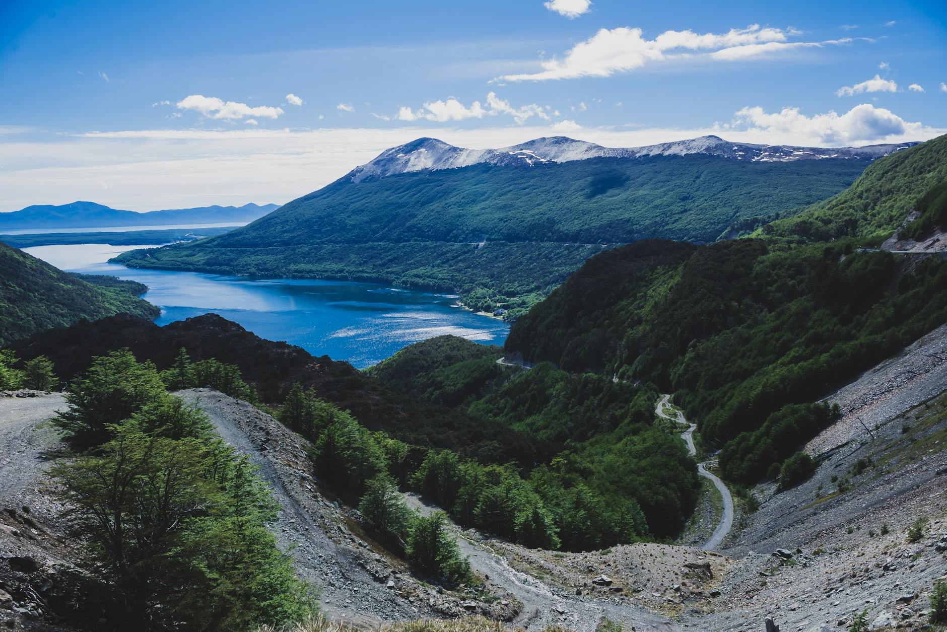
Lago Blanco and the Transition Zone
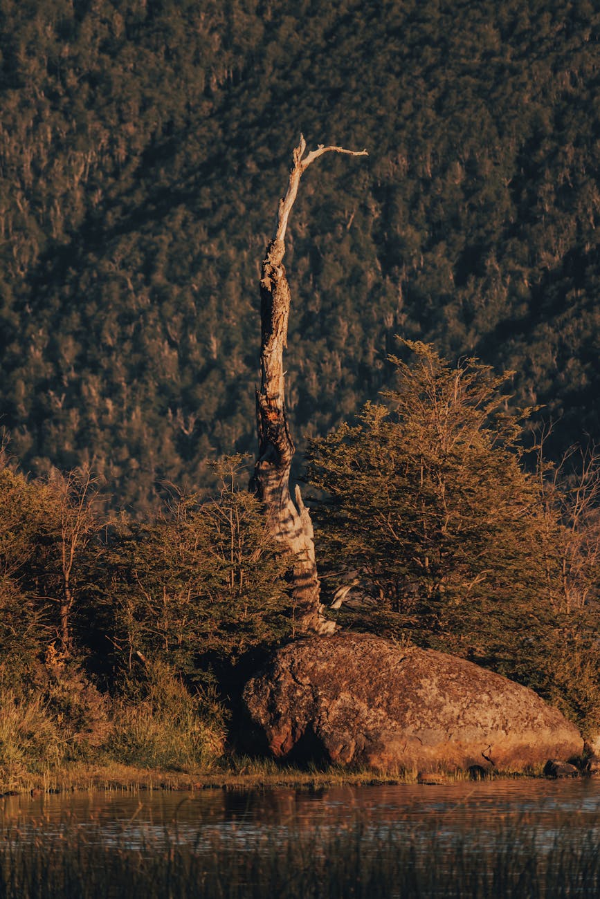
About two-thirds of the way across the island, the landscape changes. The steppe starts giving way to low scrub, then to lenga forest — a southern beech that grows thick and tangled, turning orange and gold in autumn. Lago Blanco appears in this transition zone, a large lake hemmed in by hills that feel like the first real topography since Porvenir. I stopped here for lunch, eating crackers and cheese on the shore while the wind tried to steal my map. The water was dark and still except where the wind hit it, creating these racing patches of ripples that moved across the surface like something alive.
Lago Blanco is popular with fly fishermen chasing brown trout. Other than fishing, there is not much to do except sit and absorb the scale of it. Which is enough. The road south from here drops into proper sub-Antarctic forest — dense, mossy, dripping — and the temperature drops with it.
The Road to Ushuaia (Crossing into Argentina)
Most travelers crossing Tierra del Fuego by road are headed to Ushuaia, the Argentine city that markets itself as the "End of the World." The border crossing at San Sebastian is straightforward but slow — forty-five minutes for me, which the border guard said was fast. The truck queue behind me stretched back hundreds of meters.
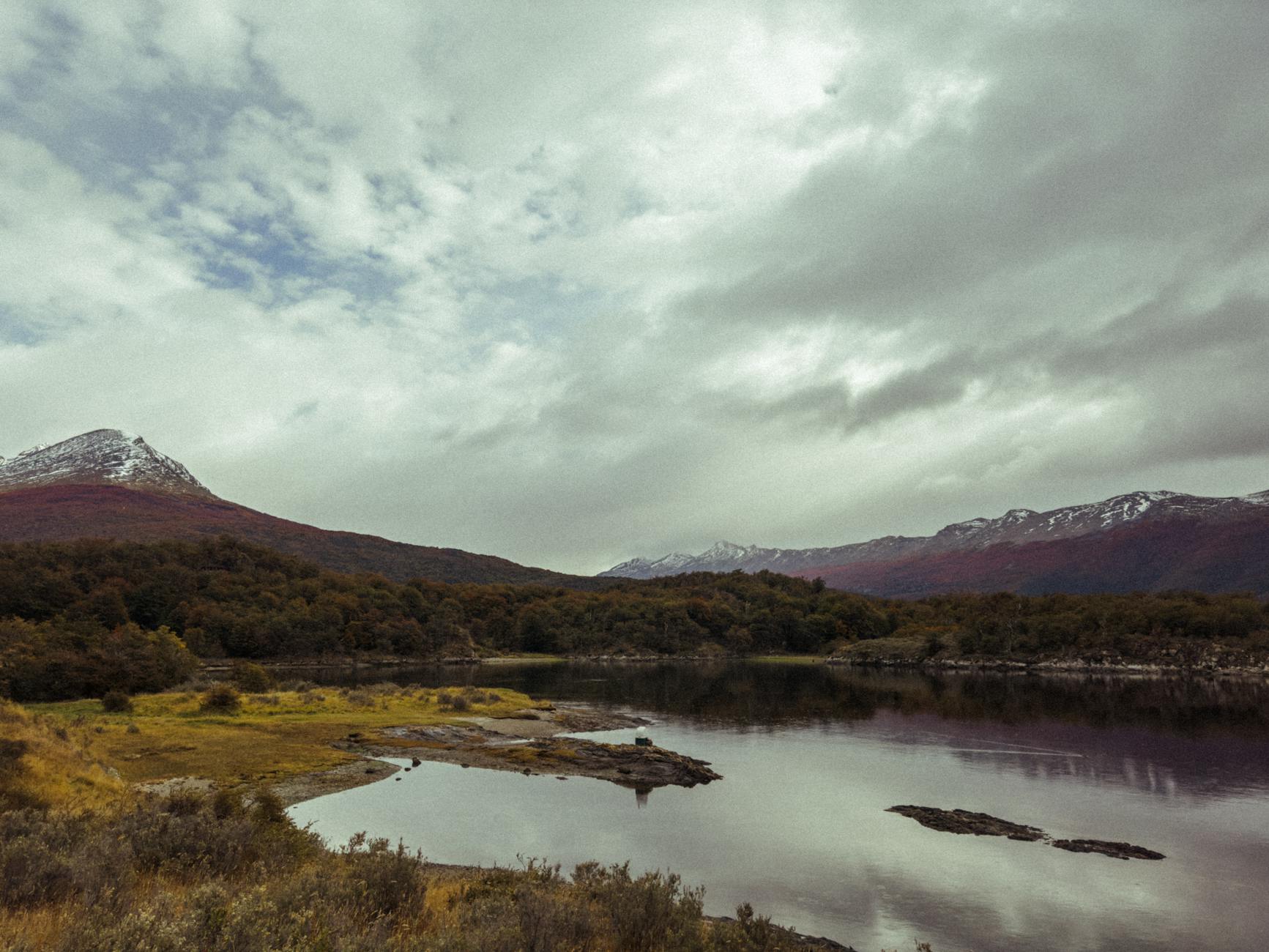
From the border, the drive to Ushuaia takes three to four hours, and the landscape shifts from steppe to mountains like someone turning up the drama dial. The Andes make their final appearance here, dropping into the Beagle Channel. By the time you reach Ushuaia the mountains are right on top of you, steep and snow-streaked even in summer.
I will say this carefully: the Chilean side of Tierra del Fuego is more interesting than the Argentine side. Ushuaia has better infrastructure, better restaurants, the famous sign. But it also has cruise ship crowds, overpriced souvenir shops, and the feeling of a place that knows exactly how to monetize its geography. Chilean Tierra del Fuego has none of that. It is raw and genuinely wild in a way Ushuaia stopped being years ago. Both are worth visiting. But the Chilean side stays with you.
Quick Tip
If you are renting a car in Chile and driving to Ushuaia, check with the rental company about crossing into Argentina — not all companies allow it, and you will need specific paperwork. International insurance is mandatory. Some travelers rent in Punta Arenas, drop in Ushuaia, and fly back. Budget the extra drop-off fee but it saves you the return drive.
Gold Rush History (When the World Came to the End of the World)
In 1879, gold was found on Tierra del Fuego. Not a lot, but enough to trigger a rush that dragged prospectors from Chile, Argentina, Croatia, and Britain to one of the most inhospitable places on earth. The rivers near Porvenir yielded alluvial deposits that could be panned by hand. A few got rich. Most got frostbite. The rush lasted two decades before the deposits thinned and the sheep estancias proved more profitable.
The Croatian community in Porvenir is the most visible legacy — descendants of Dalmatian miners who came for gold and stayed because there was nothing to go back to. Walk through the cemetery and count the Croatian surnames. There are more than you expect.
The Selk'nam, the indigenous people who had lived on the island for at least 7,000 years, did not survive any of this. They were hunted, displaced, and destroyed by disease, violence, and extermination campaigns funded by estancia owners. The last full-blooded Selk'nam died in the 1970s. The museum in Porvenir addresses this history directly and without flinching, which I respected. You should see it.
Puerto Williams and the Dientes de Navarino (the Real End of the World)
Ushuaia calls itself the southernmost city in the world. Puerto Williams, across the Beagle Channel, disagrees. In 2019 Chile officially designated Puerto Williams a city, settling the argument on paper if not in Argentine hearts. If you want the real bottom of the map, it is here.
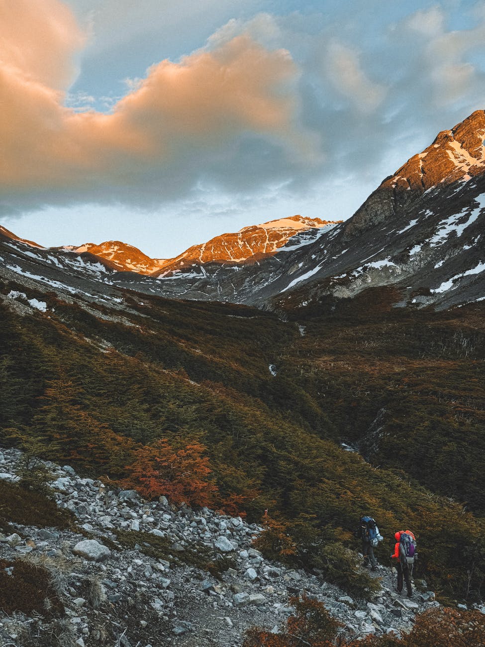
Puerto Williams is accessible by flight from Punta Arenas or boat from Ushuaia. Maybe 2,500 people, mostly naval. The town is not much to look at. But it is the starting point for the Dientes de Navarino trek — the southernmost multi-day trek in the world — and that is why people come.
I did not do the full Dientes circuit — four to five days, total self-sufficiency, weather that can turn lethal without warning. But a German couple I met in Porvenir had just finished it, and their descriptions put it on my list for next time. The route follows jagged granite peaks (dientes means teeth) through sub-Antarctic forest, past beaver dams, across exposed ridges where the wind comes straight off the Drake Passage. No refugios, no marked campsites, no rescue services. You carry everything. You navigate by GPS and cairns. On clear days you can see Cape Horn.
If the Dientes is too extreme, the Cerro Bandera day hike (four hours round trip) gives views across the Beagle Channel that justify the effort. Check our best hikes in Chile guide for the full breakdown on southern treks.
Quick Tip
The Dientes de Navarino trek is serious backcountry. Register with the carabineros (police) in Puerto Williams before you go and when you return. Bring a GPS device — trail markers are sparse. The weather window is November through March, and even then you should expect rain, sleet, and wind that will test your tent. This is not a beginner hike.
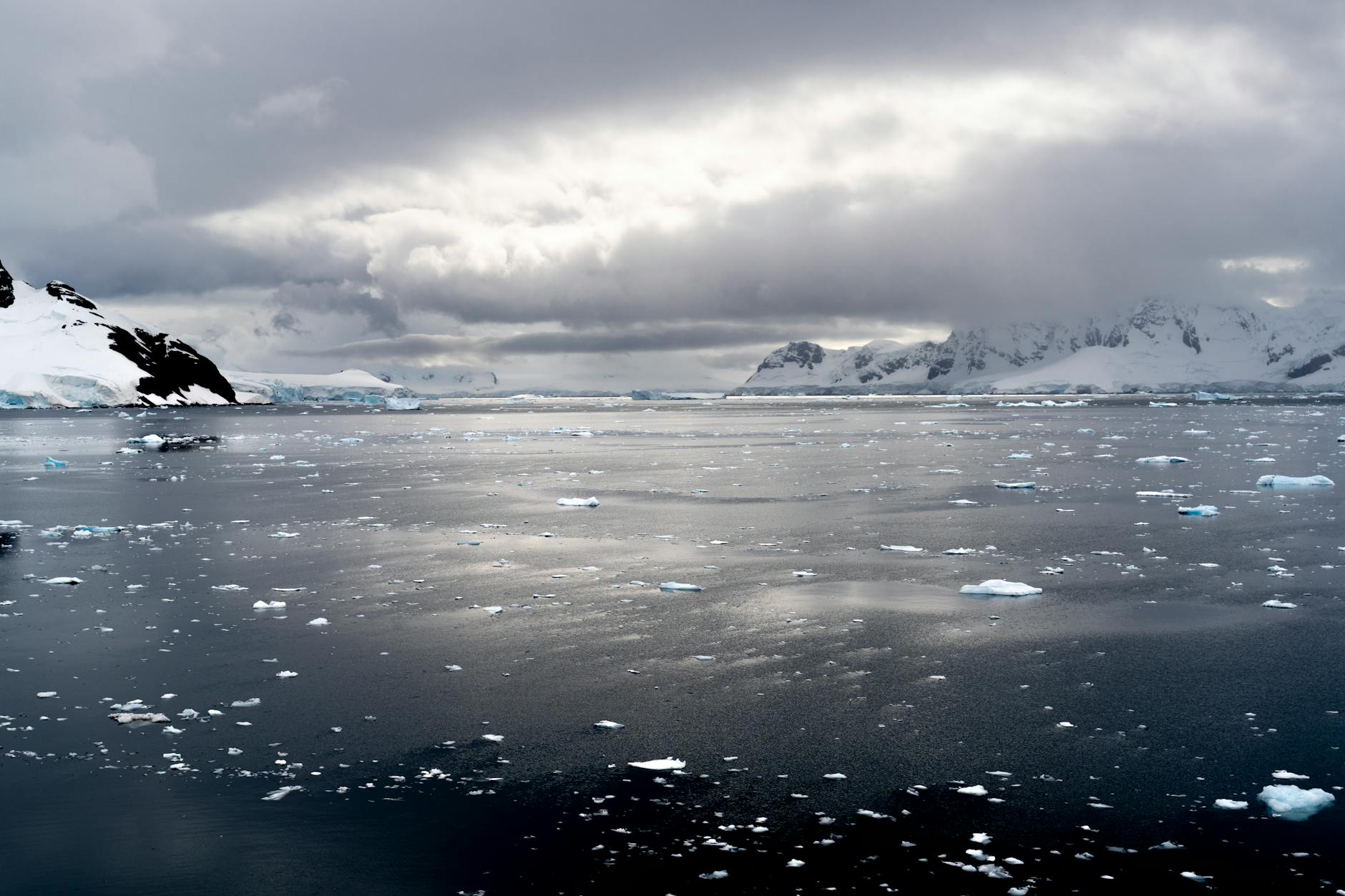
The Drake Passage and Antarctic Connections
Standing on the shore at Puerto Williams, looking south across the Beagle Channel, I tried to wrap my head around what lay beyond. Cape Horn — the southern tip of South America — is about 150 kilometers away. Past that, there is nothing but the Drake Passage, 800 kilometers of the most violent ocean on the planet, and then Antarctica. The Drake is where the Atlantic, Pacific, and Southern oceans collide, and it has been sinking ships since humans started sailing past it. Even on modern expedition vessels, the crossing takes two days and the swells can reach ten meters.
Most Antarctic expedition cruises depart from Ushuaia, though some leave from Punta Arenas. If you have the budget (trips start around $6,000 and climb fast), you are already at the jumping-off point for the seventh continent. Some operators fly you across the Drake to King George Island, skipping the rough crossing entirely. Read our Chilean Antarctica guide for operators and routes.
Even if Antarctica is not on your itinerary, the proximity shapes everything. The weather systems are the same ones circling the ice continent. The wildlife is sub-Antarctic. The light has a quality I have only seen this far south: low, raking, shadows that stretch for meters even at midday. You feel Antarctica's presence in the cold, in the wind, in the way the sky feels closer than it should.
When to Go and How to Plan It
December through February. That is the window. I went in January and had two genuinely nice days out of five. The other three were overcast, windy, and spitting rain. You dress for it and deal with it. That is southern Patagonia. March is possible but risky — days shorten fast this far south. Winter is dark and brutal. Do not.
Getting There and Around
From Punta Arenas: Austral Broom ferry to Porvenir (2.5 hours, foot passengers welcome) or drive to Primera Angostura for the short 20-minute crossing. Coming from the north on a Patagonia road trip? Primera Angostura is right on the highway.
A rental car is mandatory. Public transport barely exists — one bus between Porvenir and the border a few times a week. Gravel roads can be rough after rain; decent clearance helps for the penguin colony. Check our getting around guide for car rental tips.
Costs
| Punta Arenas-Porvenir ferry (foot passenger) | $8-12 USD |
| Primera Angostura ferry (car + passengers) | $25-35 USD |
| Car rental (Punta Arenas, per day) | $45-70 USD |
| Parque Pinguino Rey entry | $8-10 USD |
| Accommodation in Porvenir (basic) | $35-60 USD/night |
| Lunch/dinner in Porvenir | $10-18 USD |
| Flight Punta Arenas-Puerto Williams | $80-150 USD |
Suggested Itinerary
Day 1: Ferry to Porvenir. Museum, waterfront, lamb stew. Day 2: Drive to king penguin colony (full day). Day 3: Drive across the island via Lago Blanco to the Argentine border, or backtrack. Day 4+: Puerto Williams and/or Dientes de Navarino if you have the time and the nerve.
Three days minimum for Porvenir and the penguins. Five days with weather delays. Nine if you add the Dientes trek.
What Nobody Tells You Before You Go
The wind is not a weather event on Tierra del Fuego. It is a permanent condition. Every tree is bent. Every conversation outdoors happens at a raised volume. You get used to it by day two, and when you leave the island and the wind stops, you feel like something is missing.
Fuel stations are scarce outside Porvenir — fill your tank every time you see a pump. Phone service disappears outside the towns. The roads are empty enough that if you break down, you wait hours. I saw seven vehicles during my three-hour drive to the penguin colony. Seven. Bring cash too. Card acceptance outside Porvenir is unreliable. Chilean pesos, not dollars.
And bring patience. The ferry runs when the weather allows. The museum opens when the attendant arrives. You cannot optimize Tierra del Fuego. The island reveals itself on its own schedule. I fought that for a day, then gave in. The moment I stopped trying to be efficient was the moment the trip got good.
Tierra del Fuego is not for everyone. It is not pretty in the way that gets double-tapped on social media. But it is powerful — the kind of place that rearranges your sense of scale and reminds you how much of the world is empty and uninterested in human attention. I stood on the shore of Bahia Inutil watching king penguins and the sky went on forever. I did not want to be anywhere else.