This article contains affiliate links. If you book through them, I earn a small commission at no extra cost to you.
I had been staring at clouds for two days. Two full days in El Chalten, and Fitz Roy might as well have not existed. The town sits right at the base of the most dramatic mountain skyline in Patagonia, but the weather had decided I didn't deserve to see it. I was starting to wonder if the whole thing was a collective hallucination — thousands of hikers swearing this peak was real, showing you their phone wallpapers, and meanwhile outside the window: grey on grey on grey.
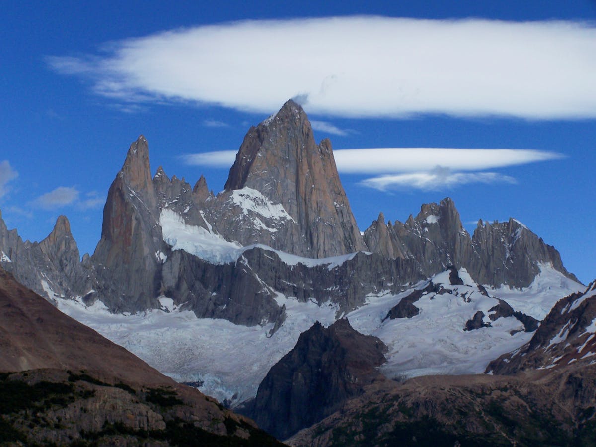
Then on the third morning, I woke up at 5am to use the bathroom and glanced out the hostel window. There it was. The entire Fitz Roy massif, lit pink and orange by sunrise, every granite spire razor-sharp against a sky so blue it looked fake. I stood there in my underwear for probably thirty seconds, mouth open, before my brain caught up and I scrambled for my camera.
That is El Chalten. Patience rewarded. And when it pays off, it pays off bigger than anywhere else I have been in Patagonia.
Wait, This Is Argentina — Why Is It on a Chile Travel Site?
Fair question. El Chalten is in Argentina, about 220 kilometers north of El Calafate in Santa Cruz province. But here is the reality: nearly every traveler doing Torres del Paine also crosses into Argentina to do El Chalten. The two are part of the same trip for most people, and if you are reading our Patagonia itinerary, El Chalten is baked right into the route.
Think of it as the Argentine half of a Patagonia circuit that starts and ends in Chile. You fly into Punta Arenas, bus to Puerto Natales, do Torres del Paine, cross into Argentina, hike El Chalten, and loop back through El Calafate. Skipping it would be like visiting the Grand Canyon and ignoring Zion because it is in a different state.
Getting There from Chilean Patagonia
This is the part where most itineraries get hand-wavy. "Take a bus from Puerto Natales to El Chalten." Sure. But that bus takes around 12 hours and involves a border crossing, and depending on the season, it may not run daily. Let me break down the actual options.
Option 1: Puerto Natales to El Calafate, Then El Calafate to El Chalten
This is the most common route and the one I took. A bus from Puerto Natales to El Calafate runs about 5 hours, costs around $20-30 USD, and crosses the border at Cerro Castillo / Cancha Carrera. The border is straightforward — you get off the bus, stamp out of Chile, walk 100 meters, stamp into Argentina, get back on. Budget 30-45 minutes for the whole process.
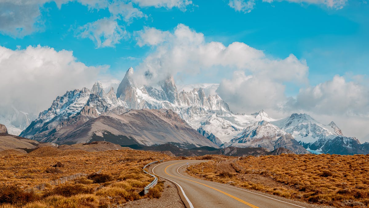
From El Calafate, separate buses run to El Chalten (3 hours, $15-25 USD). Multiple companies do this route daily in summer. The drive is flat and boring for the first two hours — Patagonian steppe, wind, guanacos if you are lucky — and then suddenly the Fitz Roy massif appears on the horizon and everyone on the bus reaches for their phones at the same time.
Quick Tip
Book the El Calafate to El Chalten bus in advance during January and February. I showed up thinking I could buy a ticket at the terminal and ended up waiting an extra day because everything was sold out. Chalten Travel and Cal Tur are the main operators.
Option 2: Direct Puerto Natales to El Chalten
A few companies run a direct bus in peak season (December to February). It takes about 12 hours and costs $40-60 USD. The advantage is obvious — no overnight in El Calafate. The disadvantage is that you arrive wrecked after a long day on a bus, and you miss Perito Moreno Glacier, which is the main reason most people stop in El Calafate anyway.
I would only recommend the direct bus if you have already seen Perito Moreno or are on a tight schedule. Otherwise, splitting the journey with a night in El Calafate makes more sense. The glacier alone is worth the detour.
Option 3: El Calafate by Air
If you are coming from Santiago or Buenos Aires, you can fly directly to El Calafate airport (FTE). From there, it is the same 3-hour bus to El Chalten. This makes sense if you are doing El Chalten and Perito Moreno but skipping Torres del Paine (though I am not sure why you would). Flights from Buenos Aires run $80-200 USD depending on how far ahead you book.
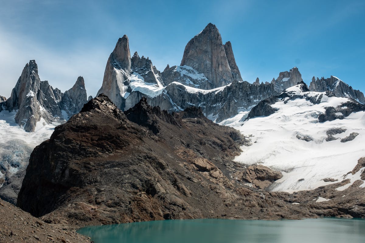
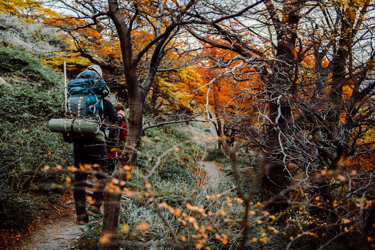
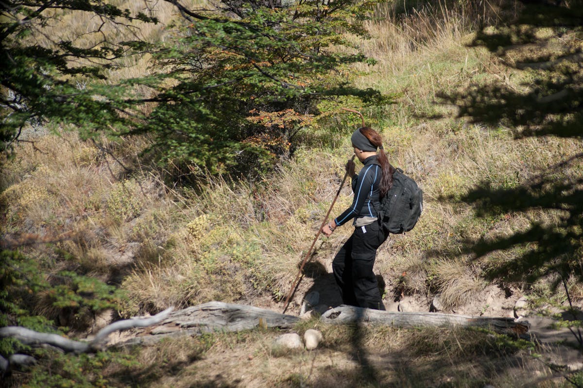
Laguna de los Tres — THE Hike (and Why It Nearly Broke Me)
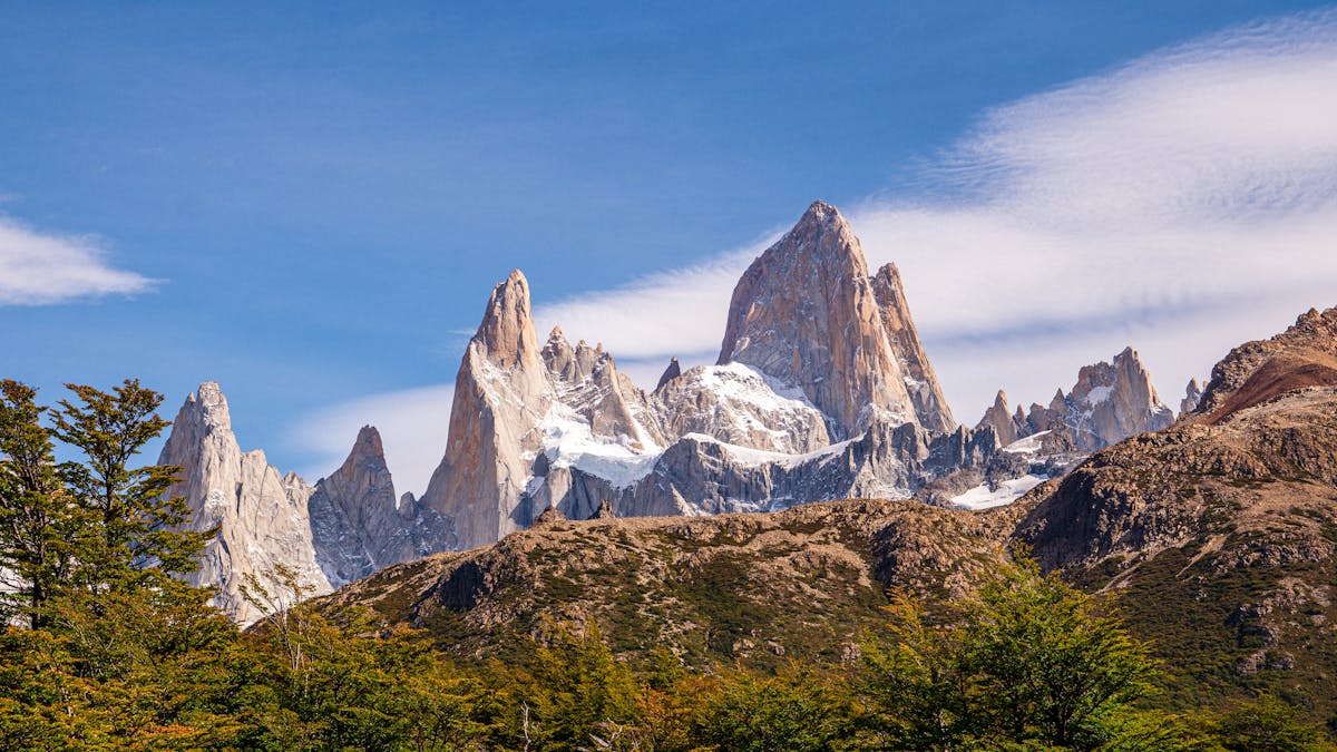
Let me be honest about this hike. Every blog and Instagram account shows Laguna de los Tres as this serene turquoise lake with Fitz Roy towering behind it, bathed in golden morning light. What they do not show is the final hour of scrambling up a steep, loose scree slope at altitude that had my thighs burning so badly I had to stop every fifty steps.
The numbers: 25 kilometers round trip, about 750 meters of elevation gain, 8-10 hours depending on your pace. The first three-quarters of the trail is genuinely pleasant — well-marked, gently climbing through lenga forest, crossing a couple of streams, with periodic viewpoints. You pass Laguna Capri around the halfway mark, which is a nice lake with a Fitz Roy backdrop where a lot of people stop for lunch. You are feeling good at this point. Strong. Capable.
Then you hit the final push. The trail drops briefly into a river valley before climbing about 400 meters in one kilometer. Straight up. The path is mostly loose rock and dirt, switchbacking up a steep moraine. My calves cramped. My pack suddenly felt twice as heavy. I watched a guy in his twenties who looked like he ran marathons sit down on a rock and put his head between his knees.
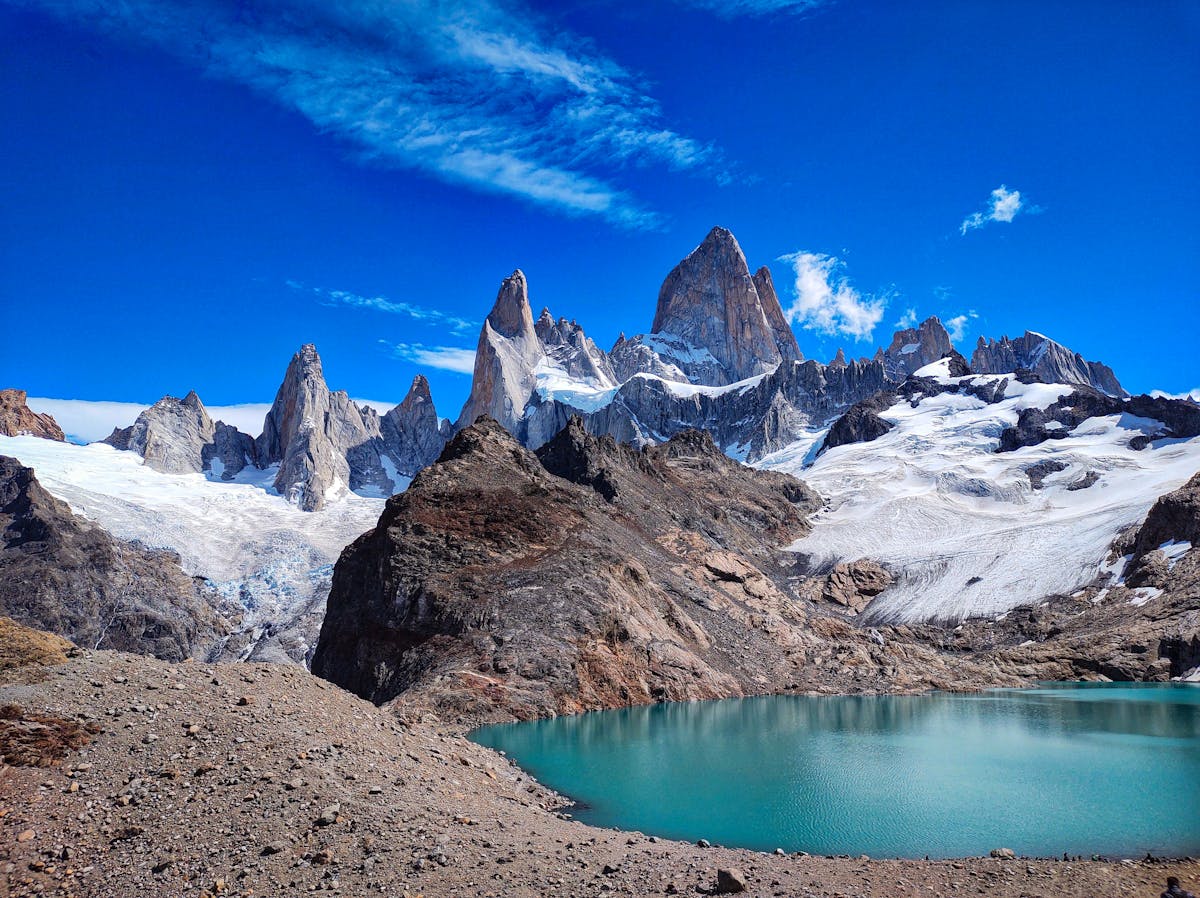
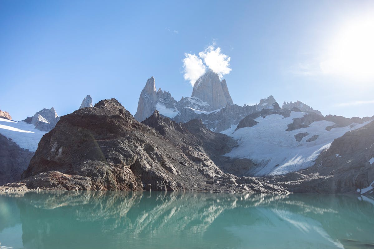
But when you top out and Laguna de los Tres appears below you — that impossible turquoise, the granite towers filling the entire sky, chunks of ice floating in the water — every step of suffering makes sense. I sat on a rock for forty minutes just staring. It is, without exaggeration, one of the most dramatic viewpoints I have ever reached on foot. The W Trek has nothing that hits this hard in a single moment.
Quick Tip
Start early. I left at 7am and had the viewpoint mostly to myself for the first twenty minutes. By 11am it was packed. Also: bring trekking poles for the descent. Coming down that scree slope without poles is asking for a knee injury.
Laguna Torre — The Easier One That Is Still Really Good
If Laguna de los Tres is the dramatic main course, Laguna Torre is the long, satisfying appetizer. This hike takes you to a lake at the base of Cerro Torre, a needle-shaped peak that climbers consider one of the hardest summits in the world. The hike itself is significantly easier than Laguna de los Tres — about 18 kilometers round trip, 200 meters of elevation gain, 5-6 hours.
The trail follows the Rio Fitz Roy valley and is mostly flat-to-gently-rolling terrain through forest and open scrubland. It is the kind of hike where you can actually have a conversation with your hiking partner instead of gasping for air. I did this one on my second day, partly as a warm-up for Laguna de los Tres and partly because the forecast said clouds were moving in later that week.
The payoff is different from Laguna de los Tres. Cerro Torre does not dominate the skyline the same way Fitz Roy does — it is more of a shy appearance, a thin spire that peeks out from behind ridgelines. On a clear day, you see it reflected in the lake with icebergs from the Torre Glacier floating in the foreground. On a cloudy day (which is more likely), you see a moody lake with ice chunks and a lot of atmosphere. Both are worth the walk.
I found Laguna Torre more peaceful overall. Fewer people, less of a competitive "race to the top" energy, and a nice lunch spot at the mirador near the lake where I ate a sandwich in total quiet for twenty minutes. If you only have one day and are not in peak physical shape, this is the hike I would recommend over Laguna de los Tres. You will not regret it.
Loma del Pliegue Tumbado — The One Nobody Talks About
This was the surprise of my trip. Loma del Pliegue Tumbado is a panoramic viewpoint hike that gives you both Fitz Roy AND Cerro Torre in a single frame, plus views south toward Lago Viedma and the southern Patagonian ice field. About 18 kilometers round trip, 1,000 meters of elevation gain, 7-8 hours.
Why does nobody talk about it? Probably because the name is a mouthful and the trail starts from the national park visitor center, which most people walk past on their way to the Laguna de los Tres trailhead without looking sideways. I almost skipped it myself — I had three days and figured the two laguna hikes were enough.
A guy at my hostel changed my mind. He had done all three and said Loma del Pliegue Tumbado was his favorite because "you see everything at once." He was right. The summit ridge gives you a panorama that no other trail in El Chalten matches. You can see the full Fitz Roy group, Cerro Torre, glaciers, lakes, and on a clear day, the ice cap stretching to the horizon. I spent an hour up there just turning in slow circles.
The trail is steeper than Laguna Torre but more gradual than the final push to Laguna de los Tres. Steady uphill through forest, then exposed alpine terrain with some wind (bring a windbreaker, always). The lack of crowds was the best part — I passed maybe fifteen people all day compared to the hundreds on the Fitz Roy trail.
Piedra del Fraile and Overnight Options
If you want to go deeper, the trek to Piedra del Fraile takes you into the north side of the park to a backcountry campsite at the base of the northern ice cap. It is about 15 kilometers one way from town, or you can start from the Laguna de los Tres trail and branch north at the Rio Electrico junction. Most people do this as an overnight with a camp at the Piedra del Fraile refugio.
I did not do this one — ran out of time — but several people I met at the hostel had, and they all described it as the most remote-feeling experience in El Chalten. You are away from the day-hikers, the trail is quieter, and the campsite sits in a beech forest with glacier views. The refugio there is privately run and has basic supplies, but bring your own food to be safe.
This is the hike I am coming back for. Everyone who did it looked slightly different when they returned — calmer, maybe a bit smug, like they had accessed a version of Patagonia that the rest of us were missing.
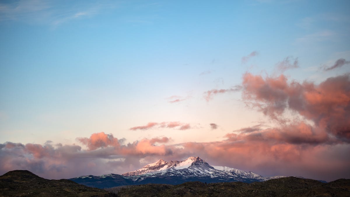
The Fitz Roy Sunrise Question
You will read advice telling you to wake up at 3am, hike to Laguna de los Tres in the dark, and catch sunrise on the peaks. The famous "alpenglow" — Fitz Roy turning pink and orange as the first light hits the granite.
Is it worth it? Complicated answer.
I attempted it. Set my alarm for 2:30am, layered up in the dark, ate a granola bar that tasted like sadness, and started hiking with a headlamp at 3am. The trail was empty. The forest was creepy and beautiful in the dark — just my footsteps and the occasional sound of something moving in the undergrowth that I chose not to investigate.
I reached the top of the scree slope at about 6:15am, right before sunrise. There were maybe twenty other people already there, all bundled in sleeping bags and down jackets, waiting. The anticipation was intense — like being at a concert before the band comes on.
And then the clouds rolled in. Not a dramatic storm, just a slow grey blanket that settled over the peaks about ten minutes before the sun would have hit them. Twenty people sat in silence watching absolutely nothing happen. A few laughed. One person cried, and I honestly could not tell if it was from the cold or the disappointment.
Here is my advice: check the weather forecast obsessively the night before. If the forecast shows clear skies at dawn, absolutely do it — the alpenglow photos I have seen from successful mornings are other-worldly. But if there is any doubt, sleep in and hike during the day instead. You will still see Fitz Roy, just without the pink light. The mountain is spectacular at any hour.
The other option is to wild camp at Laguna Capri or Poincenot campsite (free, first-come-first-served) and cut the pre-dawn approach to about an hour instead of three. This is what I would do next time.
The Town Itself — Small, Windy, and Oddly Perfect
El Chalten is tiny. One main street, a handful of hostels and hotels, a few restaurants, some gear shops, and a supermarket that has about sixty percent of what you actually need. The town exists because of the hiking and makes no pretense otherwise. There is no museum, no nightlife worth mentioning, and the main evening activity is eating pizza and comparing trail stories with other hikers.
I loved it.
There is something about a town with a single purpose that strips away the noise. Every person you meet is there for the same reason. Conversations start easily — "which trail did you do today?" is the universal opener. The bakeries open early for hikers heading out at dawn, and by 8pm everyone is either in bed or nursing a beer and a plate of milanesas at one of the restaurants on Avenida San Martin.
The free camping is worth mentioning because it is rare in Patagonia. Several campgrounds near El Chalten are completely free — no reservation, no fee. Poincenot and De Agostini on the Fitz Roy trail, and Laguna Torre campsite near the Cerro Torre trail. They have basic pit toilets and nothing else. No showers, no kitchen shelters, no electricity. But they are free, and in a region where Torres del Paine charges for everything and requires bookings months in advance, that is extraordinary.
If you are hiking your way through Chile and into Argentina on a backpacker budget, El Chalten is the place that rewards you for traveling cheap. Free trails, free camping, a supermarket where you can load up on pasta and sauce, and the most spectacular mountain scenery in South America right outside your tent flap.
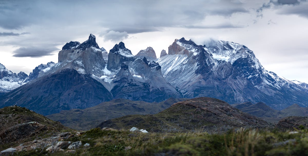
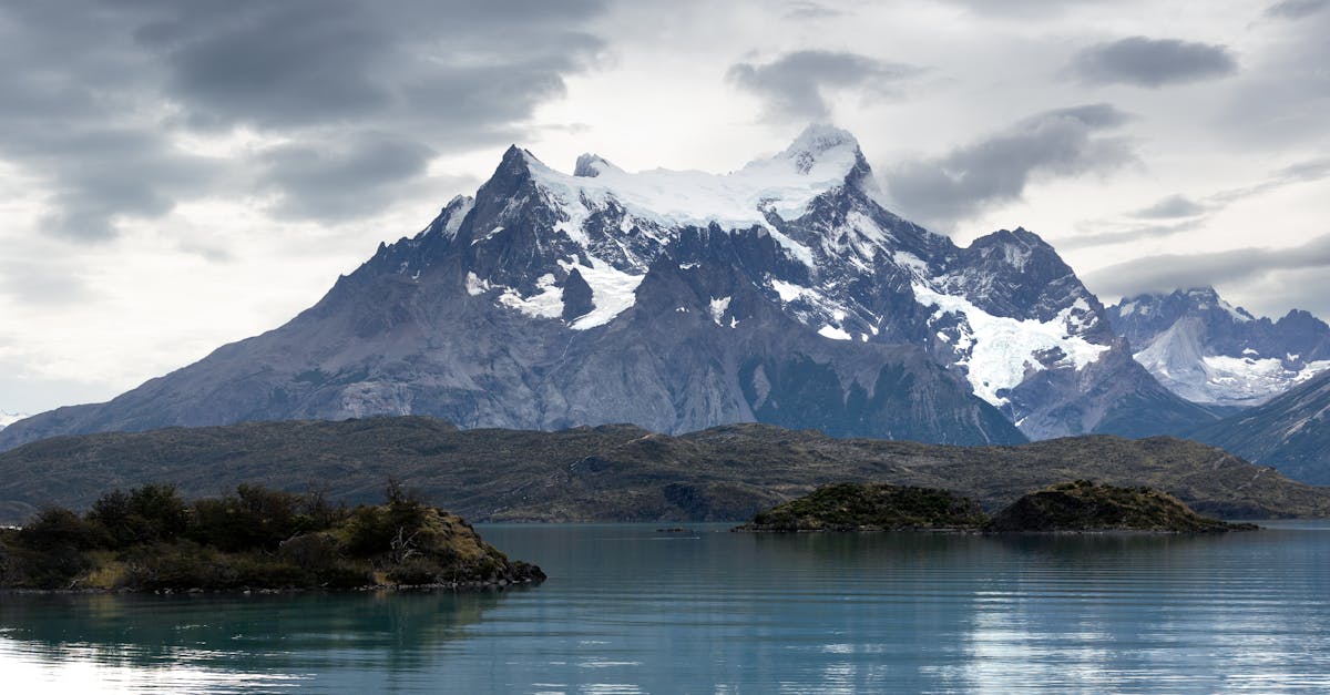
El Chalten vs. Torres del Paine — The Honest Comparison
People ask me this constantly. Both are in Patagonia, both are world-class trekking destinations, and most travelers doing a Patagonia trip will do both. But they are fundamentally different experiences, and knowing that ahead of time will shape your expectations.
Torres del Paine is a national park with infrastructure, rules, and costs to match. You book campsites months ahead, pay park entrance fees (around $35 USD for foreigners), follow a set route, and share the trail with a lot of people. The W Trek is extraordinary but it is a managed, structured experience. The day hikes are organized and well-signed.
El Chalten is the opposite in feel. There is no park entrance fee. No reservations needed for trails. No set route — you just pick a trailhead and go. The camping is free. The whole place has a loose, do-it-yourself energy that Torres del Paine has mostly lost. It feels more like what Torres del Paine probably felt like thirty years ago.
| Factor | El Chalten | Torres del Paine |
|---|---|---|
| Park entrance fee | Free | ~$35 USD (foreigners) |
| Trail reservations | Not required | Required months ahead |
| Free camping | Yes, multiple sites | No |
| Trail difficulty | Moderate to hard (day hikes) | Moderate (day hikes) to hard (W Trek) |
| Crowds | Moderate in summer | High in summer |
| Weather | Brutal and unpredictable | Brutal and unpredictable |
| Single best moment | Laguna de los Tres viewpoint | Base of the Torres at sunrise |
| Best for | Flexible travelers, backpackers | Planners, multi-day trekkers |
My take: do both. They are complementary, not competing. Torres del Paine for the multi-day immersion, El Chalten for the raw, unstructured mountain experience. If forced to pick one (please do not force yourself to pick one), El Chalten gives you more per dollar and more flexibility. But the W Trek is a bucket-list hike that nothing in El Chalten replaces.
The Weather Window Strategy
Patagonian weather is a running joke among travelers, but in El Chalten it goes from joke to genuine logistical problem. The mountains create their own weather. Cloud cover can appear in fifteen minutes and vanish just as fast. Wind that would cancel outdoor events elsewhere is just Tuesday here.
My strategy, developed over four days of trial and error: plan for three days minimum, hope for one clear day, and be ready to move fast when the window opens.
The park ranger station at the entrance to town posts a daily weather forecast — check it every morning. Windy and SpotWX are the most reliable weather apps for the area. But honestly, the best forecasting tool was the old guy running the hostel who would look at the sky at 6am and tell you whether it was worth hiking or not. He was right every time.
If you get a clear morning, do Laguna de los Tres. Do not save it for later. "Later" in El Chalten might mean clouds for the next four days. I met a couple who waited for the "perfect day" and ended up doing the hike in a whiteout on their last morning because every other day was worse. Grab the good weather when it comes.
Quick Tip
Rain does not mean a wasted day. Laguna Torre and the forest sections of the trails are beautiful in mist and light rain. Save the clear days for Laguna de los Tres and Loma del Pliegue Tumbado, where the summit views are the whole point.
What It Costs — A Rough Budget
El Chalten is cheaper than Torres del Paine but still Patagonian prices, which means more expensive than the rest of Argentina or Chile. Here is roughly what I spent per day.
| Expense | Budget Traveler | Mid-Range |
|---|---|---|
| Accommodation | Free (camping) or $15-25 (hostel dorm) | $60-120 (private room/cabin) |
| Food (cooking) | $10-15/day from supermarket | — |
| Food (eating out) | — | $25-40/day |
| Bus El Calafate-El Chalten | $15-25 each way | |
| Gear rental (tent/sleeping bag) | $10-20/day | — |
| Park entrance | Free | |
| Daily total | $25-50 | $85-160 |
The supermarket in town is small and overpriced compared to El Calafate. Buy your staples — pasta, rice, canned goods, snacks — in El Calafate before the bus. I made this mistake and ended up paying double for pasta that I could have bought the day before. The bakeries in El Chalten are good but not cheap. Budget $4-5 for a sandwich and coffee that will fuel a morning of hiking.
For gear, several shops in town rent trekking poles, tents, sleeping bags, and cooking stoves. Prices are reasonable — about $5-8 per day for trekking poles, $15-20 for a tent. If you are doing the hiking circuit through Chile and Argentina, buying your own poles in Santiago or Puerto Natales will save money over renting every time.
When to Go
The hiking season runs from October through April, with December through February being peak season. But each month has a different personality.
October-November: Early season. Some trails may still have snow on higher sections. Fewer crowds but the weather is more unstable. Daylight hours are long and getting longer. Good if you want solitude and do not mind cold mornings.
December-February: Peak season. Best weather (relatively speaking), longest days, everything open. Also the most crowded and expensive. January is the busiest month. If you come in January, start hikes early to beat the crowds at viewpoints.
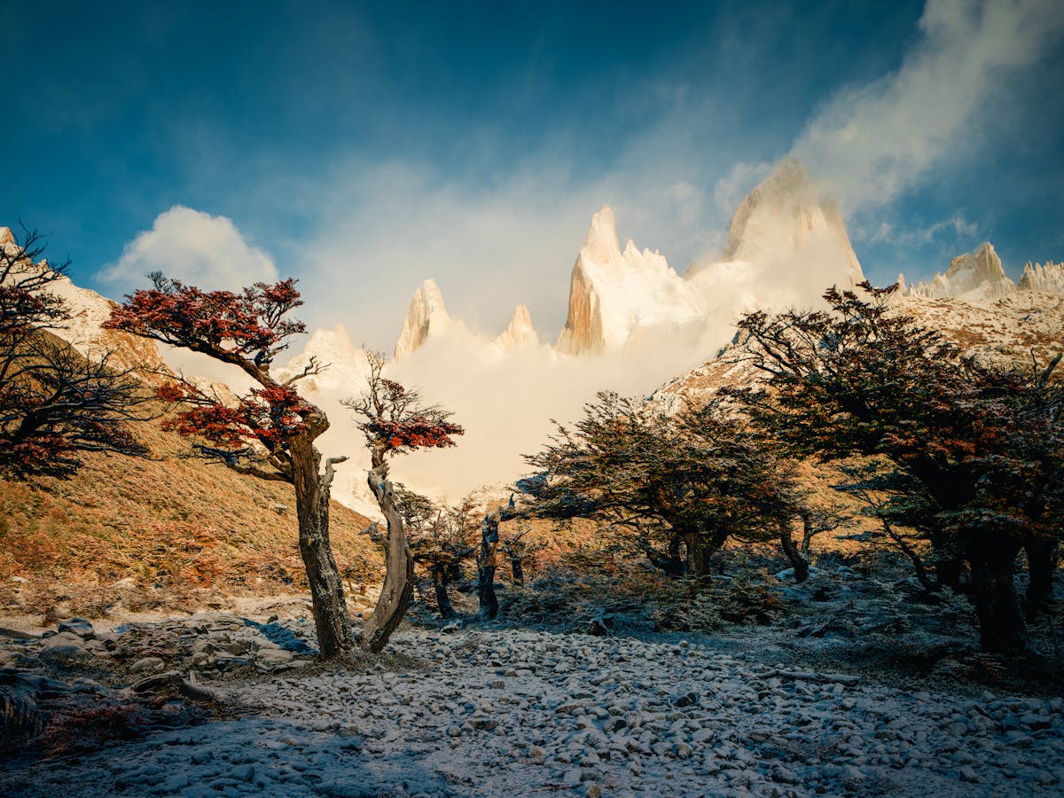
March-April: My favorite time. The lenga forests turn red and orange, the crowds thin dramatically, and the light gets softer. Temperatures drop and days get shorter, but the autumn colors make every trail look different from the summer photos. The risk is that some services close in April and bad weather windows become longer.
Fitting El Chalten into Your Chile Trip
If you are following our Patagonia itinerary, El Chalten fits naturally after Torres del Paine. The standard loop looks like this:
Puerto Natales (1 night, staging for Torres del Paine) → Torres del Paine (4-5 days for the W Trek, or 1-2 days for day hikes) → bus back to Puerto Natales → bus to El Calafate (5 hours, border crossing) → day trip to Perito Moreno Glacier → bus to El Chalten (3 hours) → 3-4 days hiking → bus back to El Calafate → fly out or continue to Buenos Aires.
Budget 3 days minimum for El Chalten. One day for Laguna de los Tres, one for Laguna Torre, and one buffer day for weather. If you have four days, add Loma del Pliegue Tumbado. Five days? Do Piedra del Fraile as an overnight.
The border crossing between Chile and Argentina is painless. You will cross at one of the southern passes, stamp out and stamp in, and be on your way. If you are a citizen of a country that requires a reciprocity fee for Argentina, check whether this still applies — it has changed several times. Carry pesos (both Chilean and Argentine) for small purchases at the border stops.
For the getting around logistics, the bus network in Patagonia is decent but not frequent. Book seats 2-3 days ahead in summer. In shoulder season, you can usually buy day-of, but do not count on it for popular routes.
Final Thought
I left El Chalten with sore legs, a sunburned nose, and the quiet certainty that I would come back. Not because I did not see enough — I hiked three of the four major trails and caught Fitz Roy in clear skies twice. But because El Chalten is the kind of place that gets better the more you know it. The couple at my hostel who were on their third visit said it best: "Every time, we find a trail we missed."
If you are building a Patagonia trip from Chile, do not treat El Chalten as an optional add-on. It is the other half of the story. Torres del Paine gives you the epic multi-day trek. El Chalten gives you the freedom to just walk into the mountains and see what happens. You need both. And when Fitz Roy finally breaks through the clouds and fills the sky from ridge to ridge, you will understand why people keep coming back.
The best hikes in Chile are extraordinary. But the best hike I did on my entire Patagonia trip was technically in Argentina. That is just how it goes down here — the mountains do not care about borders, and neither should your itinerary.
For more on planning the costs of your Patagonia circuit or figuring out the transport logistics, check our planning guides. And if you are still deciding between the W Trek and El Chalten — just do both. Your legs will hate you. Your memory card will thank you.